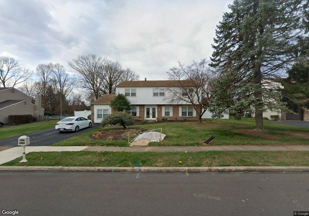
20 Toll Dr Southampton, PA 18966
Estimated Value: $673,000 - $701,000
--
Bed
4
Baths
2,965
Sq Ft
$232/Sq Ft
Est. Value
About This Home
This home is located at 20 Toll Dr, Southampton, PA 18966 and is currently estimated at $688,571, approximately $232 per square foot. 20 Toll Dr is a home located in Bucks County with nearby schools including Davis Elementary School, Klinger Middle School, and William Tennent High School.
Ownership History
Date
Name
Owned For
Owner Type
Purchase Details
Closed on
Jul 1, 2015
Sold by
Mitchell Robert M and Mitchell Ilene B
Bought by
Mitchell Ilene B and Mitchell Andrea
Current Estimated Value
Home Financials for this Owner
Home Financials are based on the most recent Mortgage that was taken out on this home.
Original Mortgage
$155,000
Outstanding Balance
$120,733
Interest Rate
3.83%
Mortgage Type
Future Advance Clause Open End Mortgage
Estimated Equity
$567,838
Purchase Details
Closed on
Jul 29, 1994
Sold by
Zucker Harvey S and Zucker Iris I
Bought by
Mitchell Robert M and Mitchell Ilene B
Home Financials for this Owner
Home Financials are based on the most recent Mortgage that was taken out on this home.
Original Mortgage
$137,800
Interest Rate
8.25%
Purchase Details
Closed on
Jul 27, 1978
Bought by
Zucker Harvey S and Zucker Iris I
Create a Home Valuation Report for This Property
The Home Valuation Report is an in-depth analysis detailing your home's value as well as a comparison with similar homes in the area
Home Values in the Area
Average Home Value in this Area
Purchase History
| Date | Buyer | Sale Price | Title Company |
|---|---|---|---|
| Mitchell Ilene B | -- | None Available | |
| Mitchell Robert M | $183,750 | -- | |
| Zucker Harvey S | -- | -- |
Source: Public Records
Mortgage History
| Date | Status | Borrower | Loan Amount |
|---|---|---|---|
| Open | Mitchell Ilene B | $155,000 | |
| Closed | Mitchell Robert M | $137,800 |
Source: Public Records
Tax History Compared to Growth
Tax History
| Year | Tax Paid | Tax Assessment Tax Assessment Total Assessment is a certain percentage of the fair market value that is determined by local assessors to be the total taxable value of land and additions on the property. | Land | Improvement |
|---|---|---|---|---|
| 2025 | $7,415 | $34,670 | $6,760 | $27,910 |
| 2024 | $7,415 | $34,670 | $6,760 | $27,910 |
| 2023 | $7,190 | $34,670 | $6,760 | $27,910 |
| 2022 | $7,039 | $34,670 | $6,760 | $27,910 |
| 2021 | $6,912 | $34,670 | $6,760 | $27,910 |
| 2020 | $6,816 | $34,670 | $6,760 | $27,910 |
| 2019 | $6,565 | $34,670 | $6,760 | $27,910 |
| 2018 | $6,414 | $34,670 | $6,760 | $27,910 |
| 2017 | $6,233 | $34,670 | $6,760 | $27,910 |
| 2016 | $6,233 | $34,670 | $6,760 | $27,910 |
| 2015 | -- | $34,670 | $6,760 | $27,910 |
| 2014 | -- | $34,670 | $6,760 | $27,910 |
Source: Public Records
Map
Nearby Homes
- 185 Toll Dr
- 43 Davisville Rd
- 325 Toll Dr
- 725 E County Line Rd
- 620 Constitutional Dr
- 377 Holly Dr
- 551 Revolutionary Way
- 530 Andrew Dr
- 2325 Pioneer Rd
- 475 Constitutional Dr
- 415 New Rd
- 766 Meadow Dr
- 117 Maple Ave
- 4145 Thistlewood Rd
- 136 Washington Dr
- 665 Whirlaway Dr
- 2015 Butternut Dr
- 206 E Hampton Crossing
- 609 Stewart Rd
- 4108 Centennial Station Unit 410
- 10 Toll Dr
- 30 Toll Dr
- 233 Davisville Rd
- 15 Toll Dr
- 276 Kingsclere Dr
- 275 Kingsclere Dr
- 219 Davisville Rd
- 50 Toll Dr
- 290 Kingsclere Dr
- 200 Davisville Rd
- 218 Davisville Rd
- 230 Davisville Rd
- 25 Laurel Rd
- 285 Kingsclere Dr
- 35 Laurel Rd
- 15 Laurel Rd
- 60 Toll Dr
- 55 Toll Dr
- 300 Kingsclere Dr
- 254 Davisville Rd