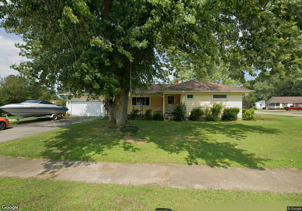
20 Tower Ave Conneaut, OH 44030
Estimated Value: $174,000 - $208,000
3
Beds
2
Baths
1,472
Sq Ft
$127/Sq Ft
Est. Value
About This Home
This home is located at 20 Tower Ave, Conneaut, OH 44030 and is currently estimated at $187,264, approximately $127 per square foot. 20 Tower Ave is a home located in Ashtabula County with nearby schools including Lakeshore Primary Elementary School, Gateway Elementary School, and Conneaut Middle School.
Ownership History
Date
Name
Owned For
Owner Type
Purchase Details
Closed on
Dec 17, 2009
Sold by
Webster Barbara and Webster Gary
Bought by
Lemak Jason J and Lemak Casandra T
Current Estimated Value
Home Financials for this Owner
Home Financials are based on the most recent Mortgage that was taken out on this home.
Original Mortgage
$83,000
Interest Rate
5%
Mortgage Type
New Conventional
Create a Home Valuation Report for This Property
The Home Valuation Report is an in-depth analysis detailing your home's value as well as a comparison with similar homes in the area
Home Values in the Area
Average Home Value in this Area
Purchase History
| Date | Buyer | Sale Price | Title Company |
|---|---|---|---|
| Lemak Jason J | $89,000 | Chicago Title |
Source: Public Records
Mortgage History
| Date | Status | Borrower | Loan Amount |
|---|---|---|---|
| Closed | Lemak Jason J | $83,000 |
Source: Public Records
Tax History
| Year | Tax Paid | Tax Assessment Tax Assessment Total Assessment is a certain percentage of the fair market value that is determined by local assessors to be the total taxable value of land and additions on the property. | Land | Improvement |
|---|---|---|---|---|
| 2024 | $3,154 | $43,120 | $9,940 | $33,180 |
| 2023 | $2,002 | $43,120 | $9,940 | $33,180 |
| 2022 | $1,699 | $32,200 | $7,630 | $24,570 |
| 2021 | $1,728 | $32,200 | $7,630 | $24,570 |
| 2020 | $1,727 | $32,200 | $7,630 | $24,570 |
| 2019 | $1,633 | $29,900 | $4,030 | $25,870 |
| 2018 | $1,557 | $29,900 | $4,030 | $25,870 |
| 2017 | $1,555 | $29,900 | $4,030 | $25,870 |
| 2016 | $1,492 | $31,260 | $4,200 | $27,060 |
| 2015 | $1,507 | $31,260 | $4,200 | $27,060 |
| 2014 | $1,327 | $31,260 | $4,200 | $27,060 |
| 2013 | $1,447 | $35,080 | $7,180 | $27,900 |
Source: Public Records
Map
Nearby Homes
- 210 W Main Rd
- 202 W Main Rd Unit 132
- 202 W Main Rd Unit 115
- 855 Spring St Unit S9
- 247 Whitney St
- 238 Whitney St
- 745 Maple Ave
- 110 Edgewood Dr
- 220 Daniels Ave
- 18 Hillcrest Ct
- 474 Sherman St
- 536 Madison St
- 1145 Lake Rd
- 2663 Lake Rd
- 1150 Lake Rd
- 475 State St
- VL Center Rd
- 19 Burrington Heights
- 1381 Robb Rd
- 375 Bliss Ave
- 265 Hosford Ave
- 268 Brown Ave
- 266 Brown Ave
- 289 Hosford Ave
- 270 Hosford Ave
- 250 Hosford Ave
- 253 Hosford Ave
- 278 Hosford Ave
- 297 Hosford Ave
- 304 Hosford Ave
- 190 Brown Ave
- 306 Hosford Ave
- 305 Hosford Ave
- 308 Hosford Ave
- 130 W Main Rd
- 311 Hosford Ave
- 142 W Main Rd
- 126 Main St
- 138 W Main Rd
- 120 W Main Usr 20 St
Your Personal Tour Guide
Ask me questions while you tour the home.