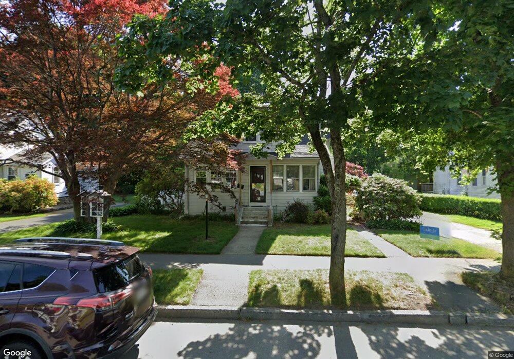
20 Vassar St Worcester, MA 01602
Newton Square NeighborhoodEstimated Value: $460,577 - $536,000
3
Beds
2
Baths
1,755
Sq Ft
$278/Sq Ft
Est. Value
About This Home
This home is located at 20 Vassar St, Worcester, MA 01602 and is currently estimated at $487,644, approximately $277 per square foot. 20 Vassar St is a home located in Worcester County with nearby schools including Chandler Magnet, Jacob Hiatt Magnet School, and Flagg Street School.
Ownership History
Date
Name
Owned For
Owner Type
Purchase Details
Closed on
Jun 11, 2010
Sold by
Renzi Margaret C
Bought by
Renzi Margaret C and Renzi Kenneth R
Current Estimated Value
Home Financials for this Owner
Home Financials are based on the most recent Mortgage that was taken out on this home.
Original Mortgage
$172,500
Outstanding Balance
$116,401
Interest Rate
5.11%
Mortgage Type
Purchase Money Mortgage
Estimated Equity
$371,243
Purchase Details
Closed on
Feb 28, 2001
Sold by
Musser Egbert Glenn and Musser Betrice T
Bought by
Renzi Margaret C
Home Financials for this Owner
Home Financials are based on the most recent Mortgage that was taken out on this home.
Original Mortgage
$149,600
Interest Rate
7%
Mortgage Type
Purchase Money Mortgage
Create a Home Valuation Report for This Property
The Home Valuation Report is an in-depth analysis detailing your home's value as well as a comparison with similar homes in the area
Home Values in the Area
Average Home Value in this Area
Purchase History
| Date | Buyer | Sale Price | Title Company |
|---|---|---|---|
| Renzi Margaret C | -- | -- | |
| Renzi Margaret C | $187,000 | -- |
Source: Public Records
Mortgage History
| Date | Status | Borrower | Loan Amount |
|---|---|---|---|
| Open | Renzi Margaret C | $172,500 | |
| Previous Owner | Renzi Margaret C | $149,600 | |
| Previous Owner | Renzi Margaret C | $80,000 | |
| Previous Owner | Renzi Margaret C | $77,500 |
Source: Public Records
Tax History
| Year | Tax Paid | Tax Assessment Tax Assessment Total Assessment is a certain percentage of the fair market value that is determined by local assessors to be the total taxable value of land and additions on the property. | Land | Improvement |
|---|---|---|---|---|
| 2025 | $4,977 | $377,300 | $118,700 | $258,600 |
| 2024 | $4,881 | $355,000 | $118,700 | $236,300 |
| 2023 | $4,699 | $327,700 | $103,200 | $224,500 |
| 2022 | $4,311 | $283,400 | $82,600 | $200,800 |
| 2021 | $4,243 | $260,600 | $66,100 | $194,500 |
| 2020 | $4,162 | $244,800 | $66,100 | $178,700 |
| 2019 | $3,949 | $219,400 | $59,500 | $159,900 |
| 2018 | $3,945 | $208,600 | $59,500 | $149,100 |
| 2017 | $3,823 | $198,900 | $59,500 | $139,400 |
| 2016 | $3,813 | $185,000 | $43,800 | $141,200 |
| 2015 | $3,713 | $185,000 | $43,800 | $141,200 |
| 2014 | $3,605 | $184,500 | $43,800 | $140,700 |
Source: Public Records
Map
Nearby Homes
- 18 Vassar St
- 22 Vassar St
- 11 Cornell St
- 24 Vassar St
- 27 Kinnicutt Rd
- 17 Vassar St
- 29 Kinnicutt Rd
- 19 Vassar St
- 16 Vassar St
- 23 Kinnicutt Rd
- 31 Kinnicutt Rd
- 21 Vassar St
- 5 Cornell St
- Bldg 16 Primmett Ln Unit 4
- Bldg 16 Primmett Ln Unit 2
- Lot 1 Salisbury St
- 10 Cornell St
- 15 Vassar St
- 14 Vassar St
- 23 Vassar St
Your Personal Tour Guide
Ask me questions while you tour the home.