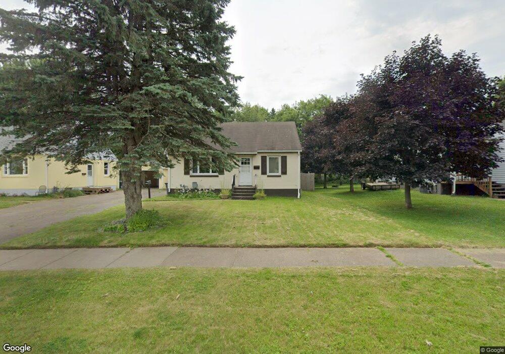
20 W Palm St Unit DULUTH HEIGHTS Duluth, MN 55811
Duluth Heights NeighborhoodEstimated Value: $257,000 - $275,000
3
Beds
1
Bath
1,209
Sq Ft
$219/Sq Ft
Est. Value
About This Home
This home is located at 20 W Palm St Unit DULUTH HEIGHTS, Duluth, MN 55811 and is currently estimated at $265,357, approximately $219 per square foot. 20 W Palm St Unit DULUTH HEIGHTS is a home located in St. Louis County with nearby schools including Lowell Elementary School, Lincoln Park Middle School, and Denfeld High School.
Ownership History
Date
Name
Owned For
Owner Type
Purchase Details
Closed on
Oct 22, 2021
Sold by
Vanemily A
Bought by
25 Group Llc
Current Estimated Value
Purchase Details
Closed on
Jul 2, 2019
Sold by
Bloxham Erin R and Kramer Aron
Bought by
Eck Emily A Van
Home Financials for this Owner
Home Financials are based on the most recent Mortgage that was taken out on this home.
Original Mortgage
$134,615
Interest Rate
3.62%
Mortgage Type
FHA
Purchase Details
Closed on
May 27, 2011
Sold by
Shimmin Bonita M
Bought by
Bloxham Erin R
Home Financials for this Owner
Home Financials are based on the most recent Mortgage that was taken out on this home.
Original Mortgage
$94,000
Interest Rate
4.81%
Mortgage Type
VA
Create a Home Valuation Report for This Property
The Home Valuation Report is an in-depth analysis detailing your home's value as well as a comparison with similar homes in the area
Home Values in the Area
Average Home Value in this Area
Purchase History
| Date | Buyer | Sale Price | Title Company |
|---|---|---|---|
| 25 Group Llc | $185,000 | Results Title | |
| Eck Emily A Van | $147,000 | First American Title Ins Co | |
| Bloxham Erin R | $94,000 | Rels Title |
Source: Public Records
Mortgage History
| Date | Status | Borrower | Loan Amount |
|---|---|---|---|
| Previous Owner | Eck Emily A Van | $134,615 | |
| Previous Owner | Bloxham Erin R | $94,000 |
Source: Public Records
Tax History Compared to Growth
Tax History
| Year | Tax Paid | Tax Assessment Tax Assessment Total Assessment is a certain percentage of the fair market value that is determined by local assessors to be the total taxable value of land and additions on the property. | Land | Improvement |
|---|---|---|---|---|
| 2024 | $2,724 | $197,600 | $23,200 | $174,400 |
| 2023 | $2,724 | $187,100 | $24,600 | $162,500 |
| 2022 | $2,200 | $176,800 | $23,400 | $153,400 |
| 2021 | $1,914 | $152,700 | $20,200 | $132,500 |
| 2020 | $1,656 | $138,800 | $16,200 | $122,600 |
| 2019 | $1,480 | $121,300 | $14,800 | $106,500 |
| 2018 | $1,374 | $112,100 | $14,800 | $97,300 |
| 2017 | $1,376 | $112,100 | $14,800 | $97,300 |
| 2016 | $1,608 | $159,700 | $37,400 | $122,300 |
| 2015 | $1,982 | $103,000 | $5,200 | $97,800 |
| 2014 | $1,982 | $128,300 | $6,400 | $121,900 |
Source: Public Records
Map
Nearby Homes
- 32 W Palm St
- 3 W Linden St
- 14 W Linden St
- 111 S Teak Ave
- 210 W Mulberry St
- 206 E Gilead St
- XXX W Quince St
- 201 S Blackman Ave
- 204 N Blackman Ave
- 519 Anderson Rd
- XXX N Basswood Ave
- 205 Bluff's Ridge Ct
- 604 N Blackman Ave
- 14 Deer Valley Rd
- 332 Hickory St
- 324 Wildwood Dr
- 1804 Rice Lake Rd
- 34XX Trinity Rd
- xx Trinity Rd
- 20xx Stanford Ave