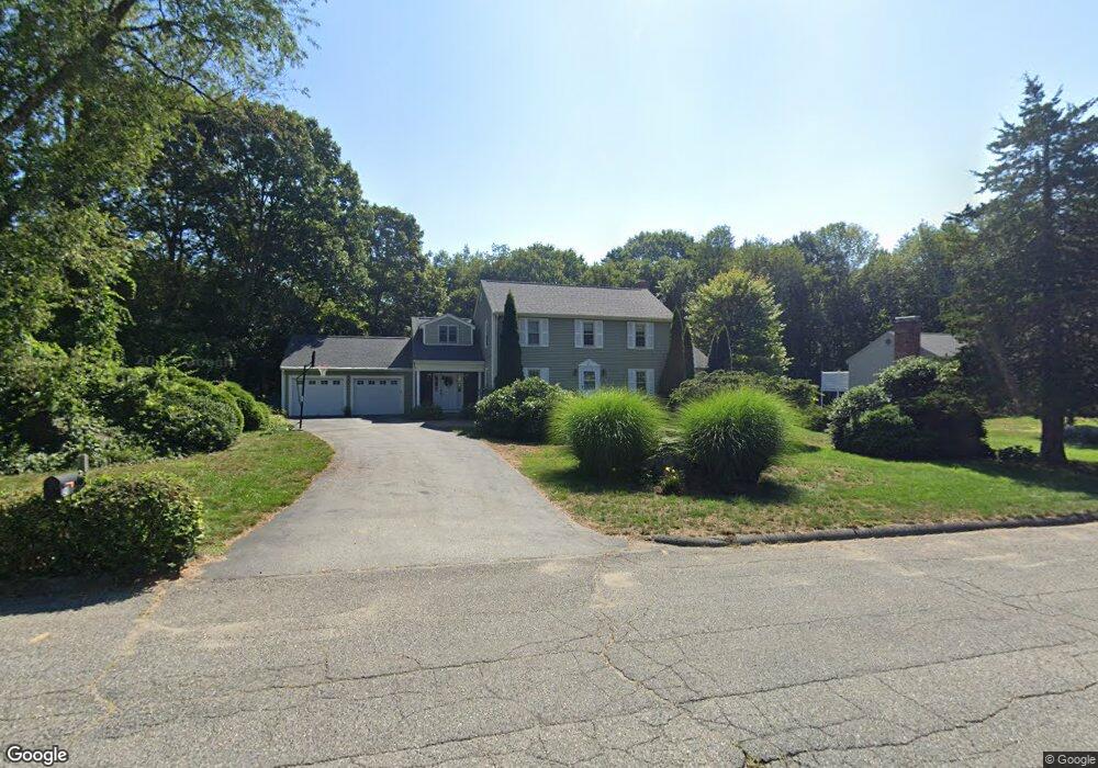
20 Walcott Cir Marlborough, MA 01752
Estimated Value: $729,000 - $810,000
4
Beds
3
Baths
2,262
Sq Ft
$342/Sq Ft
Est. Value
About This Home
This home is located at 20 Walcott Cir, Marlborough, MA 01752 and is currently estimated at $774,107, approximately $342 per square foot. 20 Walcott Cir is a home located in Middlesex County with nearby schools including Marlborough High School, Advanced Math & Science Academy, and New Covenant Christian School.
Ownership History
Date
Name
Owned For
Owner Type
Purchase Details
Closed on
Apr 25, 1997
Sold by
Nevins Keith T
Bought by
Sibole Gary R and Sibole Brenda
Current Estimated Value
Home Financials for this Owner
Home Financials are based on the most recent Mortgage that was taken out on this home.
Original Mortgage
$142,000
Interest Rate
7.77%
Mortgage Type
Purchase Money Mortgage
Purchase Details
Closed on
Apr 28, 1995
Sold by
Khorram Majid
Bought by
Kevins Keith T and Federico Lisa M
Purchase Details
Closed on
Jan 27, 1989
Sold by
20 Walcott Rt
Bought by
Khorram Majid
Create a Home Valuation Report for This Property
The Home Valuation Report is an in-depth analysis detailing your home's value as well as a comparison with similar homes in the area
Home Values in the Area
Average Home Value in this Area
Purchase History
| Date | Buyer | Sale Price | Title Company |
|---|---|---|---|
| Sibole Gary R | $177,500 | -- | |
| Kevins Keith T | $172,000 | -- | |
| Khorram Majid | $210,000 | -- |
Source: Public Records
Mortgage History
| Date | Status | Borrower | Loan Amount |
|---|---|---|---|
| Open | Khorram Majid | $11,800 | |
| Open | Khorram Majid | $144,000 | |
| Closed | Khorram Majid | $142,000 |
Source: Public Records
Tax History Compared to Growth
Tax History
| Year | Tax Paid | Tax Assessment Tax Assessment Total Assessment is a certain percentage of the fair market value that is determined by local assessors to be the total taxable value of land and additions on the property. | Land | Improvement |
|---|---|---|---|---|
| 2025 | $6,915 | $701,300 | $263,600 | $437,700 |
| 2024 | $6,618 | $646,300 | $239,600 | $406,700 |
| 2023 | $6,916 | $599,300 | $201,800 | $397,500 |
| 2022 | $6,755 | $514,900 | $192,200 | $322,700 |
| 2021 | $5,067 | $484,500 | $163,100 | $321,400 |
| 2020 | $6,377 | $449,700 | $141,800 | $307,900 |
| 2019 | $4,656 | $445,500 | $146,600 | $298,900 |
| 2018 | $112 | $424,300 | $131,000 | $293,300 |
| 2017 | $6,107 | $398,600 | $132,300 | $266,300 |
| 2016 | $6,265 | $408,400 | $132,300 | $276,100 |
| 2015 | $6,369 | $404,100 | $138,400 | $265,700 |
Source: Public Records
Map
Nearby Homes
- 11 Whispering Brook Rd Unit 55
- 273 W Main St Unit B12
- 39 Desimone Dr
- 30 Broad St Unit 104
- 30A Winter Ave
- 76 Broad St
- 11 Paris St
- 115 W Main St
- 102 Liberty St
- 32 Water St
- 156 Chestnut St
- 61 Fairmount St Unit 11
- 2 Adams St
- 87 Neil St
- 110 Pleasant St Unit 401
- 120 Airport Blvd
- 72 Chestnut St
- 111 Howe St
- 118 Elm St
- 3 Madison St