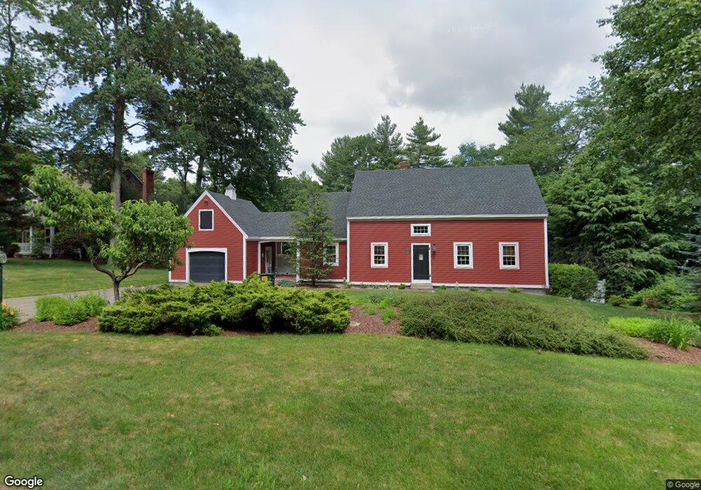
20 Wamsutta Ridge Rd Charlton, MA 01507
Estimated Value: $566,000 - $626,000
3
Beds
3
Baths
2,040
Sq Ft
$294/Sq Ft
Est. Value
About This Home
This home is located at 20 Wamsutta Ridge Rd, Charlton, MA 01507 and is currently estimated at $598,954, approximately $293 per square foot. 20 Wamsutta Ridge Rd is a home located in Worcester County with nearby schools including Shepherd Hill Regional High School.
Ownership History
Date
Name
Owned For
Owner Type
Purchase Details
Closed on
Aug 18, 1997
Sold by
Ranger Rt and Glickman Melvyn
Bought by
Kolesnik Robert S and Kolesnik Theresa M
Current Estimated Value
Create a Home Valuation Report for This Property
The Home Valuation Report is an in-depth analysis detailing your home's value as well as a comparison with similar homes in the area
Home Values in the Area
Average Home Value in this Area
Purchase History
| Date | Buyer | Sale Price | Title Company |
|---|---|---|---|
| Kolesnik Robert S | $44,000 | -- | |
| Kolesnik Robert S | $44,000 | -- |
Source: Public Records
Mortgage History
| Date | Status | Borrower | Loan Amount |
|---|---|---|---|
| Open | Kolesnik Robert S | $230,000 | |
| Closed | Kolesnik Robert S | $100,000 | |
| Closed | Kolesnik Robert S | $100,000 |
Source: Public Records
Tax History Compared to Growth
Tax History
| Year | Tax Paid | Tax Assessment Tax Assessment Total Assessment is a certain percentage of the fair market value that is determined by local assessors to be the total taxable value of land and additions on the property. | Land | Improvement |
|---|---|---|---|---|
| 2025 | $6,254 | $561,900 | $107,000 | $454,900 |
| 2024 | $6,023 | $531,100 | $101,200 | $429,900 |
| 2023 | $5,866 | $482,000 | $101,200 | $380,800 |
| 2022 | $5,483 | $412,600 | $89,700 | $322,900 |
| 2021 | $5,395 | $359,400 | $81,000 | $278,400 |
| 2020 | $5,308 | $355,300 | $76,900 | $278,400 |
| 2019 | $5,248 | $355,300 | $76,900 | $278,400 |
| 2018 | $4,797 | $355,300 | $76,900 | $278,400 |
| 2017 | $4,537 | $321,800 | $76,900 | $244,900 |
| 2016 | $4,434 | $321,800 | $76,900 | $244,900 |
| 2015 | $4,319 | $321,800 | $76,900 | $244,900 |
| 2014 | $4,074 | $321,800 | $81,100 | $240,700 |
Source: Public Records
Map
Nearby Homes
- 44 Buffum Rd
- 0 Partridge Hill Rd
- 13 Boucher Dr
- 20 Drury Ln
- 18 Old Worcester Rd
- 58 Colburn Rd
- 18 Mckinstry Dr
- 71 Bay Path Rd
- Lot 7 Coughlin Rd
- Lot 8 Coughlin Rd
- Lot 6 Coughlin Rd
- Lot 4 Coughlin Rd
- 3 Lelandville Rd
- 2 Lelandville Rd
- 0 Freeman Rd Unit 73369281
- 124 Charlton St Unit F
- 105 Carroll Hill Rd
- 0 Oxbow Rd
- 4 Toria Heights Rd
- 57 Coughlin Rd
- 22 Wamsutta Ridge Rd
- 18 Wamsutta Ridge Rd
- 19 Wamsutta Ridge Rd
- 21 Wamsutta Ridge Rd
- 21 Wamsutta Ridge Rd Unit 21
- 21 Wamsutta Ridge Rd Unit SF
- 24 Wamsutta Ridge Rd
- 16 Wamsutta Ridge Rd
- 23 Wamsutta Ridge Rd
- 26 Wamsutta Ridge Rd
- 13 Wamsutta Ridge Rd
- 29 Colicum Dr
- 25 Colicum Dr
- 12 Wamsutta Ridge Rd
- 28 Wamsutta Ridge Rd
- 23 Colicum Dr
- 33 Colicum Dr
- 11 Wamsutta Ridge Rd
- 39 Colicum Dr
- 31 Colicum Dr