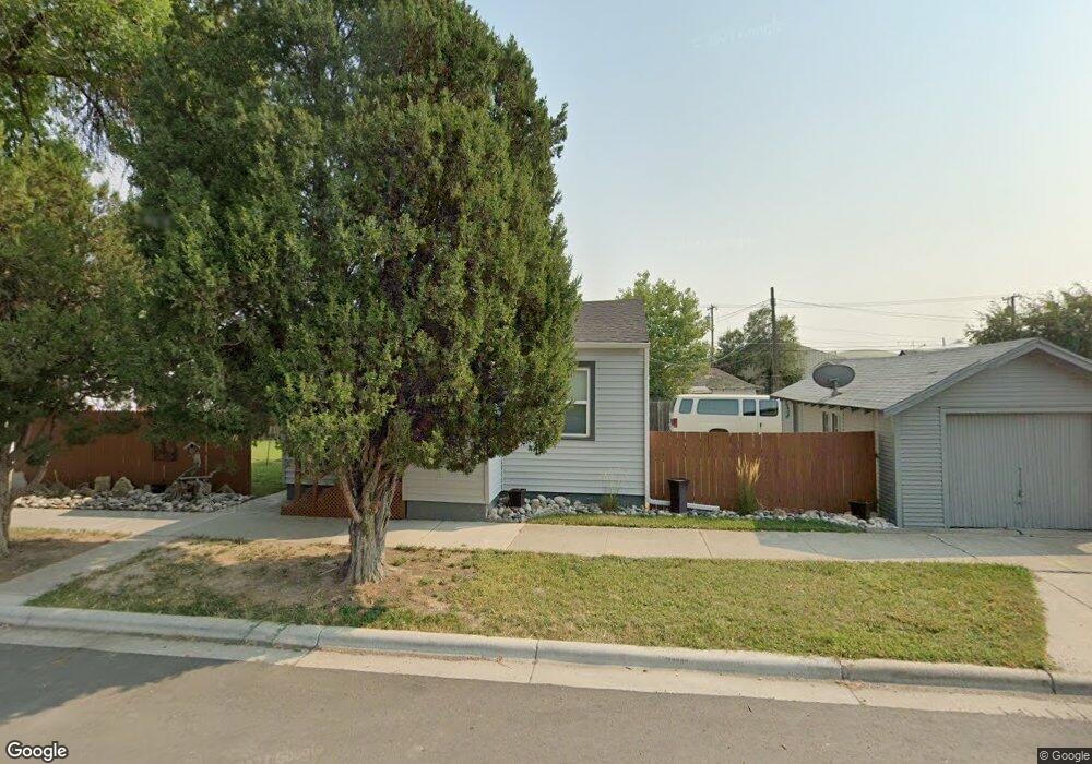
20 Washington and 512 East 1st St Laurel, MT 59044
Estimated Value: $255,000 - $294,000
2
Beds
1
Bath
1,274
Sq Ft
$219/Sq Ft
Est. Value
About This Home
This home is located at 20 Washington and 512 East 1st St, Laurel, MT 59044 and is currently estimated at $278,733, approximately $218 per square foot. 20 Washington and 512 East 1st St is a home located in Yellowstone County with nearby schools including Fred W. Graff School, West School, and Laurel Middle School.
Ownership History
Date
Name
Owned For
Owner Type
Purchase Details
Closed on
Mar 19, 2024
Sold by
Michaelson Robert J
Bought by
Sprigler Tessa Marie and Anderson Michelle
Current Estimated Value
Home Financials for this Owner
Home Financials are based on the most recent Mortgage that was taken out on this home.
Original Mortgage
$230,500
Outstanding Balance
$230,398
Interest Rate
6.74%
Mortgage Type
New Conventional
Estimated Equity
$48,335
Purchase Details
Closed on
Jun 23, 2022
Sold by
Anderson Curtis L and Anderson Geraldine K
Bought by
Michaelson Robert J
Home Financials for this Owner
Home Financials are based on the most recent Mortgage that was taken out on this home.
Original Mortgage
$176,400
Interest Rate
5.1%
Mortgage Type
New Conventional
Purchase Details
Closed on
May 29, 2009
Sold by
Doheny Francis V and Doheny Mary M
Bought by
Sheridan William J
Create a Home Valuation Report for This Property
The Home Valuation Report is an in-depth analysis detailing your home's value as well as a comparison with similar homes in the area
Home Values in the Area
Average Home Value in this Area
Purchase History
| Date | Buyer | Sale Price | Title Company |
|---|---|---|---|
| Sprigler Tessa Marie | -- | Title One | |
| Michaelson Robert J | -- | Stewart Title | |
| Sheridan William J | -- | None Available |
Source: Public Records
Mortgage History
| Date | Status | Borrower | Loan Amount |
|---|---|---|---|
| Open | Sprigler Tessa Marie | $230,500 | |
| Previous Owner | Michaelson Robert J | $176,400 |
Source: Public Records
Tax History Compared to Growth
Tax History
| Year | Tax Paid | Tax Assessment Tax Assessment Total Assessment is a certain percentage of the fair market value that is determined by local assessors to be the total taxable value of land and additions on the property. | Land | Improvement |
|---|---|---|---|---|
| 2025 | $2,349 | $288,270 | $54,520 | $233,750 |
| 2024 | $2,349 | $242,291 | $35,381 | $206,910 |
| 2023 | $2,164 | $242,291 | $35,381 | $206,910 |
| 2022 | $1,469 | $175,996 | $0 | $0 |
| 2021 | $1,703 | $175,996 | $0 | $0 |
| 2020 | $1,631 | $167,428 | $0 | $0 |
| 2019 | $1,631 | $167,428 | $0 | $0 |
| 2018 | $1,481 | $141,820 | $0 | $0 |
| 2017 | $1,377 | $141,820 | $0 | $0 |
| 2016 | $1,519 | $137,290 | $0 | $0 |
| 2015 | $1,304 | $137,290 | $0 | $0 |
| 2014 | $1,136 | $61,831 | $0 | $0 |
Source: Public Records
Map
Nearby Homes
- 516 Pennsylvania Ave
- 801 E 4th St
- 717 E 5th, 506 Alder Ave
- 110 E 5th St
- 518 Date Ave
- 1006 Sunhaven Dr
- 1008 Sunhaven Dr
- 1004 E 8th St
- 1104 E 8th St
- 1108 E 8th St
- 802-816 Date Ave
- 116 4th Ave
- 1115 Sunhaven Dr
- 810 Piper Loop
- 1003 Montana Ave
- 211 Woodland Ave
- 109 E 12th St
- 316 Durland Ave
- 102 8th Ave Unit B
- 419 Durland Ave
- 20 Washington Ave
- 16 Washington Ave
- 14 Washington Ave
- 501 E 1st St
- 505 E 1st St
- 19 Wyoming Ave
- 15 Wyoming Ave
- 507 E 1st St
- 11 Wyoming Ave
- 319 Wyoming Ave
- 308 Wyoming Ave
- 314 Wyoming Ave
- 17 Washington Ave
- 320 Wyoming Ave
- 15 Washington Ave
- 411 E 1st St
- 13 Washington Ave
- 412 E 4th St
- 409 E 1st St
- 601 E Main St