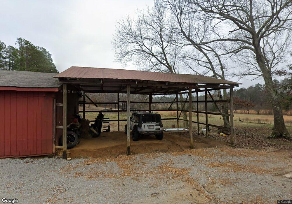
20 Wayne Patterson Ln Finger, TN 38334
Estimated Value: $268,000
--
Bed
3
Baths
2,269
Sq Ft
$118/Sq Ft
Est. Value
About This Home
This home is located at 20 Wayne Patterson Ln, Finger, TN 38334 and is currently estimated at $268,000, approximately $118 per square foot. 20 Wayne Patterson Ln is a home located in Chester County with nearby schools including Chester County High School.
Ownership History
Date
Name
Owned For
Owner Type
Purchase Details
Closed on
Sep 29, 2023
Sold by
Patter James and Patter Dorothy
Bought by
Crouse Brittiany and Crouse Cody
Current Estimated Value
Home Financials for this Owner
Home Financials are based on the most recent Mortgage that was taken out on this home.
Original Mortgage
$312,240
Outstanding Balance
$306,065
Interest Rate
7.09%
Mortgage Type
New Conventional
Estimated Equity
-$38,065
Purchase Details
Closed on
May 31, 2018
Sold by
Patterson James L
Bought by
Patterson Terry Lynn Trustee
Create a Home Valuation Report for This Property
The Home Valuation Report is an in-depth analysis detailing your home's value as well as a comparison with similar homes in the area
Home Values in the Area
Average Home Value in this Area
Purchase History
| Date | Buyer | Sale Price | Title Company |
|---|---|---|---|
| Crouse Brittiany | -- | None Listed On Document | |
| Crouse Brittiany | -- | None Listed On Document | |
| Patterson Terry Lynn Trustee | -- | -- |
Source: Public Records
Mortgage History
| Date | Status | Borrower | Loan Amount |
|---|---|---|---|
| Open | Crouse Brittiany | $312,240 | |
| Closed | Crouse Brittiany | $312,240 |
Source: Public Records
Tax History Compared to Growth
Tax History
| Year | Tax Paid | Tax Assessment Tax Assessment Total Assessment is a certain percentage of the fair market value that is determined by local assessors to be the total taxable value of land and additions on the property. | Land | Improvement |
|---|---|---|---|---|
| 2025 | $524 | $25,725 | $0 | $0 |
| 2024 | $476 | $21,775 | $0 | $0 |
| 2023 | $1,671 | $67,200 | $0 | $0 |
| 2022 | $1,369 | $67,200 | $0 | $0 |
| 2021 | $1,428 | $54,050 | $0 | $0 |
| 2020 | $1,344 | $54,050 | $0 | $0 |
| 2019 | $1,344 | $54,050 | $0 | $0 |
| 2018 | $1,344 | $54,050 | $0 | $0 |
| 2017 | $1,344 | $54,050 | $0 | $0 |
| 2014 | $1,346 | $53,416 | $0 | $0 |
Source: Public Records
Map
Nearby Homes
- 6525 State Route 225
- 5310 Old Friendship Rd
- 00 Tennessee 225
- TRACT 5 Tennessee 225
- TRACT 4 Tennessee 225
- 6145 Tennessee 225
- 2885 Old Friendship Rd
- 9020 Tennessee 225
- 0 Old Cave Springs Rd
- 0 Old Sobby Rd
- 130 Old Sobby Rd
- 1907 Elmer Cox Rd
- 0 Masseyville McNairy Rd
- 1675 Emerson Rd
- 2898 Refuge Rd
- 0 Sol Colston Rd
- 0 Smith Rd
- 226 Sherry Lynn Dr
- 0 Otis Paine Rd
- 0 Grooms Rd
- 5980 Old Friendship Rd
- 5890 Old Friendship Rd
- 6120 Old Friendship Rd
- 6140 Old Friendship Rd
- 5830 Old Friendship Rd
- 6185 Old Friendship Rd
- 6755 State Route 225
- 5725 Old Friendship Rd
- 6845 State Route 225
- 5625 Old Friendship Rd
- 6940 State Route 225
- 455 Wayne Patterson Ln
- 6495 State Route 225
- 6955 State Route 225
- 300 James Patterson Rd
- 530 Wayne Patterson Ln
- 5505 Old Friendship Rd
- 310 James Patterson Rd
- 7140 Tennessee 225
- 7140 State Route 225
