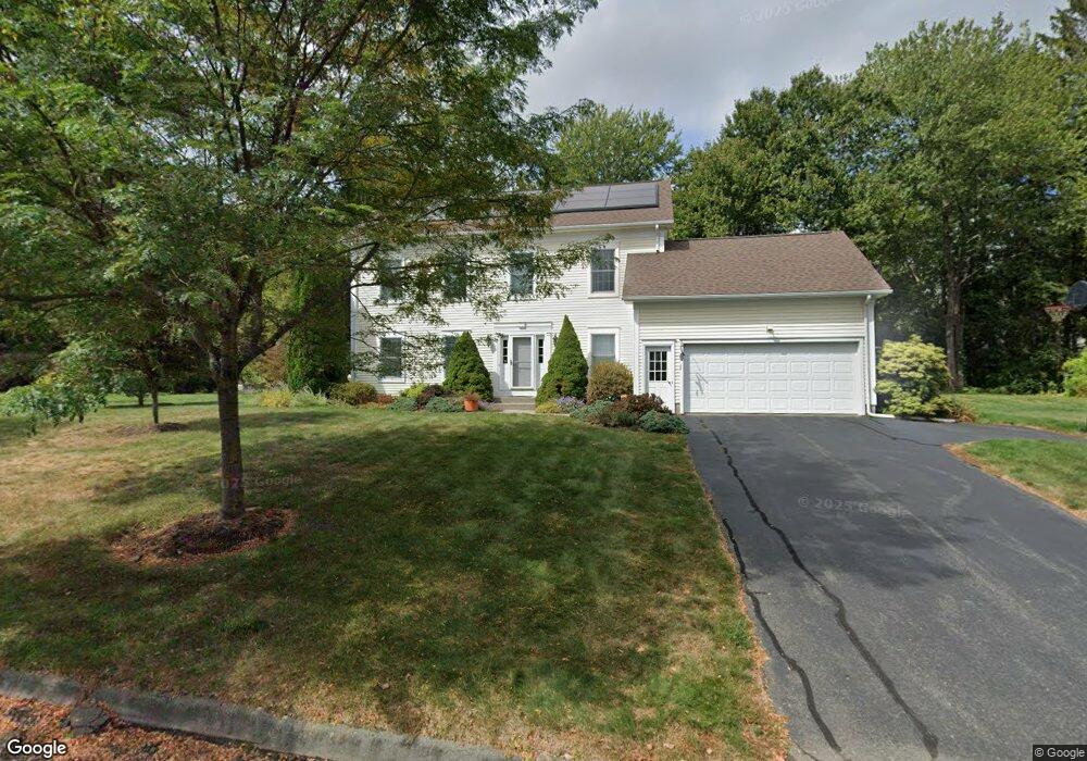
20 Weaver Cir Amherst, MA 01002
Estimated Value: $640,000 - $747,000
4
Beds
3
Baths
2,228
Sq Ft
$307/Sq Ft
Est. Value
About This Home
This home is located at 20 Weaver Cir, Amherst, MA 01002 and is currently estimated at $683,419, approximately $306 per square foot. 20 Weaver Cir is a home located in Hampshire County with nearby schools including Wildwood Elementary School, Amherst Regional Middle School, and Amherst Regional High School.
Ownership History
Date
Name
Owned For
Owner Type
Purchase Details
Closed on
Aug 14, 2025
Sold by
Shah-Mahoney Nalini
Bought by
Mahoney Colin V and Mahoney Neale A
Current Estimated Value
Purchase Details
Closed on
Mar 31, 1995
Sold by
Jones Paul C and Patterson Robert K
Bought by
Mahoney Raymond R and Shah-Mahoney Nalini
Create a Home Valuation Report for This Property
The Home Valuation Report is an in-depth analysis detailing your home's value as well as a comparison with similar homes in the area
Home Values in the Area
Average Home Value in this Area
Purchase History
| Date | Buyer | Sale Price | Title Company |
|---|---|---|---|
| Mahoney Colin V | -- | -- | |
| Mahoney Colin V | -- | -- | |
| Mahoney Raymond R | $70,000 | -- | |
| Mahoney Raymond R | $70,000 | -- |
Source: Public Records
Mortgage History
| Date | Status | Borrower | Loan Amount |
|---|---|---|---|
| Previous Owner | Mahoney Raymond R | $127,000 | |
| Previous Owner | Mahoney Raymond R | $120,000 |
Source: Public Records
Tax History
| Year | Tax Paid | Tax Assessment Tax Assessment Total Assessment is a certain percentage of the fair market value that is determined by local assessors to be the total taxable value of land and additions on the property. | Land | Improvement |
|---|---|---|---|---|
| 2025 | $9,932 | $553,300 | $206,300 | $347,000 |
| 2024 | $9,694 | $523,700 | $194,700 | $329,000 |
| 2023 | $9,393 | $467,300 | $177,100 | $290,200 |
| 2022 | $8,959 | $421,200 | $161,000 | $260,200 |
| 2021 | $8,532 | $391,000 | $149,100 | $241,900 |
| 2020 | $8,873 | $416,200 | $149,100 | $267,100 |
| 2019 | $8,567 | $393,000 | $149,100 | $243,900 |
| 2018 | $8,308 | $393,000 | $149,100 | $243,900 |
| 2017 | $8,352 | $382,600 | $142,100 | $240,500 |
| 2016 | $8,119 | $382,600 | $142,100 | $240,500 |
| 2015 | $7,859 | $382,600 | $142,100 | $240,500 |
Source: Public Records
Map
Nearby Homes
- 185 Cherry Ln
- Lot A Kingman Rd
- 12 Teawaddle Ln
- 167 Rolling Ridge Rd
- 60 Red Gate Ln
- 0 Red Gate Ln Unit 73348273
- 242 N East St Unit 24
- 48 Gray St
- 174 Lincoln Ave
- Lot 3 Roosevelt St
- 0 Main St
- 75 Amity Place Unit 75
- 63 Amity Place Unit 63
- 113 Juggler Meadow Rd
- Lot A January Hills Rd
- 3 Frost Ln
- 0 Amherst Rd
- 6 Shattuck Rd
- 38 S Plain Rd
- 9 Harkness Rd
Your Personal Tour Guide
Ask me questions while you tour the home.