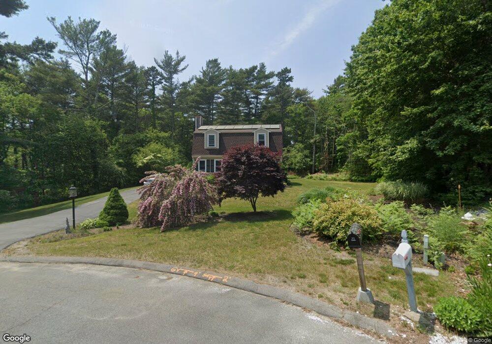
20 Weldons Rd Buzzards Bay, MA 02532
Estimated Value: $556,000 - $639,000
3
Beds
2
Baths
1,536
Sq Ft
$377/Sq Ft
Est. Value
About This Home
This home is located at 20 Weldons Rd, Buzzards Bay, MA 02532 and is currently estimated at $579,037, approximately $376 per square foot. 20 Weldons Rd is a home located in Barnstable County with nearby schools including Bourne High School and Bridgeview Montessori School.
Ownership History
Date
Name
Owned For
Owner Type
Purchase Details
Closed on
Oct 19, 2023
Sold by
Moniz Clifton H and Moniz Ramona J
Bought by
Moniz Ft and Moniz
Current Estimated Value
Purchase Details
Closed on
Jun 26, 2000
Sold by
Brown Daniel L and Brown Litza M
Bought by
Moniz Clifton
Purchase Details
Closed on
Oct 28, 1996
Sold by
Decoste Diana C and Decoste Russell
Bought by
Brown Daniel L and Brown Litza M
Purchase Details
Closed on
May 22, 1992
Sold by
Weldon Park Rt
Bought by
Rooney Diana and Decoste Russell
Create a Home Valuation Report for This Property
The Home Valuation Report is an in-depth analysis detailing your home's value as well as a comparison with similar homes in the area
Purchase History
| Date | Buyer | Sale Price | Title Company |
|---|---|---|---|
| Moniz Ft | -- | None Available | |
| Moniz Ft | -- | None Available | |
| Moniz Clifton | $185,000 | -- | |
| Moniz Clifton | $185,000 | -- | |
| Brown Daniel L | $114,000 | -- | |
| Brown Daniel L | $114,000 | -- | |
| Rooney Diana | $107,485 | -- | |
| Rooney Diana | $107,485 | -- |
Source: Public Records
Mortgage History
| Date | Status | Borrower | Loan Amount |
|---|---|---|---|
| Previous Owner | Rooney Diana | $227,000 | |
| Previous Owner | Rooney Diana | $152,000 |
Source: Public Records
Tax History
| Year | Tax Paid | Tax Assessment Tax Assessment Total Assessment is a certain percentage of the fair market value that is determined by local assessors to be the total taxable value of land and additions on the property. | Land | Improvement |
|---|---|---|---|---|
| 2025 | $3,696 | $473,200 | $193,300 | $279,900 |
| 2024 | $3,614 | $450,600 | $184,100 | $266,500 |
| 2023 | $3,673 | $416,900 | $181,100 | $235,800 |
| 2022 | $3,504 | $347,300 | $160,200 | $187,100 |
| 2021 | $3,427 | $318,200 | $145,800 | $172,400 |
| 2020 | $3,323 | $309,400 | $144,400 | $165,000 |
| 2019 | $3,154 | $300,100 | $144,400 | $155,700 |
| 2018 | $2,958 | $280,600 | $137,600 | $143,000 |
| 2017 | $2,880 | $279,600 | $136,300 | $143,300 |
| 2016 | $2,789 | $274,500 | $136,300 | $138,200 |
| 2015 | $2,764 | $274,500 | $136,300 | $138,200 |
Source: Public Records
Map
Nearby Homes
- 0 State Rd
- 150 Herring Pond Rd
- 16 Ocean Pines Dr Unit B
- 7 Swamp Rd
- 11 Village Green Dr Unit B
- 17 Ridgehill Ln
- 6 Aspen Rd Unit 6
- 6 Aspen Rd
- 4 Andrew Rd
- 110 Valley Rd
- 8 Driftwood Ln
- 11 Womponoag Rd
- 2 Womponoag Rd
- 10 Tecumseh Rd
- 10 Shore Rd
- 30 Pawtuxet Rd
- 8 Jillian Dr
- 133 Phillips Rd
- 53 Carters Bridge Rd
- 40 Menotomy Rd
Your Personal Tour Guide
Ask me questions while you tour the home.