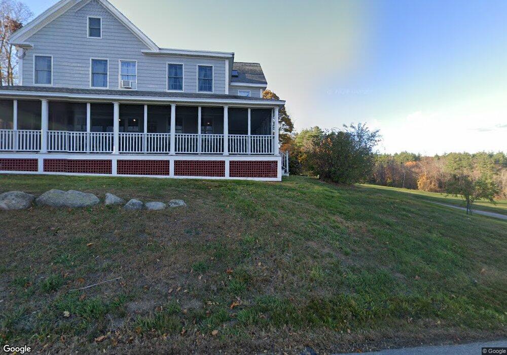
20 Whitehall Rd South Hampton, NH 03827
Estimated Value: $1,058,385 - $1,269,000
4
Beds
3
Baths
3,709
Sq Ft
$316/Sq Ft
Est. Value
About This Home
This home is located at 20 Whitehall Rd, South Hampton, NH 03827 and is currently estimated at $1,170,846, approximately $315 per square foot. 20 Whitehall Rd is a home located in Rockingham County with nearby schools including South Hampton Barnard School, Winnacunnet High School, and Amesbury Seventh-Day Adventist School.
Ownership History
Date
Name
Owned For
Owner Type
Purchase Details
Closed on
Oct 1, 2018
Sold by
Gilardi Stephen C and Harty Joyce M
Bought by
Harty Ft
Current Estimated Value
Purchase Details
Closed on
Dec 19, 2011
Sold by
Ramsdell Jill E
Bought by
Gilardi Stephen C and Harty Joyce M
Home Financials for this Owner
Home Financials are based on the most recent Mortgage that was taken out on this home.
Original Mortgage
$417,000
Interest Rate
4.01%
Mortgage Type
Purchase Money Mortgage
Create a Home Valuation Report for This Property
The Home Valuation Report is an in-depth analysis detailing your home's value as well as a comparison with similar homes in the area
Home Values in the Area
Average Home Value in this Area
Purchase History
| Date | Buyer | Sale Price | Title Company |
|---|---|---|---|
| Harty Ft | -- | -- | |
| Gilardi Stephen C | $475,000 | -- |
Source: Public Records
Mortgage History
| Date | Status | Borrower | Loan Amount |
|---|---|---|---|
| Previous Owner | Gilardi Stephen C | $36,400 | |
| Previous Owner | Gilardi Stephen C | $417,000 |
Source: Public Records
Tax History Compared to Growth
Tax History
| Year | Tax Paid | Tax Assessment Tax Assessment Total Assessment is a certain percentage of the fair market value that is determined by local assessors to be the total taxable value of land and additions on the property. | Land | Improvement |
|---|---|---|---|---|
| 2024 | $14,275 | $1,034,400 | $366,500 | $667,900 |
| 2023 | $14,275 | $1,034,400 | $366,500 | $667,900 |
| 2022 | $12,887 | $648,900 | $245,100 | $403,800 |
| 2021 | $12,259 | $615,100 | $245,100 | $370,000 |
| 2020 | $11,681 | $615,100 | $245,100 | $370,000 |
| 2019 | $10,980 | $615,100 | $245,100 | $370,000 |
| 2018 | $10,254 | $615,100 | $245,100 | $370,000 |
| 2017 | $9,451 | $491,200 | $207,800 | $283,400 |
| 2016 | $8,955 | $491,200 | $207,800 | $283,400 |
| 2015 | $9,628 | $483,100 | $207,800 | $275,300 |
| 2014 | $9,034 | $483,100 | $207,800 | $275,300 |
| 2012 | $8,894 | $603,000 | $275,400 | $327,600 |
Source: Public Records
Map
Nearby Homes
- 10 Mason Ct Unit 10
- 28 Powderhouse Ct Unit 28
- 4 Woodsom Dr
- 3 Glen Devin St
- 16 Glen Devin St
- 1 Tuxbury Ln
- 152 Kimball Rd
- 25 Whittier Meadows Dr
- 2 Locke Hill Ln
- 73 Kimball Rd
- 8 Mockingbird Hill Rd
- 188 Lions Mouth Rd
- 5 Moncrief St Unit 5
- 179 Lions Mouth Rd
- 4 Acadia Kimball Rd
- 48 Orchard St
- 81 High St Unit 27
- 1 Brown Ave Unit 3-78
- 1 Brown Ave Unit 3-80
- 3 Brown Ave Unit 75
- 20 Whitehall Rd Unit 20
- 27 Whitehall Rd Unit 27
- 27 Whitehall Rd
- 29 Whitehall Rd
- 14 Whitehall Rd
- 33 Whitehall Rd
- 32 Whitehall Rd
- 49 Whitehall Rd
- 11 Whitehall Rd
- 39 Whitehall Rd
- 66 Jewell St
- 3 Whitehall Rd
- 71 Jewell St
- 4 Whitehall Rd
- 4 Whitehall Rd
- 44 Whitehall Rd
- 60 Jewell St
- 186 Whitehall Rd
- 2 Whitehall Rd
- 184 Whitehall Rd