Estimated Value: $422,732 - $530,000
4
Beds
3
Baths
2,333
Sq Ft
$197/Sq Ft
Est. Value
About This Home
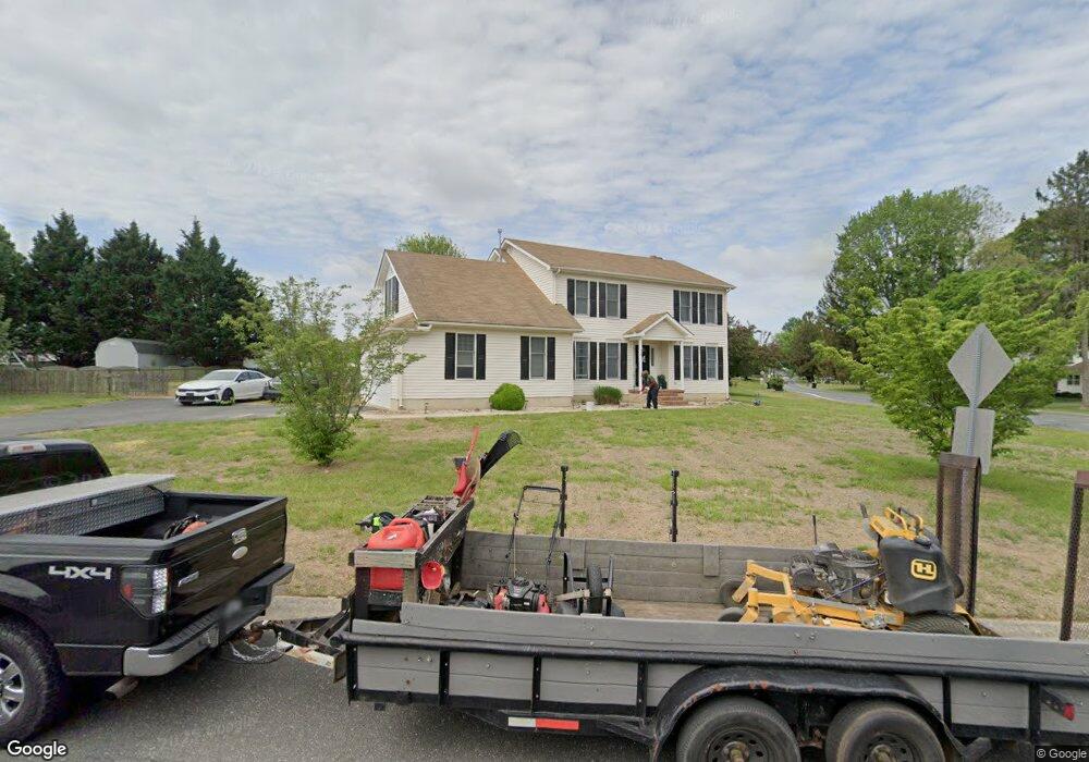
This home is located at 20 Windsor Dr, Dover, DE 19901 and is currently estimated at $459,183, approximately $196 per square foot. 20 Windsor Dr is a home located in Kent County with nearby schools including Star Hill Elementary School, F. Niel Postlethwait Middle School, and Caesar Rodney High School.
Ownership History
Date
Name
Owned For
Owner Type
Purchase Details
Closed on
Jan 31, 2005
Sold by
Barrett David L and Barrett Michelle L
Bought by
Mouhtarim Khalid
Current Estimated Value
Home Financials for this Owner
Home Financials are based on the most recent Mortgage that was taken out on this home.
Original Mortgage
$216,000
Outstanding Balance
$111,518
Interest Rate
5.99%
Mortgage Type
Adjustable Rate Mortgage/ARM
Estimated Equity
$347,665
Purchase Details
Closed on
Dec 1, 1996
Bought by
Mouhtarim Khalid and Barrett David L
Create a Home Valuation Report for This Property
The Home Valuation Report is an in-depth analysis detailing your home's value as well as a comparison with similar homes in the area
Home Values in the Area
Average Home Value in this Area
Purchase History
| Date | Buyer | Sale Price | Title Company |
|---|---|---|---|
| Mouhtarim Khalid | -- | None Available | |
| Mouhtarim Khalid | $161,600 | -- |
Source: Public Records
Mortgage History
| Date | Status | Borrower | Loan Amount |
|---|---|---|---|
| Open | Mouhtarim Khalid | $216,000 |
Source: Public Records
Tax History
| Year | Tax Paid | Tax Assessment Tax Assessment Total Assessment is a certain percentage of the fair market value that is determined by local assessors to be the total taxable value of land and additions on the property. | Land | Improvement |
|---|---|---|---|---|
| 2025 | $2,196 | $421,800 | $106,900 | $314,900 |
| 2024 | $2,209 | $421,800 | $106,900 | $314,900 |
| 2023 | $2,056 | $62,000 | $7,000 | $55,000 |
| 2022 | $1,935 | $62,000 | $7,000 | $55,000 |
| 2021 | $1,925 | $62,000 | $7,000 | $55,000 |
| 2020 | $1,870 | $62,000 | $7,000 | $55,000 |
| 2019 | $1,806 | $62,000 | $7,000 | $55,000 |
| 2018 | $1,767 | $62,000 | $7,000 | $55,000 |
| 2017 | $1,733 | $62,000 | $0 | $0 |
| 2016 | $1,634 | $62,000 | $0 | $0 |
| 2015 | $1,414 | $62,000 | $0 | $0 |
| 2014 | $1,434 | $62,000 | $0 | $0 |
Source: Public Records
Map
Nearby Homes
- 100 Brookfield Dr
- 46 Brookfield Dr
- 24 Brookfield Dr
- 42 Brookfield Dr
- 43 Brookfield Dr
- 45 Brookfield Dr
- Lot 22 Bee Brookfield Dr
- 256 Headstart Ln
- LOT 102 AST King Henry Ct
- LOT 105 SYC Brookfield Dr
- 870 Brookfield Dr
- 850 Brookfield Dr
- 1041 Fawn Haven Walk
- 157 Roundabout Trail
- 235 Fawn Haven Walk
- 464 Orchard Grove Dr
- 103 Osprey Ct
- 16 Lone Tree Dr
- 45 Capricorn Way
- 1217 Voshells Mill Star Hill Rd
- 1004 Lochmeath Way
- 18 King Henry Ct
- 21 Windsor Dr
- 1007 Lochmeath Way
- 1033 Lochmeath Way
- 42 King Henry Ct
- 15 Benson Ct
- 980 Lochmeath Way
- 4 King Henry Ct
- 70 King Henry Ct
- 1082 Lochmeath Way
- 977 Lochmeath Way
- 43 Benson Ct
- 19 King Henry Ct
- 94 King Henry Ct
- 954 Lochmeath Way
- 41 King Henry Ct
- 16 Benson Ct
- 71 Benson Ct
- 71 King Henry Ct
Your Personal Tour Guide
Ask me questions while you tour the home.