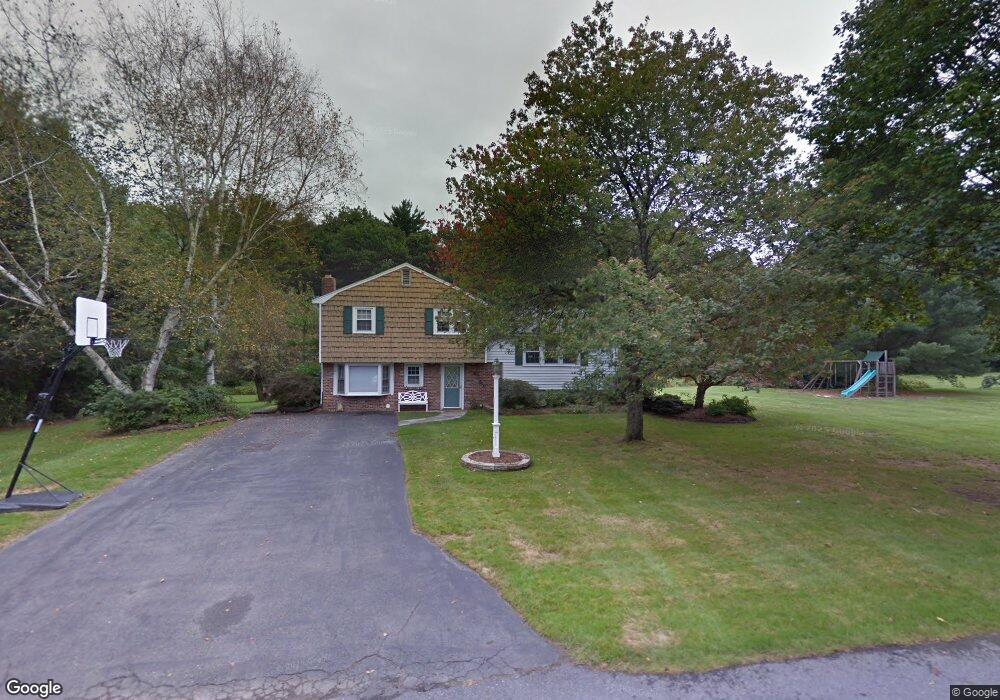
20 Wright Rd Sudbury, MA 01776
Estimated Value: $719,000 - $936,000
3
Beds
2
Baths
1,440
Sq Ft
$568/Sq Ft
Est. Value
About This Home
This home is located at 20 Wright Rd, Sudbury, MA 01776 and is currently estimated at $818,515, approximately $568 per square foot. 20 Wright Rd is a home located in Middlesex County with nearby schools including Israel Loring Elementary School, Ephraim Curtis Middle School, and Lincoln-Sudbury Regional High School.
Ownership History
Date
Name
Owned For
Owner Type
Purchase Details
Closed on
Aug 5, 2002
Sold by
Duarte Patricia F
Bought by
Graff Robin M and Graff Arlene M
Current Estimated Value
Home Financials for this Owner
Home Financials are based on the most recent Mortgage that was taken out on this home.
Original Mortgage
$240,000
Outstanding Balance
$102,209
Interest Rate
6.64%
Mortgage Type
Purchase Money Mortgage
Estimated Equity
$716,306
Create a Home Valuation Report for This Property
The Home Valuation Report is an in-depth analysis detailing your home's value as well as a comparison with similar homes in the area
Home Values in the Area
Average Home Value in this Area
Purchase History
| Date | Buyer | Sale Price | Title Company |
|---|---|---|---|
| Graff Robin M | $300,000 | -- | |
| Graff Robin M | $300,000 | -- |
Source: Public Records
Mortgage History
| Date | Status | Borrower | Loan Amount |
|---|---|---|---|
| Open | Graff Robin M | $240,000 | |
| Closed | Graff Robin M | $240,000 | |
| Previous Owner | Graff Robin M | $57,000 |
Source: Public Records
Tax History Compared to Growth
Tax History
| Year | Tax Paid | Tax Assessment Tax Assessment Total Assessment is a certain percentage of the fair market value that is determined by local assessors to be the total taxable value of land and additions on the property. | Land | Improvement |
|---|---|---|---|---|
| 2025 | $11,162 | $762,400 | $438,900 | $323,500 |
| 2024 | $10,788 | $738,400 | $426,100 | $312,300 |
| 2023 | $10,731 | $680,500 | $394,500 | $286,000 |
| 2022 | $10,077 | $558,300 | $362,100 | $196,200 |
| 2021 | $9,767 | $518,700 | $362,100 | $156,600 |
| 2020 | $9,570 | $518,700 | $362,100 | $156,600 |
| 2019 | $9,290 | $518,700 | $362,100 | $156,600 |
| 2018 | $9,266 | $516,800 | $386,100 | $130,700 |
| 2017 | $8,673 | $488,900 | $367,300 | $121,600 |
| 2016 | $8,427 | $473,400 | $353,300 | $120,100 |
| 2015 | $7,931 | $450,600 | $339,700 | $110,900 |
| 2014 | $7,868 | $436,400 | $329,700 | $106,700 |
Source: Public Records
Map
Nearby Homes
- 84 Hopestill Brown Rd
- 0 Wagonwheel Rd
- 216 Landham Rd
- 63 Landham Rd
- 23 Massasoit Ave
- 1011 Boston Post Rd
- 36 Concord Rd
- 14 Eisenhower Rd
- 128 Nobscot Rd
- 91 Eaton Rd W
- 19 Nob Hill Dr
- 32 Eaton Rd W
- 94 Goodmans Hill Rd
- 30 Edith Rd
- 27 Sloane Dr
- 30 Nobscot Rd Unit 14
- 24 Woodland Rd
- 6 Old County Rd Unit 16
- 8 Clara Rd
- 14 Francine Rd