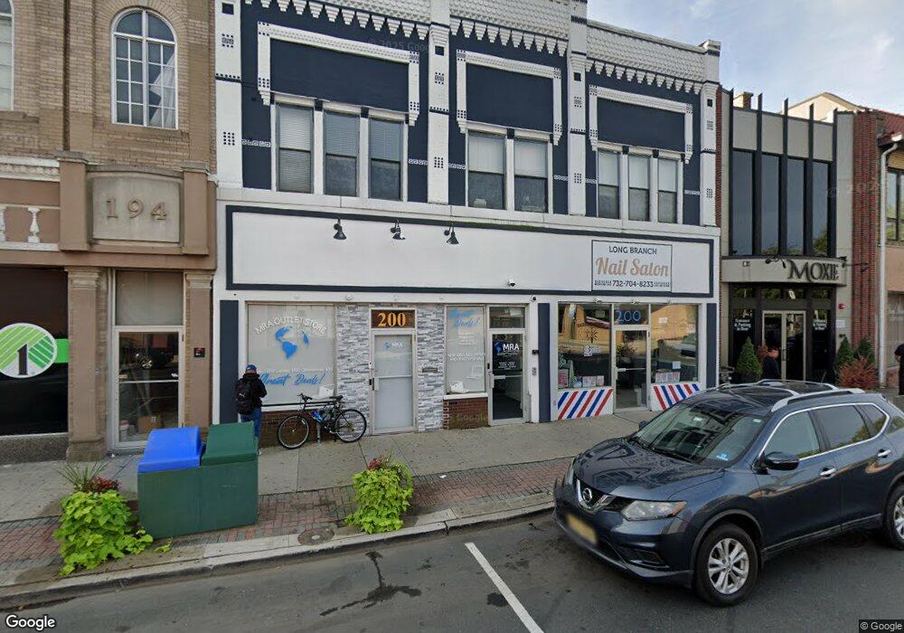
200 Broadway Long Branch, NJ 07740
Estimated Value: $1,255,847
--
Bed
--
Bath
7,694
Sq Ft
$163/Sq Ft
Est. Value
About This Home
This home is located at 200 Broadway, Long Branch, NJ 07740 and is currently estimated at $1,255,847, approximately $163 per square foot. 200 Broadway is a home located in Monmouth County with nearby schools including Long Branch High School and Holy Trinity School.
Ownership History
Date
Name
Owned For
Owner Type
Purchase Details
Closed on
Dec 31, 2014
Sold by
200 Broadway Llc
Bought by
Broadway 200 Llc
Current Estimated Value
Purchase Details
Closed on
Dec 18, 2001
Sold by
Delatush Gary
Bought by
200 Broadway Llc
Home Financials for this Owner
Home Financials are based on the most recent Mortgage that was taken out on this home.
Original Mortgage
$385,000
Interest Rate
7.04%
Mortgage Type
Commercial
Create a Home Valuation Report for This Property
The Home Valuation Report is an in-depth analysis detailing your home's value as well as a comparison with similar homes in the area
Home Values in the Area
Average Home Value in this Area
Purchase History
| Date | Buyer | Sale Price | Title Company |
|---|---|---|---|
| Broadway 200 Llc | $610,000 | Agent For Old Republic Natl | |
| 200 Broadway Llc | $490,000 | -- |
Source: Public Records
Mortgage History
| Date | Status | Borrower | Loan Amount |
|---|---|---|---|
| Previous Owner | 200 Broadway Llc | $385,000 |
Source: Public Records
Tax History Compared to Growth
Tax History
| Year | Tax Paid | Tax Assessment Tax Assessment Total Assessment is a certain percentage of the fair market value that is determined by local assessors to be the total taxable value of land and additions on the property. | Land | Improvement |
|---|---|---|---|---|
| 2025 | $13,876 | $977,500 | $216,400 | $761,100 |
| 2024 | $12,652 | $902,800 | $207,400 | $695,400 |
| 2023 | $12,652 | $814,700 | $202,900 | $611,800 |
| 2022 | $13,241 | $706,000 | $189,400 | $516,600 |
| 2021 | $13,241 | $661,700 | $184,900 | $476,800 |
| 2020 | $13,361 | $639,300 | $170,500 | $468,800 |
| 2019 | $13,039 | $620,300 | $161,500 | $458,800 |
| 2018 | $13,018 | $615,800 | $157,000 | $458,800 |
| 2017 | $12,673 | $614,900 | $156,100 | $458,800 |
| 2016 | $12,464 | $616,700 | $157,900 | $458,800 |
| 2015 | $15,268 | $685,600 | $172,300 | $513,300 |
| 2014 | $13,735 | $650,000 | $251,500 | $398,500 |
Source: Public Records
Map
Nearby Homes
- 145 Stokes Place
- 143 Stokes Place
- 167 Chelsea Ave
- 40 N 5th Ave
- 14 Slocum Place
- 166 Franklin Ave Unit 8
- 103 Franklin Ave
- 144 Westwood Ave
- 158 Franklin Ave
- 152 Franklin Ave
- 150 Franklin Ave Unit 5
- 170 Franklin Ave
- 40 University Dr
- 55 Melrose Terrace Unit 209
- 55 Melrose Terrace Unit 112
- 151 N 5th Ave
- 20 Melrose Terrace Unit 202
- 20 Melrose Terrace Unit 408
- 20 Melrose Terrace Unit 305
- 30 Melrose Terrace Unit 209
- 188-190 Broadway
- 220 Broadway
- 27 3rd Ave Unit 211
- 27 3rd Ave Unit 205
- 27 3rd Ave Unit 201
- 27 3rd Ave Unit 403
- 27 3rd Ave Unit 401
- 27 3rd Ave Unit 308
- 27 3rd Ave Unit 302
- 27 3rd Ave Unit 406
- 27 3rd Ave Unit 402
- 27 3rd Ave Unit 306
- 27 3rd Ave Unit 303
- 27 3rd Ave Unit 301
- 27 3rd Ave Unit 208
- 27 3rd Ave Unit 206
- 27 3rd Ave Unit 203
- 27 3rd Ave Unit 210
- 27 3rd Ave Unit 408
- 27 3rd Ave Unit 309