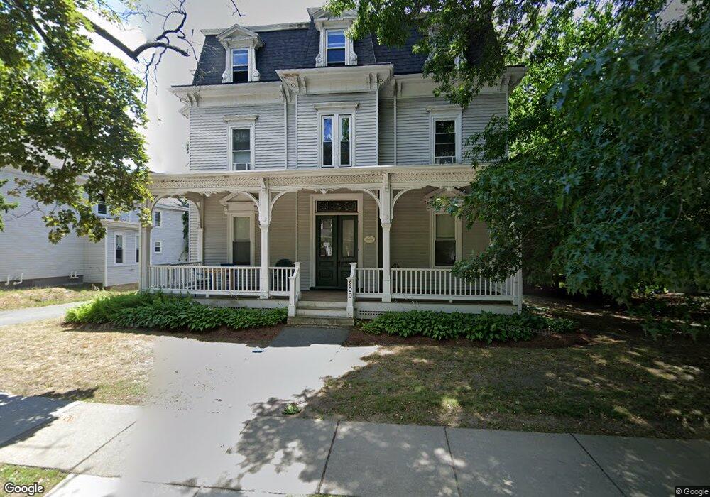
200 Church St Unit 2 Newton, MA 02458
Newton Corner NeighborhoodEstimated Value: $554,535 - $793,000
2
Beds
2
Baths
932
Sq Ft
$711/Sq Ft
Est. Value
About This Home
This home is located at 200 Church St Unit 2, Newton, MA 02458 and is currently estimated at $662,384, approximately $710 per square foot. 200 Church St Unit 2 is a home located in Middlesex County with nearby schools including Underwood Elementary School, Bigelow Middle School, and Newton North High School.
Ownership History
Date
Name
Owned For
Owner Type
Purchase Details
Closed on
Dec 15, 2008
Sold by
Ford J Marjorie
Bought by
Boger Kenneth S and Boger Robin Z
Current Estimated Value
Purchase Details
Closed on
Dec 1, 1989
Sold by
Gold Robert D
Bought by
Ford J Marjorie
Home Financials for this Owner
Home Financials are based on the most recent Mortgage that was taken out on this home.
Original Mortgage
$160,000
Interest Rate
9.82%
Mortgage Type
Purchase Money Mortgage
Create a Home Valuation Report for This Property
The Home Valuation Report is an in-depth analysis detailing your home's value as well as a comparison with similar homes in the area
Home Values in the Area
Average Home Value in this Area
Purchase History
| Date | Buyer | Sale Price | Title Company |
|---|---|---|---|
| Boger Kenneth S | $325,000 | -- | |
| Ford J Marjorie | $200,000 | -- |
Source: Public Records
Mortgage History
| Date | Status | Borrower | Loan Amount |
|---|---|---|---|
| Previous Owner | Ford J Marjorie | $160,000 |
Source: Public Records
Tax History Compared to Growth
Tax History
| Year | Tax Paid | Tax Assessment Tax Assessment Total Assessment is a certain percentage of the fair market value that is determined by local assessors to be the total taxable value of land and additions on the property. | Land | Improvement |
|---|---|---|---|---|
| 2025 | $4,990 | $509,200 | $0 | $509,200 |
| 2024 | $4,825 | $494,400 | $0 | $494,400 |
| 2023 | $4,734 | $465,000 | $0 | $465,000 |
| 2022 | $4,659 | $442,900 | $0 | $442,900 |
| 2021 | $4,496 | $417,800 | $0 | $417,800 |
| 2020 | $4,362 | $417,800 | $0 | $417,800 |
| 2019 | $4,239 | $405,600 | $0 | $405,600 |
| 2018 | $4,248 | $392,600 | $0 | $392,600 |
| 2017 | $4,119 | $370,400 | $0 | $370,400 |
| 2016 | $3,940 | $346,200 | $0 | $346,200 |
| 2015 | $3,828 | $329,700 | $0 | $329,700 |
Source: Public Records
Map
Nearby Homes
- 12 Richardson St Unit 14
- 14 Summit St
- 548 Centre St Unit 5
- 9 Baldwin St Unit 15C
- 34 Channing St Unit 1
- 34 Channing St Unit 2
- 68 Vernon St
- 1 Channing St
- 90 Waban Park Unit 2
- 35 George St Unit 35
- 37 George St Unit 37
- 686 Centre St
- 169 Washington St Unit 7
- 230 Bellevue St Unit 1
- 59 Hyde Ave
- 30 Boyd St Unit 30
- 324 Adams St Unit 2
- 159 Washington St Unit 4
- 15-17 Jewett Place Unit 2
- 164 Galen St Unit 88
- 200 Church St Unit 1
- 200 Church St
- 200 Church St Unit 4
- 200 Church St
- 200 Church St Unit 3
- 18 Maple Ave Unit 20
- 20 Maple Ave Unit 20
- 20 Maple Ave
- 19 Wesley St
- 14 Maple Ave
- 188 Church St Unit 2
- 188 Church St Unit 1
- 188 Church St
- 188 Church St Unit R
- 11 Maple Cir Unit 13
- 11 Maple Cir Unit 11
- 11 Maple Cir
- 194 Church St
- 25 Maple Ave
- 26 Maple Ave