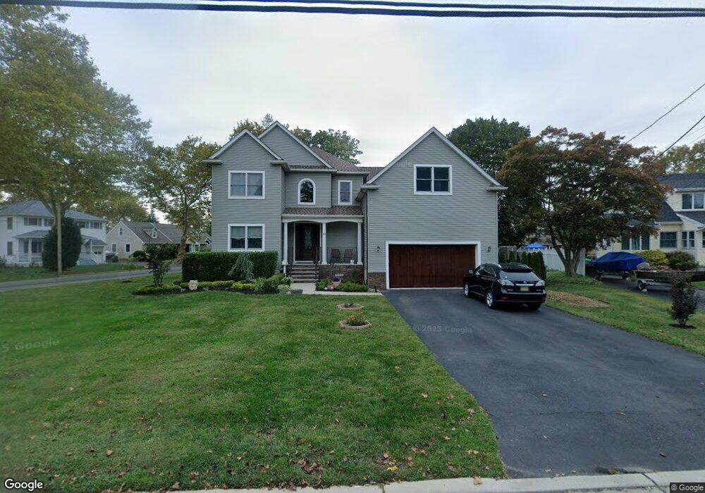
200 Comanche Dr Oceanport, NJ 07757
Estimated Value: $1,200,000 - $1,430,397
3
Beds
2
Baths
2,962
Sq Ft
$455/Sq Ft
Est. Value
About This Home
This home is located at 200 Comanche Dr, Oceanport, NJ 07757 and is currently estimated at $1,347,849, approximately $455 per square foot. 200 Comanche Dr is a home located in Monmouth County with nearby schools including Wolf Hill Elementary School, Maple Place Elementary and Middle School, and Shore Regional High School.
Ownership History
Date
Name
Owned For
Owner Type
Purchase Details
Closed on
Jul 11, 1994
Sold by
Lambkin Alfred
Bought by
Baggot Chris and Baggot Wendy
Current Estimated Value
Home Financials for this Owner
Home Financials are based on the most recent Mortgage that was taken out on this home.
Original Mortgage
$135,000
Interest Rate
8.19%
Purchase Details
Closed on
Dec 9, 1987
Bought by
Baggot Chris A and Baggot Wendy K
Create a Home Valuation Report for This Property
The Home Valuation Report is an in-depth analysis detailing your home's value as well as a comparison with similar homes in the area
Home Values in the Area
Average Home Value in this Area
Purchase History
| Date | Buyer | Sale Price | Title Company |
|---|---|---|---|
| Baggot Chris | $190,000 | -- | |
| Baggot Chris A | $235,000 | -- |
Source: Public Records
Mortgage History
| Date | Status | Borrower | Loan Amount |
|---|---|---|---|
| Closed | Baggot Chris | $135,000 |
Source: Public Records
Tax History Compared to Growth
Tax History
| Year | Tax Paid | Tax Assessment Tax Assessment Total Assessment is a certain percentage of the fair market value that is determined by local assessors to be the total taxable value of land and additions on the property. | Land | Improvement |
|---|---|---|---|---|
| 2025 | $14,442 | $971,000 | $408,300 | $562,700 |
| 2024 | $14,705 | $914,600 | $370,300 | $544,300 |
| 2023 | $14,705 | $883,700 | $360,800 | $522,900 |
| 2022 | $14,733 | $797,800 | $332,300 | $465,500 |
| 2021 | $14,733 | $773,400 | $327,600 | $445,800 |
| 2020 | $13,909 | $760,900 | $322,800 | $438,100 |
| 2019 | $13,511 | $750,200 | $322,800 | $427,400 |
| 2018 | $5,775 | $322,800 | $322,800 | $0 |
| 2017 | $3,915 | $181,500 | $181,500 | $0 |
| 2016 | $3,909 | $182,400 | $182,400 | $0 |
| 2015 | $4,884 | $235,500 | $177,700 | $57,800 |
| 2014 | $5,787 | $283,000 | $225,200 | $57,800 |
Source: Public Records
Map
Nearby Homes
- 27 Ithaca Ave
- 580 Patten Ave Unit 47
- 580 Patten Ave Unit 48
- 580 Patten Ave Unit 62
- 580 Patten Ave Unit 86
- 165 Riddle Ave Unit 7
- 16 Shore Dr
- 13 Bayview Ct
- 165 Kingsley St
- 177 Kingsley St
- 15 Signal Ave
- 8 Mann Ct
- 25 Meadow Ave Unit 30
- 25 Spaulding Place
- 164 Airsdale Ave
- 31 Wesley St
- 26 Wesley St
- 3 Foggia Way
- 1 Foggia Way
- 392 Florence Ave