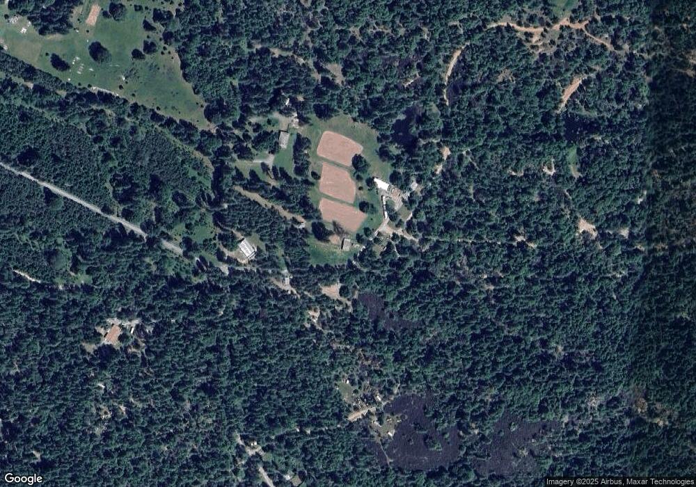
200 Covered Bridge Rd Rogue River, OR 97537
Wimer NeighborhoodEstimated Value: $591,000 - $868,000
2
Beds
2
Baths
1,860
Sq Ft
$398/Sq Ft
Est. Value
About This Home
This home is located at 200 Covered Bridge Rd, Rogue River, OR 97537 and is currently estimated at $741,041, approximately $398 per square foot. 200 Covered Bridge Rd is a home located in Jackson County with nearby schools including Rogue River Elementary School, South Valley Academy, and Rogue River Junior/Senior High School.
Ownership History
Date
Name
Owned For
Owner Type
Purchase Details
Closed on
Feb 25, 2002
Sold by
Taylor Cleo H
Bought by
Lack Robert O and Lack Beverly A
Current Estimated Value
Home Financials for this Owner
Home Financials are based on the most recent Mortgage that was taken out on this home.
Original Mortgage
$150,000
Outstanding Balance
$61,732
Interest Rate
6.85%
Estimated Equity
$679,309
Create a Home Valuation Report for This Property
The Home Valuation Report is an in-depth analysis detailing your home's value as well as a comparison with similar homes in the area
Home Values in the Area
Average Home Value in this Area
Purchase History
| Date | Buyer | Sale Price | Title Company |
|---|---|---|---|
| Lack Robert O | $290,000 | First American Title Ins Co |
Source: Public Records
Mortgage History
| Date | Status | Borrower | Loan Amount |
|---|---|---|---|
| Open | Lack Robert O | $150,000 |
Source: Public Records
Tax History Compared to Growth
Tax History
| Year | Tax Paid | Tax Assessment Tax Assessment Total Assessment is a certain percentage of the fair market value that is determined by local assessors to be the total taxable value of land and additions on the property. | Land | Improvement |
|---|---|---|---|---|
| 2025 | $1,854 | $189,407 | $67,467 | $121,940 |
| 2024 | $1,854 | $184,013 | $65,623 | $118,390 |
| 2023 | $1,819 | $178,779 | $63,829 | $114,950 |
| 2022 | $1,725 | $178,779 | $63,829 | $114,950 |
| 2021 | $1,623 | $173,694 | $62,084 | $111,610 |
| 2020 | $1,580 | $168,759 | $60,399 | $108,360 |
| 2019 | $1,531 | $159,306 | $57,156 | $102,150 |
| 2018 | $1,488 | $154,788 | $55,608 | $99,180 |
| 2017 | $1,465 | $154,788 | $55,608 | $99,180 |
| 2016 | $1,426 | $146,136 | $52,646 | $93,490 |
| 2015 | $1,380 | $146,136 | $52,646 | $93,490 |
| 2014 | $1,329 | $137,986 | $49,846 | $88,140 |
Source: Public Records
Map
Nearby Homes
- 798 Covered Bridge Rd
- 643 Covered Bridge Rd
- 149 Queens Branch Rd
- 255 Queens Branch Rd
- 8951 E Evans Creek Rd Unit 14
- 6324 E Evans Creek Rd
- 9820 E Evans Creek Rd
- 1205 Pine Grove Rd
- 1105 Pine Grove Rd
- 7118 Redthorne Rd
- 835 Minthorne Rd
- 7310 W Evans Creek Rd
- 7435 W Evans Creek Rd
- 1475 Pleasant Creek Rd
- 5406 E Evans Creek Rd
- 9184 W Evans Creek Rd
- 0 E Evans Creek Rd Unit 11568775
- 0 E Evans Creek Rd Unit 24656493
- 250 Deruyte Way
- 252 Deruyte Way
- 10 Covered Bridge Rd
- 7436 E Evans Creek Rd
- 296 Covered Bridge Rd
- 7432 E Evans Creek Rd
- 678 Covered Bridge Rd
- 792 Covered Bridge Rd
- 674 Covered Bridge Rd
- 350 Covered Bridge Rd
- 712 Covered Bridge Rd
- 714 Covered Bridge Rd
- 374 Covered Bridge Realty
- 598 Covered Bridge Rd
- 598 Cov Bridge
- 534 Covered Bridge Rd
- 708 Covered Bridge Rd
- 7502 E Evans Creek Rd
- 368 Covered Bridge Rd
- 628 Covered Bridge
- 788 Covered Bridge Rd
- 3302 TL# Covered Bridge Rd
