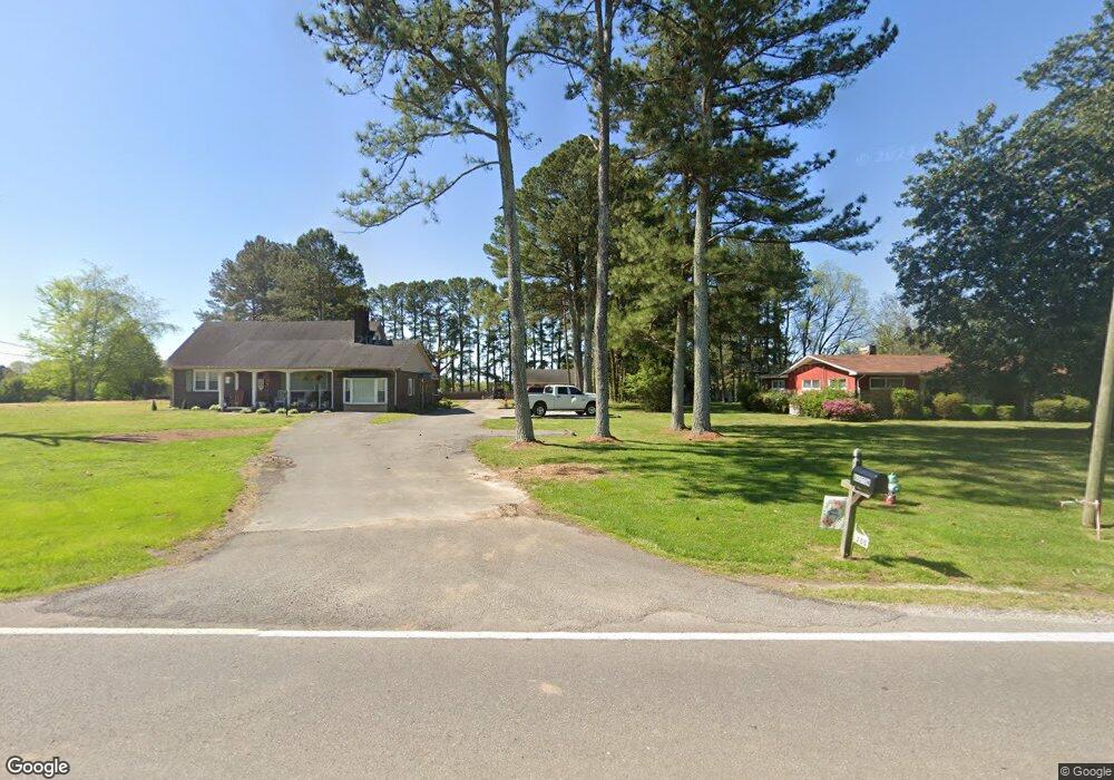
200 E Main St Loretto, TN 38469
Estimated Value: $271,000 - $331,000
Studio
2
Baths
2,380
Sq Ft
$125/Sq Ft
Est. Value
About This Home
This home is located at 200 E Main St, Loretto, TN 38469 and is currently estimated at $296,837, approximately $124 per square foot. 200 E Main St is a home located in Lawrence County with nearby schools including South Lawrence Elementary School, Lawrenceburg Public Elementary School, and Ingram Sowell Elementary School.
Ownership History
Date
Name
Owned For
Owner Type
Purchase Details
Closed on
May 16, 2025
Sold by
Methvin Ray E and Methvin Sondra
Bought by
Ray And Sondra Methvin Family Living Trust and Methvin
Current Estimated Value
Purchase Details
Closed on
Jun 22, 2022
Sold by
Mcnatt Amy L and Mcnatt Christopher L
Bought by
Boston Derek James and Boston Payten Rhenae
Home Financials for this Owner
Home Financials are based on the most recent Mortgage that was taken out on this home.
Original Mortgage
$200,450
Interest Rate
5.3%
Mortgage Type
New Conventional
Purchase Details
Closed on
Aug 7, 2006
Sold by
Green Elizabeth
Bought by
Cole Amy
Home Financials for this Owner
Home Financials are based on the most recent Mortgage that was taken out on this home.
Original Mortgage
$140,000
Interest Rate
6.71%
Purchase Details
Closed on
Nov 10, 1993
Bought by
Green Johnathan Lee
Purchase Details
Closed on
Sep 3, 1993
Bought by
Green Elizabeth
Purchase Details
Closed on
May 19, 1980
Bought by
Peters Joel and Peters Imogene
Create a Home Valuation Report for This Property
The Home Valuation Report is an in-depth analysis detailing your home's value as well as a comparison with similar homes in the area
Purchase History
| Date | Buyer | Sale Price | Title Company |
|---|---|---|---|
| Ray And Sondra Methvin Family Living Trust | -- | None Listed On Document | |
| Ray And Sondra Methvin Family Living Trust | -- | None Listed On Document | |
| Boston Derek James | $211,000 | Plant Paul B | |
| Cole Amy | $140,000 | -- | |
| Green Johnathan Lee | $50,000 | -- | |
| Green Elizabeth | $103,500 | -- | |
| Peters Joel | -- | -- |
Source: Public Records
Mortgage History
| Date | Status | Borrower | Loan Amount |
|---|---|---|---|
| Previous Owner | Boston Derek James | $200,450 | |
| Previous Owner | Peters Joel | $140,000 |
Source: Public Records
Tax History
| Year | Tax Paid | Tax Assessment Tax Assessment Total Assessment is a certain percentage of the fair market value that is determined by local assessors to be the total taxable value of land and additions on the property. | Land | Improvement |
|---|---|---|---|---|
| 2025 | $1,609 | $57,225 | $3,750 | $53,475 |
| 2024 | $1,340 | $57,225 | $3,750 | $53,475 |
| 2023 | $1,340 | $57,225 | $3,750 | $53,475 |
| 2022 | $1,313 | $56,100 | $2,625 | $53,475 |
| 2021 | $1,026 | $30,550 | $2,625 | $27,925 |
| 2020 | $1,026 | $30,550 | $2,625 | $27,925 |
| 2019 | $1,026 | $30,550 | $2,625 | $27,925 |
| 2018 | $1,011 | $30,550 | $2,625 | $27,925 |
| 2017 | $980 | $30,550 | $2,625 | $27,925 |
| 2016 | $980 | $30,550 | $2,625 | $27,925 |
| 2015 | $895 | $30,550 | $2,625 | $27,925 |
| 2014 | $867 | $29,600 | $2,625 | $26,975 |
Source: Public Records
Map
Nearby Homes
- 130 Beartown Rd
- 202 Vine St
- 200 Church St
- 211 Church St
- 205 Dixon Rd E
- 205 Dixon Branch Rd
- 411 2nd Ave S
- 456 S Military St
- 109 2nd Ave N
- 402 W Commerce St
- 518 2nd Ave S
- 412 Eells St
- 118 Park St
- 219 Vine Cir
- 402 N Military St
- 530 S Military St
- 110 Kitty Meyer Ln
- 502 N Main St
- 176 Beartown Rd
- 188 Beartown Rd
Your Personal Tour Guide
Ask me questions while you tour the home.