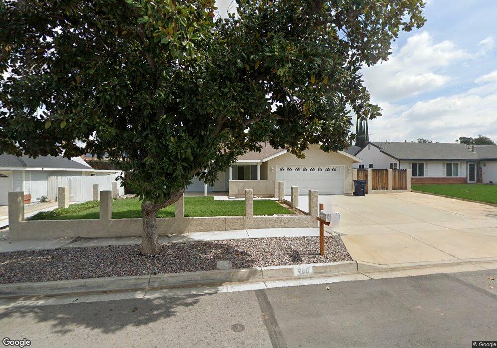
200 Ferndale Ct Redlands, CA 92374
North Redlands NeighborhoodEstimated Value: $535,377 - $591,000
4
Beds
2
Baths
1,430
Sq Ft
$395/Sq Ft
Est. Value
About This Home
This home is located at 200 Ferndale Ct, Redlands, CA 92374 and is currently estimated at $565,094, approximately $395 per square foot. 200 Ferndale Ct is a home located in San Bernardino County with nearby schools including Crafton Elementary School, Moore Middle School, and Redlands East Valley High School.
Ownership History
Date
Name
Owned For
Owner Type
Purchase Details
Closed on
Oct 25, 1999
Sold by
Shek Family Trust and Lai Ka
Bought by
Williams Christine
Current Estimated Value
Home Financials for this Owner
Home Financials are based on the most recent Mortgage that was taken out on this home.
Original Mortgage
$108,516
Interest Rate
7.68%
Mortgage Type
FHA
Purchase Details
Closed on
Aug 11, 1997
Sold by
Shek David and Shek Frances
Bought by
Shek Family Trust
Create a Home Valuation Report for This Property
The Home Valuation Report is an in-depth analysis detailing your home's value as well as a comparison with similar homes in the area
Home Values in the Area
Average Home Value in this Area
Purchase History
| Date | Buyer | Sale Price | Title Company |
|---|---|---|---|
| Williams Christine | $118,500 | Orange Coast Title | |
| Shek Family Trust | -- | -- |
Source: Public Records
Mortgage History
| Date | Status | Borrower | Loan Amount |
|---|---|---|---|
| Previous Owner | Williams Christine | $108,516 | |
| Closed | Williams Christine | $11,850 |
Source: Public Records
Tax History
| Year | Tax Paid | Tax Assessment Tax Assessment Total Assessment is a certain percentage of the fair market value that is determined by local assessors to be the total taxable value of land and additions on the property. | Land | Improvement |
|---|---|---|---|---|
| 2025 | $2,207 | $182,132 | $45,532 | $136,600 |
| 2024 | $2,061 | $178,561 | $44,639 | $133,922 |
| 2023 | $2,057 | $175,060 | $43,764 | $131,296 |
| 2022 | $2,026 | $171,628 | $42,906 | $128,722 |
| 2021 | $2,061 | $168,263 | $42,065 | $126,198 |
| 2020 | $2,030 | $166,538 | $41,634 | $124,904 |
| 2019 | $1,972 | $163,273 | $40,818 | $122,455 |
| 2018 | $1,922 | $160,072 | $40,018 | $120,054 |
| 2017 | $1,904 | $156,933 | $39,233 | $117,700 |
| 2016 | $1,881 | $153,856 | $38,464 | $115,392 |
| 2015 | $1,866 | $151,545 | $37,886 | $113,659 |
| 2014 | $1,831 | $148,577 | $37,144 | $111,433 |
Source: Public Records
Map
Nearby Homes
- 100 Amber Ct
- 1592 Christopher Ln
- 1580 Lisa Ln
- 1575 Christopher Ln
- 56 Dearborn Cir
- 1528 Laramie Ave
- 626 N Dearborn St Unit 150
- 626 N Dearborn St Unit 192
- 626 N Dearborn St Unit 7
- 626 N Dearborn St
- 0 E Colton Ave
- 1556 Gary Ln
- 1617 Waterford Ave
- 1665 Wabash Ave
- 616 N Lincoln St
- 212 Eastpark Ln
- 1721 E Colton Ave Unit 33
- 1721 E Colton Ave Unit 106
- 1427 Laramie Ave
- 614 Naomi St
- 220 Ferndale Ct
- 142 Ferndale Ct
- 203 Greenbriar Ct
- 145 Greenbriar Ct
- 223 Greenbriar Ct
- 240 Ferndale Ct
- 122 Ferndale Ct
- 201 Ferndale Ct
- 143 Ferndale Ct
- 125 Greenbriar Ct
- 243 Greenbriar Ct
- 221 Ferndale Ct
- 123 Ferndale Ct
- 102 Ferndale Ct
- 260 Ferndale Ct
- 105 Greenbriar Ct
- 263 Greenbriar Ct
- 241 Ferndale Ct
- 103 Ferndale Ct
- 204 Greenbriar Ct
Your Personal Tour Guide
Ask me questions while you tour the home.