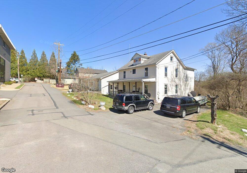
200 Front St Milford, PA 18337
Estimated Value: $344,000 - $558,548
2
Beds
2
Baths
2,496
Sq Ft
$181/Sq Ft
Est. Value
About This Home
This home is located at 200 Front St, Milford, PA 18337 and is currently estimated at $451,274, approximately $180 per square foot. 200 Front St is a home with nearby schools including Delaware Valley High School.
Ownership History
Date
Name
Owned For
Owner Type
Purchase Details
Closed on
Jan 31, 2024
Sold by
Passarge Richard
Bought by
Passarge Sherri A and Passarge Randall P
Current Estimated Value
Purchase Details
Closed on
Aug 18, 2022
Sold by
Passarge Anna Marie
Bought by
Passarge Richard and Passarge Sheri A
Purchase Details
Closed on
Dec 11, 2020
Sold by
Hengel Bernard C and Plate Robert S
Bought by
Plate Robert S
Home Financials for this Owner
Home Financials are based on the most recent Mortgage that was taken out on this home.
Original Mortgage
$187,500
Interest Rate
2.7%
Mortgage Type
Seller Take Back
Create a Home Valuation Report for This Property
The Home Valuation Report is an in-depth analysis detailing your home's value as well as a comparison with similar homes in the area
Home Values in the Area
Average Home Value in this Area
Purchase History
| Date | Buyer | Sale Price | Title Company |
|---|---|---|---|
| Passarge Sherri A | -- | -- | |
| Passarge Richard | $80,666 | -- | |
| Plate Robert S | $187,500 | None Available |
Source: Public Records
Mortgage History
| Date | Status | Borrower | Loan Amount |
|---|---|---|---|
| Previous Owner | Plate Robert S | $187,500 |
Source: Public Records
Tax History Compared to Growth
Tax History
| Year | Tax Paid | Tax Assessment Tax Assessment Total Assessment is a certain percentage of the fair market value that is determined by local assessors to be the total taxable value of land and additions on the property. | Land | Improvement |
|---|---|---|---|---|
| 2025 | $7,292 | $39,700 | $26,390 | $13,310 |
| 2024 | $7,292 | $39,700 | $26,390 | $13,310 |
| 2023 | $7,292 | $39,700 | $26,390 | $13,310 |
| 2022 | $7,134 | $39,700 | $26,390 | $13,310 |
| 2021 | $7,273 | $39,700 | $26,390 | $13,310 |
| 2020 | $7,193 | $39,700 | $26,390 | $13,310 |
| 2019 | $7,447 | $42,180 | $26,390 | $15,790 |
| 2018 | $7,046 | $39,910 | $26,390 | $13,520 |
| 2017 | $6,898 | $39,910 | $26,390 | $13,520 |
| 2016 | $0 | $39,910 | $26,390 | $13,520 |
| 2014 | -- | $39,910 | $26,390 | $13,520 |
Source: Public Records
Map
Nearby Homes
- 208 E High St
- 107 Broad St
- 509 Broad St
- 112 W High St
- 408 5th St
- 134 Bennett Ave
- 105 Bennett Ave
- 203 W Harford St
- 619 5th St
- LOT 600 W High St
- 212 W John St
- Lot 469 W Sarah St
- 106 Mill St
- 311 W Catherine St
- 121 Millcreek Ct
- Lot 54 Skyline Dr
- Lot 59 Skyline Dr
- 0 Route 6 & 209 Unit PWBPW252055
- 106 Orben Ln
- 110 Wheatfield Ct