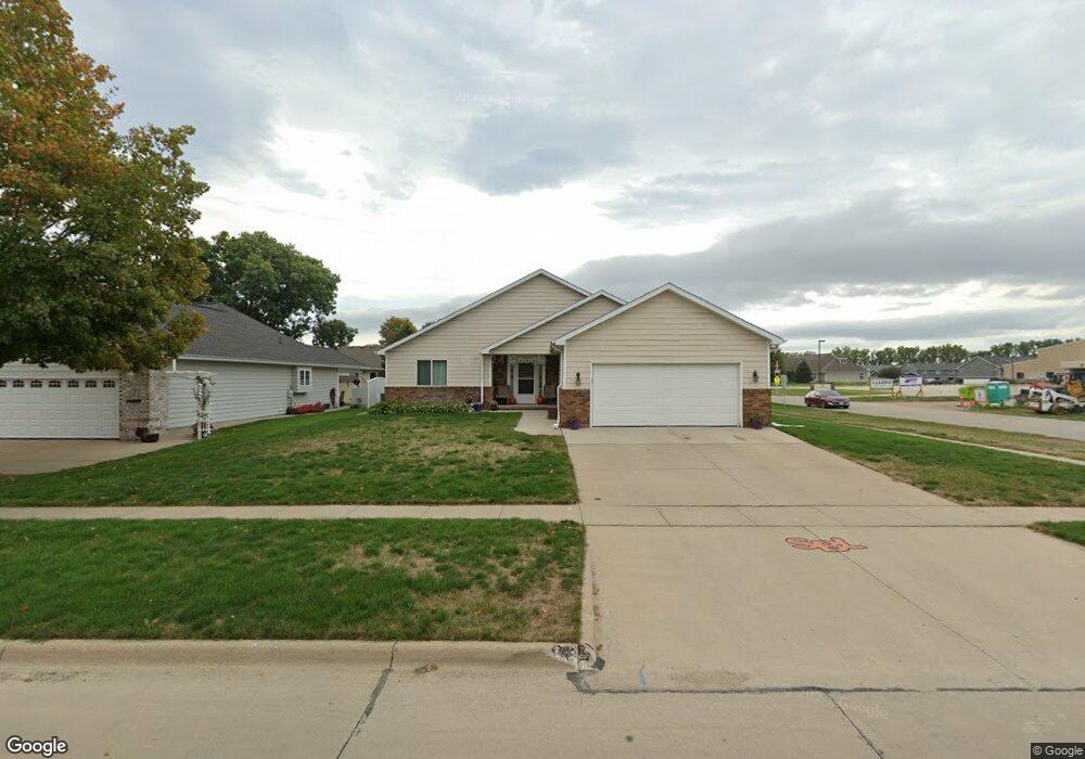
200 Frontier St Sergeant Bluff, IA 51054
Estimated Value: $346,463 - $401,000
--
Bed
4
Baths
1,508
Sq Ft
$246/Sq Ft
Est. Value
About This Home
This home is located at 200 Frontier St, Sergeant Bluff, IA 51054 and is currently estimated at $370,616, approximately $245 per square foot. 200 Frontier St is a home located in Woodbury County with nearby schools including Sergeant Bluff-Luton Primary School, Sergeant Bluff-Luton Elementary School, and Sergeant Bluff-Luton Middle School.
Ownership History
Date
Name
Owned For
Owner Type
Purchase Details
Closed on
Apr 19, 2024
Sold by
Judy E Fredinburg Revocable Trust and Cloud Deanna J
Bought by
Cloud Deanna J
Current Estimated Value
Purchase Details
Closed on
Jul 12, 2016
Sold by
Fredinburg Judy E and Fredinburg Ellen
Bought by
Judy E Fredinburg Ret
Purchase Details
Closed on
Oct 6, 2005
Sold by
Kober Richard G and Kober Corinne L
Bought by
Fredinburg Judy E
Create a Home Valuation Report for This Property
The Home Valuation Report is an in-depth analysis detailing your home's value as well as a comparison with similar homes in the area
Home Values in the Area
Average Home Value in this Area
Purchase History
| Date | Buyer | Sale Price | Title Company |
|---|---|---|---|
| Cloud Deanna J | -- | None Listed On Document | |
| Judy E Fredinburg Ret | -- | -- | |
| Fredinburg Judy E | $172,500 | None Available |
Source: Public Records
Tax History
| Year | Tax Paid | Tax Assessment Tax Assessment Total Assessment is a certain percentage of the fair market value that is determined by local assessors to be the total taxable value of land and additions on the property. | Land | Improvement |
|---|---|---|---|---|
| 2025 | $4,324 | $321,300 | $44,550 | $276,750 |
| 2024 | $41 | $290,540 | $28,920 | $261,620 |
| 2023 | $4,078 | $290,540 | $28,920 | $261,620 |
| 2022 | $4,042 | $240,950 | $28,920 | $212,030 |
| 2021 | $4,042 | $240,950 | $28,920 | $212,030 |
| 2020 | $3,696 | $216,910 | $30,940 | $185,970 |
| 2019 | $3,754 | $216,910 | $30,940 | $185,970 |
| 2018 | $3,660 | $216,910 | $30,940 | $185,970 |
| 2017 | $3,660 | $216,910 | $30,940 | $185,970 |
| 2016 | $4,214 | $216,910 | $0 | $0 |
| 2015 | $3,647 | $202,720 | $28,920 | $173,800 |
| 2014 | $3,648 | $182,570 | $28,920 | $153,650 |
Source: Public Records
Map
Nearby Homes
Your Personal Tour Guide
Ask me questions while you tour the home.