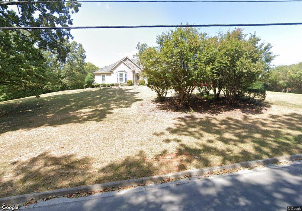
200 Highpoint Dr Calhoun, GA 30701
Estimated Value: $279,769 - $385,000
3
Beds
2
Baths
1,649
Sq Ft
$194/Sq Ft
Est. Value
About This Home
This home is located at 200 Highpoint Dr, Calhoun, GA 30701 and is currently estimated at $320,692, approximately $194 per square foot. 200 Highpoint Dr is a home located in Gordon County with nearby schools including Calhoun Primary School, Calhoun Elementary School, and Calhoun Middle School.
Ownership History
Date
Name
Owned For
Owner Type
Purchase Details
Closed on
May 21, 2004
Sold by
Silvers Ricky L
Bought by
Lord Jonathan
Current Estimated Value
Purchase Details
Closed on
Mar 28, 1995
Bought by
Silvers Ricky L
Purchase Details
Closed on
Aug 8, 1990
Sold by
Silvers Ricky L
Bought by
Duke Gary and Duke Larriann
Create a Home Valuation Report for This Property
The Home Valuation Report is an in-depth analysis detailing your home's value as well as a comparison with similar homes in the area
Home Values in the Area
Average Home Value in this Area
Purchase History
| Date | Buyer | Sale Price | Title Company |
|---|---|---|---|
| Lord Jonathan | $150,000 | -- | |
| Silvers Ricky L | $12,500 | -- | |
| Duke Gary | $10,000 | -- |
Source: Public Records
Tax History Compared to Growth
Tax History
| Year | Tax Paid | Tax Assessment Tax Assessment Total Assessment is a certain percentage of the fair market value that is determined by local assessors to be the total taxable value of land and additions on the property. | Land | Improvement |
|---|---|---|---|---|
| 2024 | $2,585 | $92,588 | $11,200 | $81,388 |
| 2023 | $2,427 | $86,956 | $11,200 | $75,756 |
| 2022 | $759 | $81,724 | $11,200 | $70,524 |
| 2021 | $2,051 | $69,536 | $11,200 | $58,336 |
| 2020 | $2,089 | $70,264 | $11,200 | $59,064 |
| 2019 | $2,086 | $70,264 | $11,200 | $59,064 |
| 2018 | $612 | $65,572 | $11,200 | $54,372 |
| 2017 | $595 | $62,492 | $11,200 | $51,292 |
| 2016 | $596 | $62,492 | $11,200 | $51,292 |
| 2015 | $594 | $61,492 | $11,200 | $50,292 |
| 2014 | $571 | $59,977 | $11,200 | $48,777 |
Source: Public Records
Map
Nearby Homes
- 103 Mims Dr
- 106 Mount Vernon Dr
- 108 Mill Stone Dr
- 91 Echota 4th St
- 135 Millers Ln
- 137 Millers Ln
- 154 Millers Ln
- 98 Echota 5th St
- 125 Mill Pond Ln
- 122 Millers Ln
- 622 Pisgah Way
- 114 Lindsey Ct NE
- 106 Millers Ln
- 113 Waterside Dr
- 107 Garden Hill Dr
- 113 Mill Pond Ln
- 118 Old Mill Dr
- 115 Old Mill Dr
- 105 Garden Hill Dr
- 121 Hunt Dr