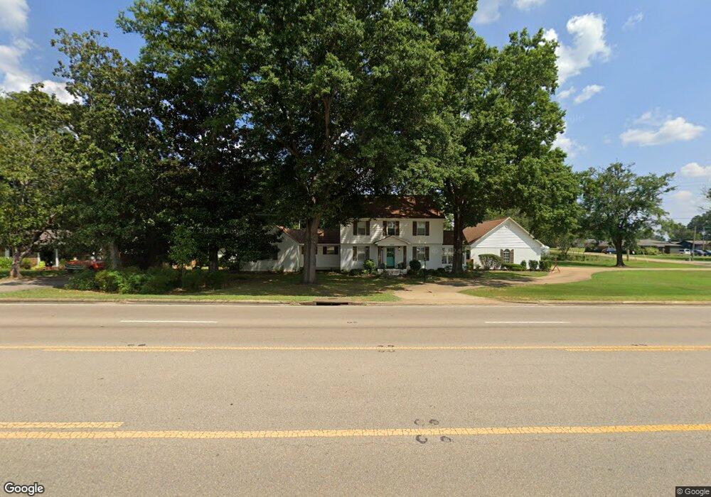
200 Hwy 15 N New Albany, MI 38652
Estimated Value: $316,000 - $364,000
4
Beds
5
Baths
2,932
Sq Ft
$117/Sq Ft
Est. Value
About This Home
This home is located at 200 Hwy 15 N, New Albany, MI 38652 and is currently estimated at $342,484, approximately $116 per square foot. 200 Hwy 15 N is a home located in Union County with nearby schools including New Albany Elementary School, New Albany/S.Tippah/Union County Alternative School, and New Albany Middle School.
Ownership History
Date
Name
Owned For
Owner Type
Purchase Details
Closed on
Feb 19, 2016
Sold by
Mattox William and Mattox Danita
Bought by
Murphy Perry Kendall and Murphy Leann Manning
Current Estimated Value
Home Financials for this Owner
Home Financials are based on the most recent Mortgage that was taken out on this home.
Original Mortgage
$160,000
Outstanding Balance
$126,623
Interest Rate
3.81%
Mortgage Type
New Conventional
Estimated Equity
$215,861
Purchase Details
Closed on
Jul 30, 2010
Sold by
Cousar Enterprises Llc
Bought by
Mattox William and Mattox Danita
Create a Home Valuation Report for This Property
The Home Valuation Report is an in-depth analysis detailing your home's value as well as a comparison with similar homes in the area
Home Values in the Area
Average Home Value in this Area
Purchase History
| Date | Buyer | Sale Price | Title Company |
|---|---|---|---|
| Murphy Perry Kendall | -- | -- | |
| Mattox William | -- | -- |
Source: Public Records
Mortgage History
| Date | Status | Borrower | Loan Amount |
|---|---|---|---|
| Open | Murphy Perry Kendall | $160,000 |
Source: Public Records
Tax History Compared to Growth
Tax History
| Year | Tax Paid | Tax Assessment Tax Assessment Total Assessment is a certain percentage of the fair market value that is determined by local assessors to be the total taxable value of land and additions on the property. | Land | Improvement |
|---|---|---|---|---|
| 2025 | $3,005 | $23,086 | $0 | $0 |
| 2024 | $3,005 | $23,086 | $0 | $0 |
| 2023 | $3,015 | $23,086 | $0 | $0 |
| 2022 | $2,410 | $18,808 | $0 | $0 |
| 2021 | $2,335 | $18,808 | $0 | $0 |
| 2020 | $2,335 | $18,808 | $0 | $0 |
| 2019 | $2,321 | $18,708 | $0 | $0 |
| 2018 | $2,074 | $16,942 | $0 | $0 |
| 2017 | $1,749 | $15,049 | $0 | $0 |
| 2016 | $1,681 | $15,049 | $0 | $0 |
| 2015 | -- | $15,049 | $0 | $0 |
| 2014 | -- | $14,653 | $0 | $0 |
Source: Public Records
Map
Nearby Homes
- 917 N Acre Dr
- Lot 82 Sarah Grace Ln
- 0 Cr 371 Unit 22-3931
- Lot 18 Sarah Grace Ln
- Lot 84 Sara Grace Ln
- Lot 81 Sarah Grace Ln
- 504 Hobson St
- 0 Denmill Rd
- 410 Pineridge Dr
- 211 E Main St
- 313 Garfield St
- 0 North St
- 810 Brookwood St
- 0 Mississippi 348
- 409 Broad St
- 828 Brookwood St
- 111 Cleveland St
- 400 Alabama St
- 613 Ramble Ln
- 203 Alabama St
- 200 State Highway 15 N
- 200 State Highway 15 N
- 202 State Highway 15 N
- 205 Union Ave
- 118 Mississippi 15
- 800 Daniel St
- 201 Union Ave
- 209 Union Ave
- 806 Jay St
- 202 Union Ave
- 200 Union Ave
- 801 Daniel St
- 811 David
- 811 David St
- 801 Daniel St
- 114 Mississippi 15
- 809 Jay St
- 809 Jay St
- 116 Union St
- 803 Daniel St