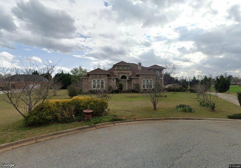
200 Liberty Trace Macon, GA 31216
Estimated Value: $509,000 - $657,000
5
Beds
4
Baths
4,714
Sq Ft
$128/Sq Ft
Est. Value
About This Home
This home is located at 200 Liberty Trace, Macon, GA 31216 and is currently estimated at $603,730, approximately $128 per square foot. 200 Liberty Trace is a home located in Bibb County with nearby schools including Heard Elementary School, Rutland Middle School, and Rutland High School.
Ownership History
Date
Name
Owned For
Owner Type
Purchase Details
Closed on
Oct 14, 2011
Sold by
Graham Debbie A
Bought by
Pham Phong Duc and Pham Ngoc Thi
Current Estimated Value
Purchase Details
Closed on
Aug 4, 2003
Bought by
Graham Debbie A
Create a Home Valuation Report for This Property
The Home Valuation Report is an in-depth analysis detailing your home's value as well as a comparison with similar homes in the area
Home Values in the Area
Average Home Value in this Area
Purchase History
| Date | Buyer | Sale Price | Title Company |
|---|---|---|---|
| Pham Phong Duc | $400,000 | None Available | |
| Graham Debbie A | -- | -- |
Source: Public Records
Tax History Compared to Growth
Tax History
| Year | Tax Paid | Tax Assessment Tax Assessment Total Assessment is a certain percentage of the fair market value that is determined by local assessors to be the total taxable value of land and additions on the property. | Land | Improvement |
|---|---|---|---|---|
| 2025 | $5,864 | $245,617 | $20,520 | $225,097 |
| 2024 | $6,810 | $275,136 | $20,520 | $254,616 |
| 2023 | $5,603 | $245,617 | $15,960 | $229,657 |
| 2022 | $5,267 | $159,124 | $20,000 | $139,124 |
| 2021 | $5,781 | $159,124 | $20,000 | $139,124 |
| 2020 | $5,906 | $159,124 | $20,000 | $139,124 |
| 2019 | $5,955 | $159,124 | $20,000 | $139,124 |
| 2018 | $9,300 | $159,124 | $20,000 | $139,124 |
| 2017 | $5,699 | $159,124 | $20,000 | $139,124 |
| 2016 | $5,263 | $159,124 | $20,000 | $139,124 |
| 2015 | $7,450 | $159,124 | $20,000 | $139,124 |
| 2014 | $7,462 | $159,124 | $20,000 | $139,124 |
Source: Public Records
Map
Nearby Homes
- 205 Liberty Trace
- 108 Liberty Ridge Dr
- 2987 Liberty Church Rd
- 2925 Liberty Church Rd
- 217 Liberty Trace
- 221 Liberty Trace
- 3017 Liberty Church Rd
- 0 Liberty Ridge Dr Unit 7403011
- 0 Liberty Ridge Dr Unit 7053054
- 0 Liberty Ridge Dr Unit 8047654
- 0 Liberty Ridge Dr
- 131 Francis Dr
- 229 Liberty Trace
- 224 Liberty Trace
- 132 Francis Dr
- 129 Francis Dr
- 233 Liberty Trace
- 228 Liberty Trace
- 6304 Tinley Dr
- 2891 Liberty Church Rd