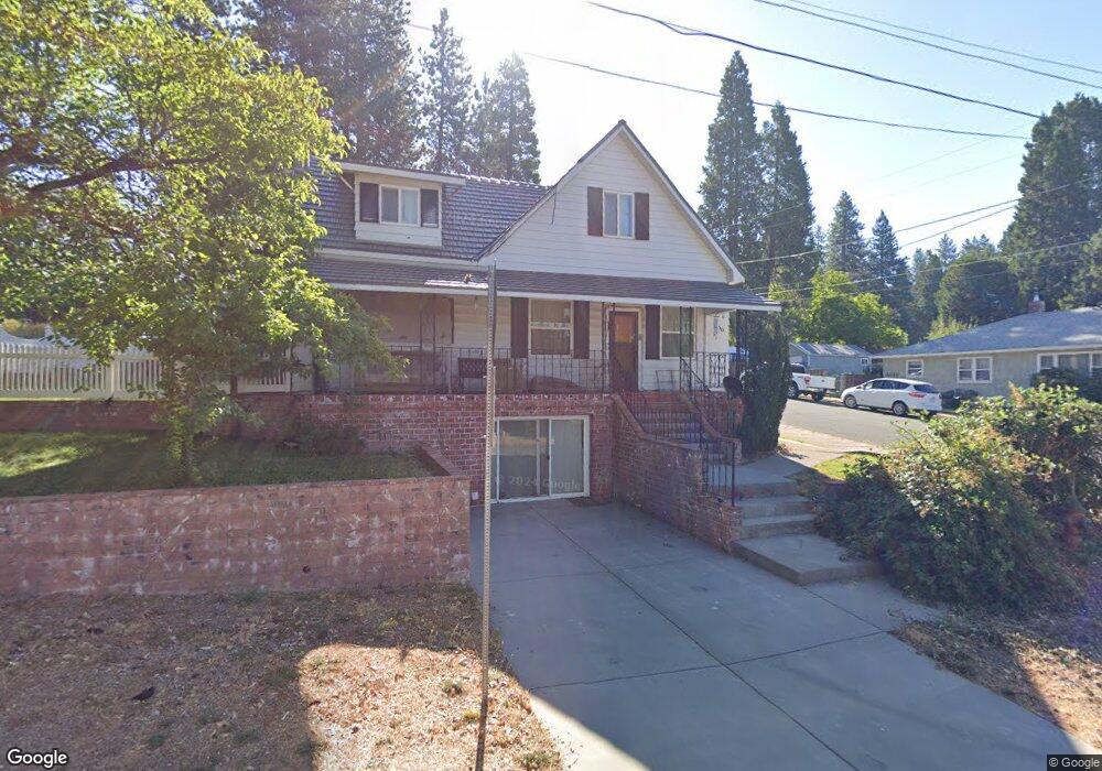
200 N A St Mount Shasta, CA 96067
Estimated Value: $425,189 - $542,000
5
Beds
2
Baths
2,027
Sq Ft
$238/Sq Ft
Est. Value
About This Home
This home is located at 200 N A St, Mount Shasta, CA 96067 and is currently estimated at $481,547, approximately $237 per square foot. 200 N A St is a home located in Siskiyou County with nearby schools including Mt. Shasta Elementary School, Mt. Shasta High School, and Golden Eagle Charter School.
Ownership History
Date
Name
Owned For
Owner Type
Purchase Details
Closed on
Dec 26, 2016
Sold by
Milton Robert P and Milton Maria K
Bought by
Mcarthur Victoria P and Victoria P Mcarthur Trust
Current Estimated Value
Purchase Details
Closed on
Dec 20, 2012
Sold by
Mcarthur Victoria P and Victoria P Mcarthur Trust
Bought by
Milton Robert P
Purchase Details
Closed on
Apr 7, 2005
Sold by
Mcgregor Shirley L and Mc Gregor Separate P Shirley L
Bought by
Mcarthur Victoria P and Victoria P Mc Arthur Trust
Home Financials for this Owner
Home Financials are based on the most recent Mortgage that was taken out on this home.
Original Mortgage
$240,000
Interest Rate
5.7%
Mortgage Type
Seller Take Back
Purchase Details
Closed on
May 21, 2004
Sold by
Mcgregor Shirley Laclede
Bought by
Mcgregor Shirley L and The Shirley L Mcgregor Separat
Create a Home Valuation Report for This Property
The Home Valuation Report is an in-depth analysis detailing your home's value as well as a comparison with similar homes in the area
Home Values in the Area
Average Home Value in this Area
Purchase History
| Date | Buyer | Sale Price | Title Company |
|---|---|---|---|
| Mcarthur Victoria P | -- | None Available | |
| Milton Robert P | -- | None Available | |
| Mcarthur Victoria P | $290,000 | Mount Shasta Title & Escrow | |
| Mcgregor Shirley L | -- | -- |
Source: Public Records
Mortgage History
| Date | Status | Borrower | Loan Amount |
|---|---|---|---|
| Previous Owner | Mcarthur Victoria P | $240,000 |
Source: Public Records
Tax History Compared to Growth
Tax History
| Year | Tax Paid | Tax Assessment Tax Assessment Total Assessment is a certain percentage of the fair market value that is determined by local assessors to be the total taxable value of land and additions on the property. | Land | Improvement |
|---|---|---|---|---|
| 2025 | $2,642 | $246,274 | $61,567 | $184,707 |
| 2023 | $2,642 | $236,713 | $59,177 | $177,536 |
| 2022 | $2,543 | $232,072 | $58,017 | $174,055 |
| 2021 | $2,501 | $227,523 | $56,880 | $170,643 |
| 2020 | $2,501 | $225,191 | $56,297 | $168,894 |
| 2019 | $2,456 | $220,777 | $55,194 | $165,583 |
| 2018 | $2,409 | $216,449 | $54,112 | $162,337 |
| 2017 | $2,386 | $212,205 | $53,051 | $159,154 |
| 2016 | $2,341 | $208,045 | $52,011 | $156,034 |
| 2015 | -- | $204,921 | $51,230 | $153,691 |
| 2014 | -- | $200,908 | $50,227 | $150,681 |
Source: Public Records
Map
Nearby Homes
- 208 Mccloud Ave
- 109 N Washington Dr
- Parcel 1,2,3 Pine Field St
- 0 Alma St Apn #057-203-040
- 114 Smith St
- lot 7 Ream Ave
- 506 Eiler Rd
- 509 Mccloud Ave
- parcel 3 Deetz Rd
- 0 Berry St
- 322 E Jessie St
- 704 Marjorie St
- Financing Miningclaim Ownership
- Financing Miningclaim Ownership
- 619 Spring St
- 1007 Mccloud Ave
- 809 Caroline Ave
- 206 E Hinckley St
- 201 Terry Lynn Ave
- 00 Kenneth Marjorie