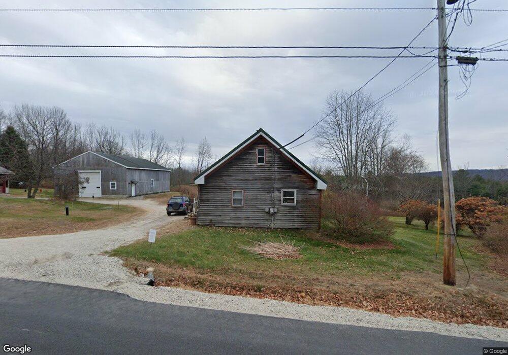
200 Range Hill Rd Poland, ME 04274
Estimated Value: $277,966 - $433,000
2
Beds
2
Baths
944
Sq Ft
$389/Sq Ft
Est. Value
About This Home
This home is located at 200 Range Hill Rd, Poland, ME 04274 and is currently estimated at $367,242, approximately $389 per square foot. 200 Range Hill Rd is a home with nearby schools including Poland Community School, Bruce M. Whittier Middle School, and Poland Regional High School.
Ownership History
Date
Name
Owned For
Owner Type
Purchase Details
Closed on
Jun 1, 2021
Sold by
King Pauline H
Bought by
King Pauline H and King Timothy D
Current Estimated Value
Purchase Details
Closed on
Mar 8, 2021
Sold by
King Pauline H
Bought by
King Pauline H and King Timothy D
Purchase Details
Closed on
Mar 22, 2007
Sold by
King Patrick J
Bought by
King Pauline H and King Patrick J
Create a Home Valuation Report for This Property
The Home Valuation Report is an in-depth analysis detailing your home's value as well as a comparison with similar homes in the area
Home Values in the Area
Average Home Value in this Area
Purchase History
| Date | Buyer | Sale Price | Title Company |
|---|---|---|---|
| King Pauline H | -- | None Available | |
| King Pauline H | -- | None Available | |
| King Pauline H | -- | -- |
Source: Public Records
Tax History
| Year | Tax Paid | Tax Assessment Tax Assessment Total Assessment is a certain percentage of the fair market value that is determined by local assessors to be the total taxable value of land and additions on the property. | Land | Improvement |
|---|---|---|---|---|
| 2024 | $3,124 | $189,000 | $77,000 | $112,000 |
| 2023 | $2,578 | $189,000 | $77,000 | $112,000 |
| 2022 | $2,350 | $155,600 | $62,300 | $93,300 |
| 2021 | $2,442 | $161,700 | $68,400 | $93,300 |
| 2020 | $2,556 | $170,600 | $77,300 | $93,300 |
| 2019 | $4,903 | $170,600 | $77,300 | $93,300 |
| 2018 | $2,556 | $170,660 | $77,330 | $93,330 |
| 2016 | $2,456 | $170,660 | $77,330 | $93,330 |
| 2015 | $2,423 | $170,660 | $77,330 | $93,330 |
| 2014 | $2,562 | $182,970 | $77,330 | $105,640 |
| 2013 | $2,498 | $182,970 | $77,330 | $105,640 |
Source: Public Records
Map
Nearby Homes
- Lot 47C Hines Rd
- 46-47D Hines Rd & Main St
- 53 Westview Dr
- Lot 46-1 Maine St
- Lot 47C-D Maine St
- 325 N Raymond Rd
- 74 Jackson Rd
- TBD Emmaus Rd
- M10 L35 Plains Rd
- 14 Golden Way
- 80 Spiller Hill Rd
- 27 Justrite Way
- 136 Mountain Rd
- 192 Mountain Rd
- 1006 Bakerstown Rd
- Lot 8 Bakerstown Rd
- 0 Mountain Rd
- 218 Bailey Hill Rd
- 163 Valley Rd
- 0 Lucys Dr
- 203 Range Hill Rd
- 186 Range Hill Rd
- 199 Range Hill Rd
- 211 Range Hill Rd
- 216 Range Hill Rd
- 185 Range Hill Rd
- 221 Range Hill Rd
- 225 Range Hill Rd
- 222 Range Hill Rd
- 25 Colbath Rd
- 168 Range Hill Rd
- 000 Range Hill Rd
- 28 Colbath Rd
- 237 Range Hill Rd
- 230 Range Hill Rd
- 157 Range Hill Rd
- 158 Range Hill Rd
- 14 Number 5 Rd
- 252 Range Hill Rd
- 34 Colbath Rd
Your Personal Tour Guide
Ask me questions while you tour the home.