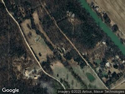
200 Riverside Trail Imboden, AR 72434
Estimated Value: $143,341 - $212,000
--
Bed
2
Baths
1,440
Sq Ft
$122/Sq Ft
Est. Value
About This Home
This home is located at 200 Riverside Trail, Imboden, AR 72434 and is currently estimated at $176,335, approximately $122 per square foot. 200 Riverside Trail is a home located in Randolph County with nearby schools including Alma Spikes Elementary School, M.D. Williams Intermediate School, and Pocahontas Junior High School.
Ownership History
Date
Name
Owned For
Owner Type
Purchase Details
Closed on
Jan 10, 2025
Sold by
Bowen Nasa L
Bought by
Morrill James Patrick and Gustin Samantha
Current Estimated Value
Home Financials for this Owner
Home Financials are based on the most recent Mortgage that was taken out on this home.
Original Mortgage
$130,500
Outstanding Balance
$130,384
Interest Rate
6.6%
Mortgage Type
New Conventional
Estimated Equity
$22,517
Purchase Details
Closed on
Sep 9, 2002
Bought by
Colburn To Bowen
Purchase Details
Closed on
Jul 2, 1999
Bought by
Colburn To Bowen
Create a Home Valuation Report for This Property
The Home Valuation Report is an in-depth analysis detailing your home's value as well as a comparison with similar homes in the area
Home Values in the Area
Average Home Value in this Area
Purchase History
| Date | Buyer | Sale Price | Title Company |
|---|---|---|---|
| Morrill James Patrick | $145,000 | None Listed On Document | |
| Colburn To Bowen | -- | -- | |
| Colburn To Bowen | -- | -- |
Source: Public Records
Mortgage History
| Date | Status | Borrower | Loan Amount |
|---|---|---|---|
| Open | Morrill James Patrick | $130,500 | |
| Closed | Morrill James Patrick | $130,500 | |
| Previous Owner | Bowen Nasa | $6,616 |
Source: Public Records
Tax History Compared to Growth
Tax History
| Year | Tax Paid | Tax Assessment Tax Assessment Total Assessment is a certain percentage of the fair market value that is determined by local assessors to be the total taxable value of land and additions on the property. | Land | Improvement |
|---|---|---|---|---|
| 2024 | $169 | $20,010 | $5,180 | $14,830 |
| 2023 | $244 | $20,010 | $5,180 | $14,830 |
| 2022 | $324 | $20,010 | $5,180 | $14,830 |
| 2021 | $324 | $20,010 | $5,180 | $14,830 |
| 2020 | $316 | $18,450 | $5,180 | $13,270 |
| 2019 | $257 | $18,450 | $5,180 | $13,270 |
| 2018 | $253 | $18,450 | $5,180 | $13,270 |
| 2017 | $174 | $14,805 | $800 | $14,005 |
| 2016 | $174 | $14,805 | $800 | $14,005 |
| 2015 | $174 | $14,805 | $800 | $14,005 |
| 2014 | $144 | $14,805 | $800 | $14,005 |
Source: Public Records
Map
Nearby Homes
- 6934 Blacks Ferry Rd
- 138 Hampton
- 0 Shiloh Rd
- 200 Red Rock Trail
- 0 County Road 529
- TBD Highway 90 W
- 4884 Pyburn Extension
- 1407 Rush Ln
- 4624 U S 62
- 653 Squirrel Rd
- 667 Hill Rd
- 10821 Highway 62 W
- 9212 Highway 90 W
- 100 Stephens Ln
- 118 Burgess Rd
- 185 Decliff Ln
- 0 Lower Janes Creek Rd
- 1815 Stubblefield Rd
- 3787 Highway 90 W
- 1929 Stubblefield Rd
- 200 Riverside Trail
- 255 Riverside Trail
- 131 Riverside Trail
- 5028 Blacks Ferry Rd
- 256 McCurter Trail
- 65 Riverside Trail
- 301 McCurter Trail
- 5219 Blacks Ferry Rd
- 14 McCurter Trail
- 4546 Blacks Ferry Rd
- 362 Valley Chapel Rd
- 0 Heron Trail Unit 16003768
- 0 Heron Trail Unit 21038947
- 500 Heron Trail
- 351 Heron Trail
- 4150 Blacks Ferry Rd
- 307 Heron Trail
- 291 Herman Trail
- 291 Heron Trail
- 227 Harmony Rd
