Estimated Value: $83,000 - $133,000
2
Beds
1
Bath
816
Sq Ft
$136/Sq Ft
Est. Value
About This Home
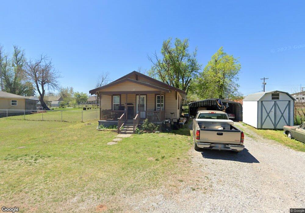
This home is located at 200 S 2nd St, Yukon, OK 73099 and is currently estimated at $111,153, approximately $136 per square foot. 200 S 2nd St is a home located in Canadian County with nearby schools including Central Elementary School, Independence Elementary School, and Yukon Middle School.
Ownership History
Date
Name
Owned For
Owner Type
Purchase Details
Closed on
Mar 15, 2022
Sold by
Babb Ronnie G
Bought by
Babb Ronnie G and Babb Ingeborg C
Current Estimated Value
Purchase Details
Closed on
Mar 20, 2009
Sold by
Post Roy D and Post Becky M
Bought by
Babb Ronnie G
Home Financials for this Owner
Home Financials are based on the most recent Mortgage that was taken out on this home.
Original Mortgage
$52,334
Interest Rate
5.14%
Mortgage Type
FHA
Purchase Details
Closed on
Jul 22, 2002
Sold by
Post Roy Dean and Post Becky M
Purchase Details
Closed on
Jan 8, 1988
Create a Home Valuation Report for This Property
The Home Valuation Report is an in-depth analysis detailing your home's value as well as a comparison with similar homes in the area
Home Values in the Area
Average Home Value in this Area
Purchase History
| Date | Buyer | Sale Price | Title Company |
|---|---|---|---|
| Babb Ronnie G | -- | None Listed On Document | |
| Babb Ronnie G | $53,500 | Agt | |
| -- | -- | -- | |
| -- | -- | -- |
Source: Public Records
Mortgage History
| Date | Status | Borrower | Loan Amount |
|---|---|---|---|
| Previous Owner | Babb Ronnie G | $52,334 |
Source: Public Records
Tax History Compared to Growth
Tax History
| Year | Tax Paid | Tax Assessment Tax Assessment Total Assessment is a certain percentage of the fair market value that is determined by local assessors to be the total taxable value of land and additions on the property. | Land | Improvement |
|---|---|---|---|---|
| 2024 | $267 | $4,460 | $565 | $3,895 |
| 2023 | $267 | $4,460 | $591 | $3,869 |
| 2022 | $268 | $4,460 | $816 | $3,644 |
| 2021 | $269 | $4,460 | $816 | $3,644 |
| 2020 | $265 | $4,460 | $784 | $3,676 |
| 2019 | $266 | $4,460 | $902 | $3,558 |
| 2018 | $267 | $4,460 | $959 | $3,501 |
| 2017 | $267 | $4,460 | $991 | $3,469 |
| 2016 | $362 | $4,389 | $991 | $3,398 |
| 2015 | -- | $4,204 | $991 | $3,213 |
| 2014 | -- | $4,325 | $991 | $3,334 |
Source: Public Records
Map
Nearby Homes
- 11817 Corie Nicole Ln
- 4601 Grassland Dr
- 2117 Aminas Way
- 12033 SW 31st St
- 12100 Birch Ave
- 12201 Birch Ave
- 3608 Northover Ridge Dr
- 3509 Sawtooth Ridge Dr
- 10401 NW 33rd St
- 11020 SW 34th Terrace
- 121 Birch Ave
- 2001 Aminas Way
- 11033 NW 20th Terrace
- 210 N 4th St
- 224 N 3rd St
- 316 Ash Ave
- 502 Walnut Ave
- 11200 SW 32nd St
- 11717 Annette Dr
- 9509 NW 118th St