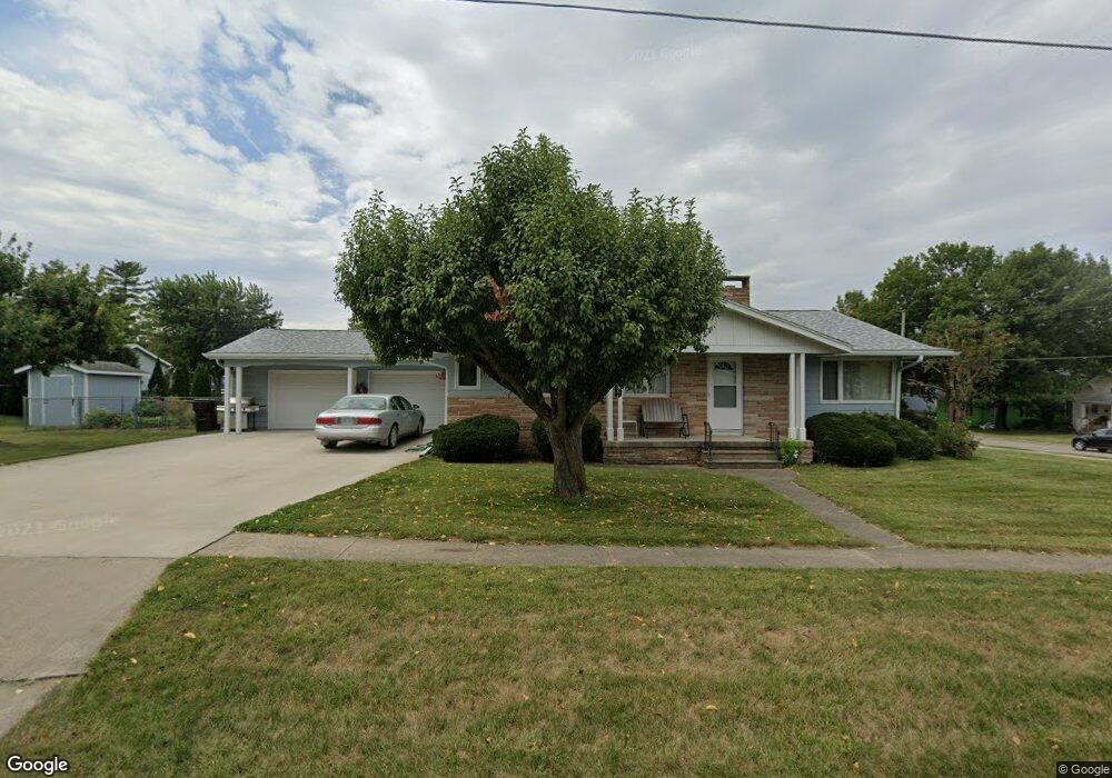
200 S Adams St Osceola, IA 50213
Estimated Value: $175,000 - $245,567
5
Beds
2
Baths
1,530
Sq Ft
$135/Sq Ft
Est. Value
About This Home
This home is located at 200 S Adams St, Osceola, IA 50213 and is currently estimated at $205,892, approximately $134 per square foot. 200 S Adams St is a home located in Clarke County with nearby schools including Clarke Community Elementary School, Clarke Middle School, and Clarke Community High School.
Ownership History
Date
Name
Owned For
Owner Type
Purchase Details
Closed on
May 14, 2009
Sold by
Surber Ronda E and Surber Gene L
Bought by
Haltom Donald A and Haltom Lila E
Current Estimated Value
Purchase Details
Closed on
Dec 5, 2008
Sold by
Jhl Properties Llp
Bought by
Haltorm Donald and Haltom Lila
Home Financials for this Owner
Home Financials are based on the most recent Mortgage that was taken out on this home.
Original Mortgage
$90,017
Interest Rate
6.04%
Mortgage Type
Future Advance Clause Open End Mortgage
Create a Home Valuation Report for This Property
The Home Valuation Report is an in-depth analysis detailing your home's value as well as a comparison with similar homes in the area
Home Values in the Area
Average Home Value in this Area
Purchase History
| Date | Buyer | Sale Price | Title Company |
|---|---|---|---|
| Haltom Donald A | $40,000 | None Available | |
| Haltorm Donald | $120,000 | None Available |
Source: Public Records
Mortgage History
| Date | Status | Borrower | Loan Amount |
|---|---|---|---|
| Previous Owner | Haltorm Donald | $90,017 |
Source: Public Records
Tax History Compared to Growth
Tax History
| Year | Tax Paid | Tax Assessment Tax Assessment Total Assessment is a certain percentage of the fair market value that is determined by local assessors to be the total taxable value of land and additions on the property. | Land | Improvement |
|---|---|---|---|---|
| 2024 | $3,928 | $218,800 | $27,030 | $191,770 |
| 2023 | $4,388 | $218,800 | $27,030 | $191,770 |
| 2022 | $4,204 | $198,440 | $27,780 | $170,660 |
| 2021 | $3,730 | $166,390 | $23,290 | $143,100 |
| 2020 | $3,624 | $166,390 | $23,290 | $143,100 |
| 2019 | $3,766 | $166,390 | $0 | $0 |
| 2018 | $3,656 | $166,390 | $0 | $0 |
| 2017 | $3,656 | $152,650 | $0 | $0 |
| 2016 | $3,442 | $152,650 | $0 | $0 |
| 2014 | $3,318 | $139,640 | $0 | $0 |
Source: Public Records
Map
Nearby Homes
- 220 Eastside Dr
- 119 N Park St
- 131 N Park St
- 303 S Dewey St
- 213 N Adams St
- 115 W Mclane St
- 114 E Grant St
- 214 W Jefferson St
- 116 W Grant St
- 215 W Clay St
- 219 N East St
- 322 S Temple St
- 117 W Logan St
- 420 W Mclane St
- 101 N Lincoln St
- 717 S Jackson St
- 321 W Clay St
- 601 N Main St
- 213 W Logan St
- 215 N Lincoln St
- 214 S Adams St
- 220 E Jefferson St
- 300 E Jefferson St
- 231 E Jefferson St
- 215 1/2 S Adams St
- 215 S Adams St
- 216 S Adams St
- 209 S Adams St
- 223 E Jefferson St
- 229 E Jefferson St
- 208 E Jefferson St
- 217 S Adams St
- 118 S Adams St
- 215 E Jefferson St
- 314 E Jefferson St
- 307 E Jefferson St
- 217 E Jefferson St
- 216 S Sunset Dr
- 219 S Adams St
- 121 S Adams St