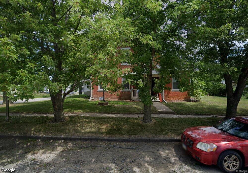
200 S Main St Grandview, IA 52752
Estimated Value: $163,000 - $211,386
3
Beds
3
Baths
2,563
Sq Ft
$72/Sq Ft
Est. Value
About This Home
This home is located at 200 S Main St, Grandview, IA 52752 and is currently estimated at $185,097, approximately $72 per square foot. 200 S Main St is a home with nearby schools including Louisa-Muscatine Elementary School and Louisa-Muscatine High School.
Ownership History
Date
Name
Owned For
Owner Type
Purchase Details
Closed on
May 9, 2007
Sold by
Mcgill Earl Wayne and Mcgill Nancy Elaine
Bought by
Conry Jackie M
Current Estimated Value
Home Financials for this Owner
Home Financials are based on the most recent Mortgage that was taken out on this home.
Original Mortgage
$106,000
Outstanding Balance
$64,266
Interest Rate
6.2%
Mortgage Type
New Conventional
Estimated Equity
$120,831
Create a Home Valuation Report for This Property
The Home Valuation Report is an in-depth analysis detailing your home's value as well as a comparison with similar homes in the area
Home Values in the Area
Average Home Value in this Area
Purchase History
| Date | Buyer | Sale Price | Title Company |
|---|---|---|---|
| Conry Jackie M | $106,000 | None Available |
Source: Public Records
Mortgage History
| Date | Status | Borrower | Loan Amount |
|---|---|---|---|
| Open | Conry Jackie M | $106,000 |
Source: Public Records
Tax History Compared to Growth
Tax History
| Year | Tax Paid | Tax Assessment Tax Assessment Total Assessment is a certain percentage of the fair market value that is determined by local assessors to be the total taxable value of land and additions on the property. | Land | Improvement |
|---|---|---|---|---|
| 2025 | $2,138 | $161,290 | $15,400 | $145,890 |
| 2024 | $2,066 | $166,070 | $15,400 | $150,670 |
| 2023 | $2,066 | $166,070 | $15,400 | $150,670 |
| 2022 | $2,098 | $147,300 | $15,400 | $131,900 |
| 2021 | $1,914 | $147,300 | $15,400 | $131,900 |
| 2020 | $1,914 | $130,440 | $15,400 | $115,040 |
| 2019 | $1,770 | $130,440 | $15,400 | $115,040 |
| 2018 | $1,734 | $118,330 | $15,400 | $102,930 |
| 2017 | $1,850 | $118,330 | $0 | $0 |
| 2016 | $1,922 | $118,330 | $15,400 | $102,930 |
| 2015 | $1,922 | $118,330 | $15,400 | $102,930 |
| 2014 | $1,894 | $123,230 | $13,340 | $109,890 |
Source: Public Records
Map
Nearby Homes
- 16782 I Ave
- 0 G44x Parcel
- 0000
- 17297 State Hwy 92
- 17297 Iowa 92
- 17297 Highway 92
- 0000 County Road X61
- 125 N Cherry St
- 10257 County Road G44x
- 17138 County Road X61
- 8965 Ripley Ave
- 18503 Maverick Ln
- 0 Unit 24-52
- 18173 115th St
- 121 Turkey Rd
- 000 140th St
- 00 140th St
- 9881 F Ave
- 9854 F Ave
- 105 Spencer Ave