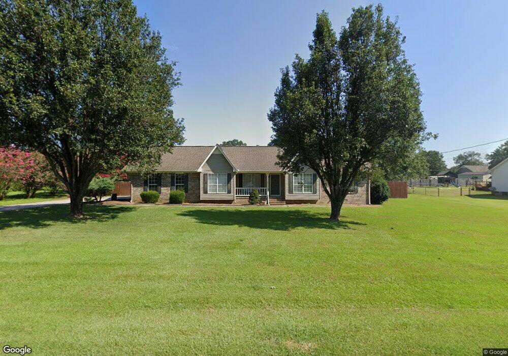
200 Sharp Dr Gadsden, AL 35903
Estimated Value: $235,854 - $280,000
3
Beds
2
Baths
1,671
Sq Ft
$156/Sq Ft
Est. Value
About This Home
This home is located at 200 Sharp Dr, Gadsden, AL 35903 and is currently estimated at $260,964, approximately $156 per square foot. 200 Sharp Dr is a home located in Etowah County with nearby schools including Glencoe Elementary School, Glencoe Middle School, and Glencoe High School.
Ownership History
Date
Name
Owned For
Owner Type
Purchase Details
Closed on
Apr 25, 2018
Sold by
Marbut Tim
Bought by
Allen Hillary and Allen Jeffery Ryan
Current Estimated Value
Home Financials for this Owner
Home Financials are based on the most recent Mortgage that was taken out on this home.
Original Mortgage
$121,600
Outstanding Balance
$104,349
Interest Rate
4.44%
Mortgage Type
Stand Alone First
Estimated Equity
$156,615
Purchase Details
Closed on
Mar 8, 2017
Sold by
Citimortgage Inc
Bought by
Marbut Tim
Purchase Details
Closed on
Feb 10, 2017
Sold by
Citimortgage Inc
Bought by
Allen Jeffery Ryan and Allen Hillary
Purchase Details
Closed on
Dec 6, 2016
Sold by
Harden Janet and Harden Roger
Bought by
Citimortgage Inc
Create a Home Valuation Report for This Property
The Home Valuation Report is an in-depth analysis detailing your home's value as well as a comparison with similar homes in the area
Home Values in the Area
Average Home Value in this Area
Purchase History
| Date | Buyer | Sale Price | Title Company |
|---|---|---|---|
| Allen Hillary | $152,000 | None Available | |
| Marbut Tim | $105,000 | None Available | |
| Allen Jeffery Ryan | -- | -- | |
| Citimortgage Inc | $103,600 | None Available |
Source: Public Records
Mortgage History
| Date | Status | Borrower | Loan Amount |
|---|---|---|---|
| Open | Allen Hillary | $121,600 |
Source: Public Records
Tax History
| Year | Tax Paid | Tax Assessment Tax Assessment Total Assessment is a certain percentage of the fair market value that is determined by local assessors to be the total taxable value of land and additions on the property. | Land | Improvement |
|---|---|---|---|---|
| 2025 | $631 | $18,880 | $2,100 | $16,780 |
| 2024 | $631 | $18,880 | $2,100 | $16,780 |
| 2023 | $631 | $18,870 | $2,100 | $16,770 |
| 2022 | $506 | $15,410 | $2,100 | $13,310 |
| 2021 | $405 | $12,610 | $1,750 | $10,860 |
| 2020 | $405 | $12,620 | $0 | $0 |
| 2019 | $405 | $12,620 | $0 | $0 |
| 2017 | $914 | $25,380 | $0 | $0 |
| 2016 | $0 | $12,700 | $0 | $0 |
| 2015 | -- | $12,700 | $0 | $0 |
| 2013 | -- | $12,900 | $0 | $0 |
Source: Public Records
Map
Nearby Homes
- 400 Lonz St Unit Lonz St.
- 3.5 +/- E US Hwy 278
- 2110 Cove Cir N
- 411 Meadowlark Place
- 102 Meadowpoint Way
- 0 Riverchase Dr Unit 1339922
- 2580 Reeves St
- 51 Aqua Vista Dr W
- 2.5 Aqua Vista Dr E
- 607 Riverview Dr
- 1.48 Acres River Cliff Dr
- 916 Riverview Dr
- 2792 E Rexford St
- 2482 Barnes Dr
- 0 US Highway 278 Unit 21252717
- 2610 Barnes Dr
- 2794 Veranda Trace
- Lot #5 Veranda Trace
- 3720 Tidmore Bend Rd
- 105 Kaying Rd S
- 202 Sharp Dr
- 110 Sharp Dr
- 219 Cove Creek Rd
- 221 Cove Creek Rd
- 201 Sharp Dr
- 203 Sharp Dr
- 113 Sharp Dr
- 217 Cove Creek Rd
- 204 Sharp Dr
- 108 Sharp Dr
- 225 Cove Creek Rd
- 111 Sharp Dr
- 218 Cove Creek Rd
- 106 Sharp Dr
- 206 Sharp Dr
- 214 Cove Creek Rd
- 222 Cove Creek Rd
- 215 Cove Creek Rd
- 227 Cove Creek Rd
- 109 Sharp Dr
Your Personal Tour Guide
Ask me questions while you tour the home.