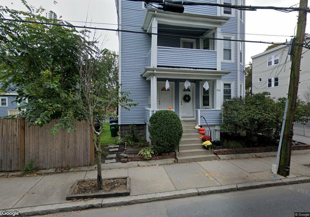
200 Sherman St Unit 2 Cambridge, MA 02140
North Cambridge NeighborhoodEstimated Value: $694,000 - $806,000
3
Beds
1
Bath
950
Sq Ft
$792/Sq Ft
Est. Value
About This Home
This home is located at 200 Sherman St Unit 2, Cambridge, MA 02140 and is currently estimated at $752,824, approximately $792 per square foot. 200 Sherman St Unit 2 is a home located in Middlesex County with nearby schools including Benjamin Banneker Charter Public School, Cambridge Friends School, and Cambridge Montessori School.
Ownership History
Date
Name
Owned For
Owner Type
Purchase Details
Closed on
Dec 17, 1999
Sold by
Smith Steven J and Smith Donna M
Bought by
Reilly Kathleen
Current Estimated Value
Home Financials for this Owner
Home Financials are based on the most recent Mortgage that was taken out on this home.
Original Mortgage
$135,000
Interest Rate
7.81%
Mortgage Type
Purchase Money Mortgage
Create a Home Valuation Report for This Property
The Home Valuation Report is an in-depth analysis detailing your home's value as well as a comparison with similar homes in the area
Home Values in the Area
Average Home Value in this Area
Purchase History
| Date | Buyer | Sale Price | Title Company |
|---|---|---|---|
| Reilly Kathleen | $169,000 | -- |
Source: Public Records
Mortgage History
| Date | Status | Borrower | Loan Amount |
|---|---|---|---|
| Open | Reilly Kathleen | $158,000 | |
| Closed | Reilly Kathleen | $165,000 | |
| Closed | Reilly Kathleen | $135,000 |
Source: Public Records
Tax History
| Year | Tax Paid | Tax Assessment Tax Assessment Total Assessment is a certain percentage of the fair market value that is determined by local assessors to be the total taxable value of land and additions on the property. | Land | Improvement |
|---|---|---|---|---|
| 2025 | $3,988 | $628,100 | $0 | $628,100 |
| 2024 | $3,701 | $625,200 | $0 | $625,200 |
| 2023 | $3,545 | $604,900 | $0 | $604,900 |
| 2022 | $3,531 | $596,400 | $0 | $596,400 |
| 2021 | $3,472 | $593,500 | $0 | $593,500 |
| 2020 | $3,398 | $590,900 | $0 | $590,900 |
| 2019 | $3,252 | $547,500 | $0 | $547,500 |
| 2018 | $3,156 | $501,800 | $0 | $501,800 |
| 2017 | $3,039 | $468,200 | $0 | $468,200 |
| 2016 | $2,952 | $422,300 | $0 | $422,300 |
| 2015 | $2,918 | $373,200 | $0 | $373,200 |
| 2014 | $2,869 | $342,400 | $0 | $342,400 |
Source: Public Records
Map
Nearby Homes
- 57 Cedar St
- 151 Sherman St
- 151 Sherman St Unit 151
- 66 Reed Street Ct Unit 3
- 54 Bellis Cir
- 49 Clifton St
- 124 Jackson St
- 108 Clay St
- 126 Harvey St Unit 2
- 2353 Massachusetts Ave Unit 44
- 2353 Massachusetts Ave Unit 93
- 109 Harvey St
- 69 Harvey St Unit 1
- 127 Harvey St
- 7A Meacham Rd Unit 7A
- 178 Richdale Ave
- 9-11 Edmunds St
- 3 Warwick Park Unit 2
- 38 Brookford St Unit 2
- 97 Elmwood St Unit 313
- 200 Sherman St Unit 3
- 200 Sherman St Unit 1
- 198 Sherman St
- 198 Sherman St Unit 3
- 198 Sherman St Unit 2
- 208 Sherman St Unit B
- 208 Sherman St Unit A
- 208 Sherman St Unit C
- 196 Sherman St Unit 2
- 196 Sherman St
- 196 Sherman St
- 196 Sherman St Unit 3
- 196 Sherman St Unit 1
- 197 Sherman St
- 197 Sherman St Unit 3
- 206 Rindge Ave Unit 206
- 206 Rindge Ave Unit C
- 206 Rindge Ave
- 198 Rindge Ave
- 194 Sherman St
Your Personal Tour Guide
Ask me questions while you tour the home.