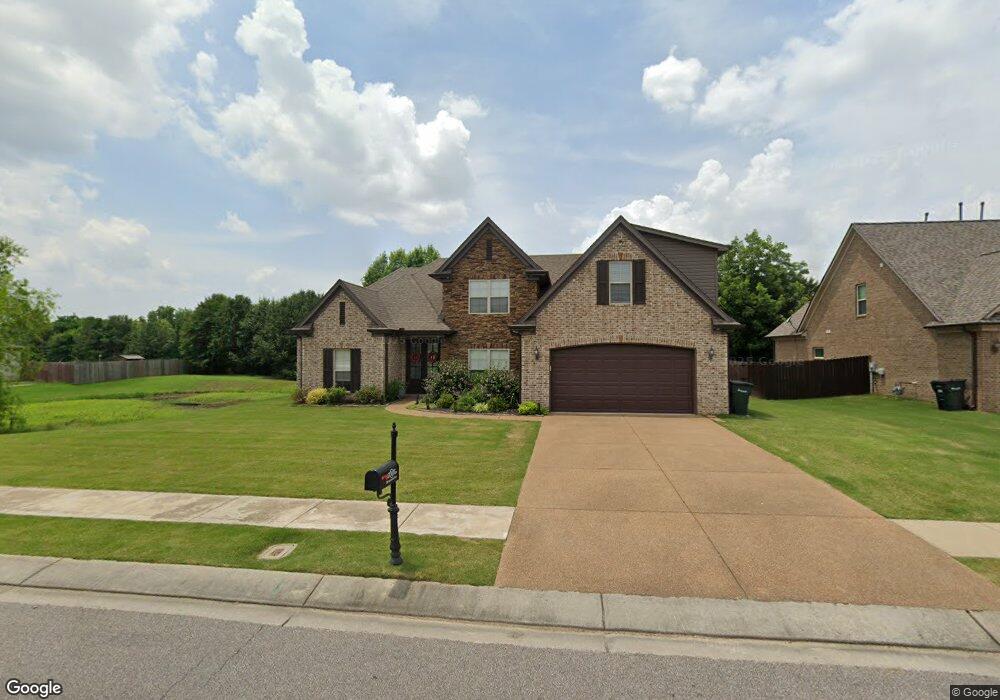
200 Southwind Dr Oakland, TN 38060
Estimated Value: $368,127 - $384,000
--
Bed
--
Bath
2,135
Sq Ft
$177/Sq Ft
Est. Value
About This Home
This home is located at 200 Southwind Dr, Oakland, TN 38060 and is currently estimated at $377,532, approximately $176 per square foot. 200 Southwind Dr is a home with nearby schools including Oakland Elementary School, West Junior High School, and Fayette Ware Comprehensive High School.
Ownership History
Date
Name
Owned For
Owner Type
Purchase Details
Closed on
Apr 20, 2016
Sold by
Apex Home Builders Llc
Bought by
Mccurdy Ashley Victoria and Mccurdy Todd J
Current Estimated Value
Home Financials for this Owner
Home Financials are based on the most recent Mortgage that was taken out on this home.
Original Mortgage
$223,250
Outstanding Balance
$177,533
Interest Rate
3.71%
Mortgage Type
New Conventional
Estimated Equity
$199,999
Purchase Details
Closed on
Oct 23, 2013
Sold by
First Citizens National Ba
Bought by
Apex Home Builders Llc
Create a Home Valuation Report for This Property
The Home Valuation Report is an in-depth analysis detailing your home's value as well as a comparison with similar homes in the area
Home Values in the Area
Average Home Value in this Area
Purchase History
| Date | Buyer | Sale Price | Title Company |
|---|---|---|---|
| Mccurdy Ashley Victoria | $240,000 | -- | |
| Apex Home Builders Llc | $360,000 | -- |
Source: Public Records
Mortgage History
| Date | Status | Borrower | Loan Amount |
|---|---|---|---|
| Open | Mccurdy Ashley Victoria | $223,250 |
Source: Public Records
Tax History Compared to Growth
Tax History
| Year | Tax Paid | Tax Assessment Tax Assessment Total Assessment is a certain percentage of the fair market value that is determined by local assessors to be the total taxable value of land and additions on the property. | Land | Improvement |
|---|---|---|---|---|
| 2024 | $958 | $75,575 | $8,750 | $66,825 |
| 2023 | $1,952 | $75,575 | $0 | $0 |
| 2022 | $1,294 | $75,575 | $8,750 | $66,825 |
| 2021 | $1,294 | $75,575 | $8,750 | $66,825 |
| 2020 | $1,000 | $75,575 | $8,750 | $66,825 |
| 2019 | $1,346 | $66,325 | $7,500 | $58,825 |
| 2018 | $1,372 | $65,750 | $7,500 | $58,250 |
| 2017 | $1,169 | $65,750 | $7,500 | $58,250 |
| 2016 | $1,018 | $53,500 | $7,500 | $46,000 |
| 2015 | $917 | $48,175 | $7,500 | $40,675 |
| 2014 | $917 | $48,175 | $7,500 | $40,675 |
Source: Public Records
Map
Nearby Homes
- 25 Breezy Loop
- 40 Windy Cove
- 215 Hughetta St S
- 30 Southampton St
- 265 Kipling Dr
- 250 Kipling Dr
- 255 Kipling Dr
- 70 Valleyview Ln
- 245 Mossy Springs Dr
- 245 Susanne Dr
- 0 Mcfadden Dr Unit 10209515
- 30 Mossy Springs Cove
- 45 Sadie Cove
- 165 Susanne Dr
- 170 Oakland Ridge Cove
- 40 Gracie Cove
- 24.17 AC Tennessee 194
- 65 Grace Ann Ln
- 45 Bob White Rd
- 270 Oak St
- 190 Southwind Dr
- 170 Southwind Dr
- 0 Southwind Subdivision Dr Unit 3134370
- 0 Breezy Loop Unit 3169580
- 0 Breezy Loop Unit 3169579
- 0 Breezy Loop Unit 3169598
- 0 Breezy Loop Unit 3169594
- 0 Breezy Loop Unit 3169592
- 0 Breezy Loop Unit 3169590
- 0 Breezy Loop Unit 3169588
- 0 Breezy Loop Unit 3169585
- 0 Breezy Loop Unit 3169584
- 0 Breezy Loop Unit 3169581
- 0 Breezy Loop Unit 3169610
- 0 Breezy Loop Unit 3169605
- 0 Breezy Loop Unit 3169604
- 0 Breezy Loop Unit 3169600
- 0 Breezy Loop Unit 3169599
- 0 Breezy Loop Unit 3169623
- 0 Breezy Loop Unit 3169621