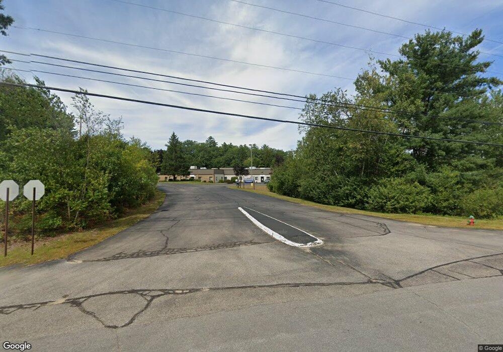
200 Tilton Rd Northfield, NH 03276
Estimated Value: $1,763,544
--
Bed
7
Baths
40,707
Sq Ft
$43/Sq Ft
Est. Value
About This Home
This home is located at 200 Tilton Rd, Northfield, NH 03276 and is currently estimated at $1,763,544, approximately $43 per square foot. 200 Tilton Rd is a home located in Merrimack County with nearby schools including Union Sanborn School, Sanbornton Central School, and Winnisquam Regional Middle School.
Ownership History
Date
Name
Owned For
Owner Type
Purchase Details
Closed on
Oct 20, 2009
Sold by
Thunderbird Real Estat
Bought by
Young Enterprises Nh L
Current Estimated Value
Home Financials for this Owner
Home Financials are based on the most recent Mortgage that was taken out on this home.
Original Mortgage
$700,000
Outstanding Balance
$458,487
Interest Rate
5.14%
Mortgage Type
Commercial
Estimated Equity
$1,305,057
Create a Home Valuation Report for This Property
The Home Valuation Report is an in-depth analysis detailing your home's value as well as a comparison with similar homes in the area
Home Values in the Area
Average Home Value in this Area
Purchase History
| Date | Buyer | Sale Price | Title Company |
|---|---|---|---|
| Young Enterprises Nh L | $800,000 | -- |
Source: Public Records
Mortgage History
| Date | Status | Borrower | Loan Amount |
|---|---|---|---|
| Open | Young Enterprises Nh L | $700,000 |
Source: Public Records
Tax History Compared to Growth
Tax History
| Year | Tax Paid | Tax Assessment Tax Assessment Total Assessment is a certain percentage of the fair market value that is determined by local assessors to be the total taxable value of land and additions on the property. | Land | Improvement |
|---|---|---|---|---|
| 2024 | $36,257 | $2,454,800 | $313,500 | $2,141,300 |
| 2023 | $34,490 | $2,454,800 | $313,500 | $2,141,300 |
| 2022 | $35,717 | $2,454,800 | $313,500 | $2,141,300 |
| 2021 | $41,124 | $1,851,600 | $145,500 | $1,706,100 |
| 2020 | $42,161 | $1,851,600 | $145,500 | $1,706,100 |
| 2019 | $122 | $1,851,600 | $145,500 | $1,706,100 |
| 2018 | $41,587 | $1,851,600 | $145,500 | $1,706,100 |
| 2017 | $99 | $1,857,500 | $160,300 | $1,697,200 |
| 2016 | $34,122 | $1,313,400 | $234,900 | $1,078,500 |
| 2015 | $33,149 | $1,324,900 | $234,900 | $1,090,000 |
| 2014 | $33,196 | $1,296,200 | $234,900 | $1,061,300 |
| 2012 | $36,294 | $1,296,200 | $234,900 | $1,061,300 |
Source: Public Records
Map
Nearby Homes
- 282 Bay Hill Rd
- 32 Andrews Rd
- 164 Gardners Grove Rd
- 107 Gardners Grove Rd
- 44 Noyes Rd
- 52 Noyes Rd
- 59 Coons Point Rd
- 110 Knowles Pond Rd
- 44 Fellows Hill Rd
- 41 Willow St
- 0 Ashuelot Dr Unit 47
- 20 Patricia Ann Dr
- 4 West St
- 375 Depot St
- 8 West St
- 53 Gaslight Rd
- 9 High St
- 12 Holmes Ave
- 22 Cedar St
- 335 Depot St
- 200 Tilton Rd
- 7 & 8 Industrial Dr
- 43 Riverside Rd
- 0 Riverside Business Park Unit 8-3 7 8-5
- 0 Route 14 Riverside Business Park
- 008 Industrial Dr
- 0 Rt 140
- 0 Rt 140
- 0 Rt 140
- 0 Rt 140
- 0 Route 140 Riverside Business Park Unit 4512075
- 66 Shaker Rd
- 44 Shaker Rd
- 40 Shaker Rd
- 34 Shaker Rd
- 007 Industrial Dr
- 14 Shaker Rd Unit Map R-14, Lot 4F
- 90 Shaker Rd
- 90 Shaker Rd Unit R14 Lot 4F
- 51 Shaker Rd
