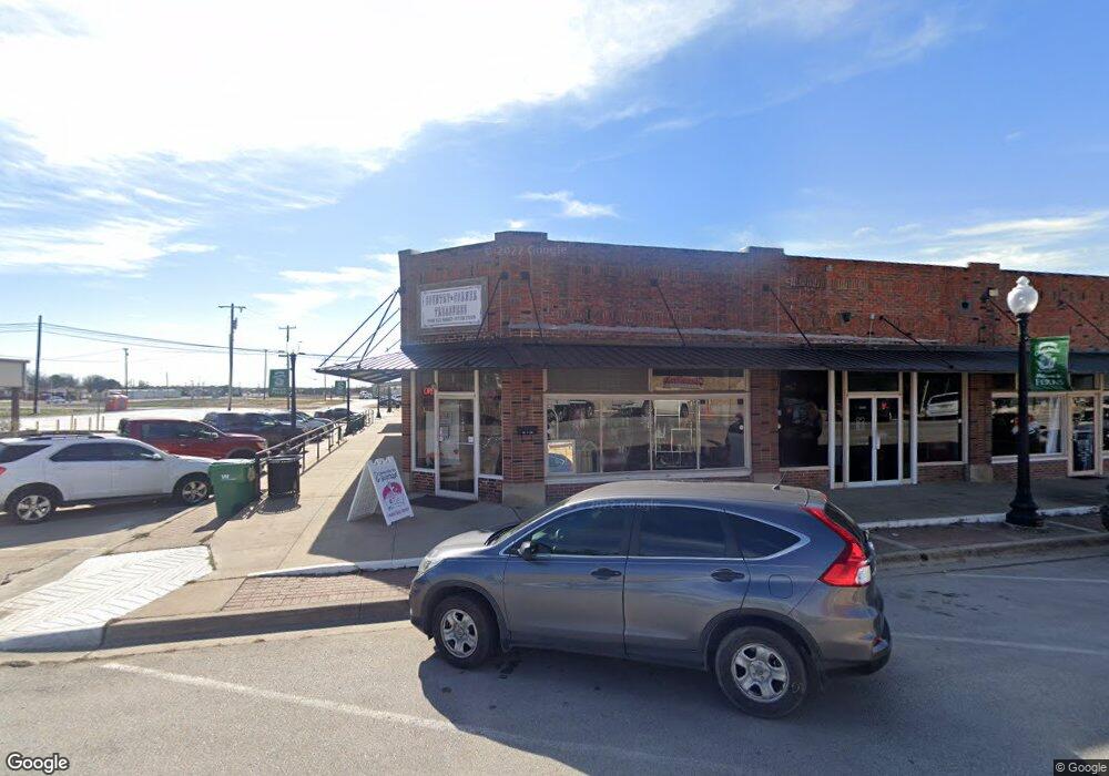
200 W 6th St Unit 1 Ferris, TX 75125
--
Bed
1
Bath
10,542
Sq Ft
0.35
Acres
About This Home
This home is located at 200 W 6th St Unit 1, Ferris, TX 75125. 200 W 6th St Unit 1 is a home located in Ellis County with nearby schools including Hazel Ingram Elementary School, Lee Longino Elementary School, and Lucy Mae Mcdonald Elementary School.
Ownership History
Date
Name
Owned For
Owner Type
Purchase Details
Closed on
Sep 12, 2021
Sold by
Jackie Ray Wills Revocable Trust
Bought by
Mountain Creek Partners Iii Llc and 1020 Group Llc
Purchase Details
Closed on
Sep 10, 2021
Sold by
Mountain Creek Partners Iii Llc
Bought by
1020 Group Llc
Purchase Details
Closed on
Oct 1, 2007
Sold by
Wills Jackie Ray
Bought by
Wills Hazleton and Jackie Ray Wills Revocable Trust
Create a Home Valuation Report for This Property
The Home Valuation Report is an in-depth analysis detailing your home's value as well as a comparison with similar homes in the area
Home Values in the Area
Average Home Value in this Area
Purchase History
| Date | Buyer | Sale Price | Title Company |
|---|---|---|---|
| Mountain Creek Partners Iii Llc | -- | None Listed On Document | |
| 1020 Group Llc | -- | None Listed On Document | |
| Wills Hazleton | -- | None Available |
Source: Public Records
Tax History Compared to Growth
Tax History
| Year | Tax Paid | Tax Assessment Tax Assessment Total Assessment is a certain percentage of the fair market value that is determined by local assessors to be the total taxable value of land and additions on the property. | Land | Improvement |
|---|---|---|---|---|
| 2025 | $15,543 | $824,648 | $205,047 | $619,601 |
| 2024 | $15,543 | $785,379 | $205,047 | $580,332 |
| 2023 | $15,543 | $680,000 | $205,047 | $474,953 |
| 2022 | $15,751 | $678,346 | $201,094 | $477,252 |
| 2021 | $14,108 | $566,360 | $169,470 | $396,890 |
| 2020 | $11,030 | $452,480 | $114,850 | $337,630 |
| 2019 | $11,666 | $447,840 | $0 | $0 |
| 2018 | $5,642 | $225,890 | $42,970 | $182,920 |
| 2017 | $5,620 | $226,110 | $42,970 | $183,140 |
| 2016 | $5,634 | $226,650 | $42,970 | $183,680 |
| 2015 | $5,380 | $226,650 | $42,970 | $183,680 |
| 2014 | $5,380 | $219,080 | $0 | $0 |
Source: Public Records
Map
Nearby Homes
- 1114 Hartson Trail
- 207 E 6th St
- 205 W 10th St
- 510 S Church St
- 315 S Mable St
- 311 E 9th St
- 409 E 7th St
- 400 S Mable St
- 313 E 3rd St
- Silverbell Plan at Sperling Farms
- Roanoke Plan at Sperling Farms
- Sutherland Plan at Sperling Farms
- Rosenberg Plan at Sperling Farms
- Willow Plan at Sperling Farms
- 471 Suffolk Dr
- 475 Suffolk Dr
- 521 Aberdeen Dr
- 481 Suffolk Dr
- 470 Suffolk Dr
- 485 Suffolk Dr
- 200 W 6th St Unit 2
- 216 W 6th St
- 218 W 6th St
- 414 Aberdeen Dr
- 520 Aberdeen Dr
- 534 Aberdeen Dr
- 434 Aberdeen Dr
- 495 Norfolk Dr
- 540 Aberdeen Dr
- 441 Aberdeen Dr
- 435 Aberdeen Dr
- 430 Aberdeen Dr
- 505 Aberdeen Dr
- 415 Aberdeen Dr
- 421 Aberdeen Dr
- 110 Geronimo
- TBD Andrews Rd
- 3431 Farm To Market Road 660
- 115 S Main St
- 221 W 6th St