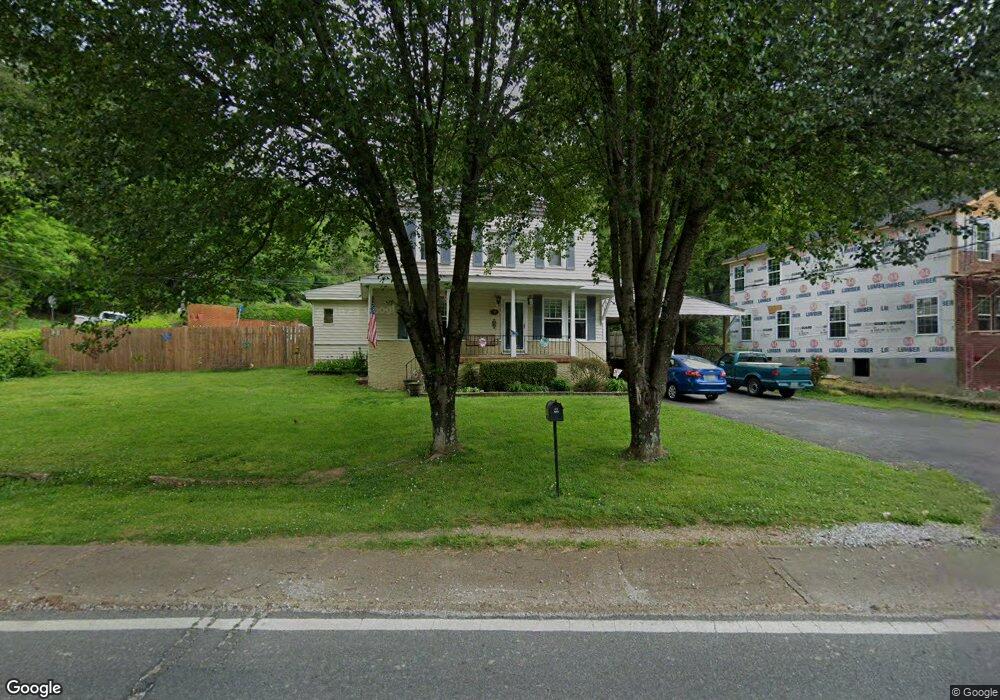
200 W Crest Rd Rossville, GA 30741
Estimated Value: $283,738 - $317,000
5
Beds
3
Baths
2,176
Sq Ft
$136/Sq Ft
Est. Value
About This Home
This home is located at 200 W Crest Rd, Rossville, GA 30741 and is currently estimated at $294,935, approximately $135 per square foot. 200 W Crest Rd is a home located in Walker County with nearby schools including Rossville Elementary School, Rossville Middle School, and Ridgeland High School.
Ownership History
Date
Name
Owned For
Owner Type
Purchase Details
Closed on
Apr 26, 2006
Sold by
Butts Albert M
Bought by
Morgan Calrence R
Current Estimated Value
Home Financials for this Owner
Home Financials are based on the most recent Mortgage that was taken out on this home.
Original Mortgage
$114,096
Outstanding Balance
$65,815
Interest Rate
6.33%
Mortgage Type
FHA
Estimated Equity
$229,120
Purchase Details
Closed on
Jan 1, 1972
Sold by
Confrancisco Henry and Wf Bever
Bought by
Butts Albert M and Mother Edna
Purchase Details
Closed on
Jan 11, 1971
Bought by
Confrancisco Henry and Wf Bever
Create a Home Valuation Report for This Property
The Home Valuation Report is an in-depth analysis detailing your home's value as well as a comparison with similar homes in the area
Home Values in the Area
Average Home Value in this Area
Purchase History
| Date | Buyer | Sale Price | Title Company |
|---|---|---|---|
| Morgan Calrence R | $115,000 | -- | |
| Butts Albert M | $45,000 | -- | |
| Confrancisco Henry | -- | -- |
Source: Public Records
Mortgage History
| Date | Status | Borrower | Loan Amount |
|---|---|---|---|
| Open | Morgan Calrence R | $114,096 |
Source: Public Records
Tax History Compared to Growth
Tax History
| Year | Tax Paid | Tax Assessment Tax Assessment Total Assessment is a certain percentage of the fair market value that is determined by local assessors to be the total taxable value of land and additions on the property. | Land | Improvement |
|---|---|---|---|---|
| 2024 | $3,421 | $104,793 | $4,004 | $100,789 |
| 2023 | $3,288 | $99,614 | $4,004 | $95,610 |
| 2022 | $1,487 | $56,483 | $4,004 | $52,479 |
| 2021 | $1,522 | $51,840 | $4,004 | $47,836 |
| 2020 | $1,387 | $45,198 | $4,004 | $41,194 |
| 2019 | $1,387 | $45,198 | $4,004 | $41,194 |
| 2018 | $1,345 | $45,198 | $4,004 | $41,194 |
| 2017 | $1,503 | $45,198 | $4,004 | $41,194 |
| 2016 | $1,246 | $45,198 | $4,004 | $41,194 |
| 2015 | $1,319 | $45,574 | $4,696 | $40,878 |
| 2014 | $1,270 | $45,574 | $4,696 | $40,878 |
| 2013 | -- | $45,573 | $4,696 | $40,877 |
Source: Public Records
Map
Nearby Homes
- 0 W Crest Rd Unit 1514944
- 220 W Crest Rd
- 308 W Crest Rd
- 701 S Crest Rd
- 404 E Gordon Ave
- 702 S Crest Rd
- 680 S Crest Rd
- 1200 S Crest Rd
- 1812 John Ross Rd
- 3423 Missionaire Ave
- 302 E Gordon Ave
- 4900 15th Ave
- 3203 E 44th St
- 71 Georgia Terrace
- 643 E Crest Rd
- 3312 E 51st St
- 4807 14th Ave
- 4908 13th Ave
- 39 Clift Trail
- 4400 13th Ave
- 204 W Crest Rd
- 300 Waheela Dr
- 1 Battery Dr
- 113 W Crest Rd
- 206 W Crest Rd
- 205 W Crest Rd
- 508 W Crest Rd
- 0 W Crest Rd Unit 1385362
- 1 W Crest Rd
- 215 Waheela Dr
- 2 Battery Dr
- 3312 51 Th St E
- 0 E 51 Th St
- 210 W Crest Rd
- 207 W Crest Rd
- 18 Battery Dr
- 149 Battery Dr
- 216 Waheela Dr
- 3604 Tanaka Trail Unit B
- 213 Waheela Dr