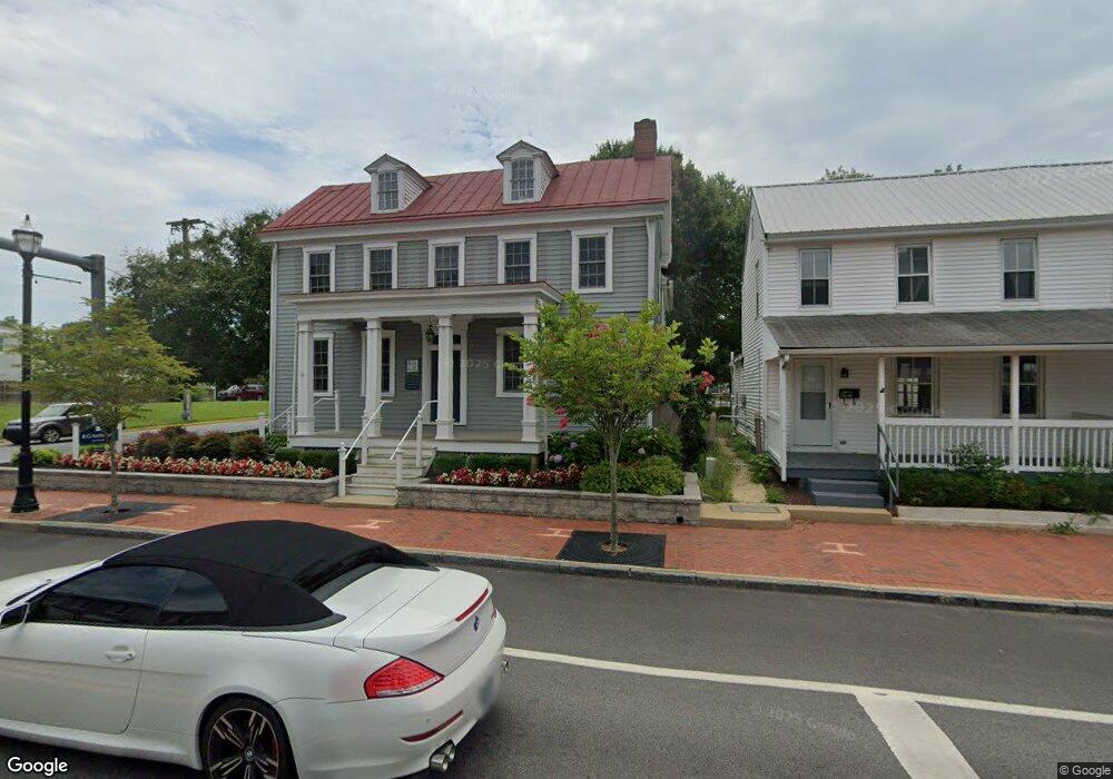
200 W Main St Middletown, DE 19709
Estimated Value: $271,000 - $416,000
3
Beds
1
Bath
1,925
Sq Ft
$180/Sq Ft
Est. Value
About This Home
This home is located at 200 W Main St, Middletown, DE 19709 and is currently estimated at $346,363, approximately $179 per square foot. 200 W Main St is a home located in New Castle County with nearby schools including Silver Lake Elementary School, Everett Meredith Middle School, and Middletown High School.
Ownership History
Date
Name
Owned For
Owner Type
Purchase Details
Closed on
Apr 29, 2016
Sold by
Skrobot Peter and Skrobot Tracy R
Bought by
200 West Main St Llc
Current Estimated Value
Home Financials for this Owner
Home Financials are based on the most recent Mortgage that was taken out on this home.
Original Mortgage
$22,100
Outstanding Balance
$17,622
Interest Rate
3.71%
Mortgage Type
Future Advance Clause Open End Mortgage
Estimated Equity
$328,741
Purchase Details
Closed on
Feb 28, 2005
Sold by
Roberts Carlos D and Roberts Barbara A
Bought by
Skrobot Peter and Skrobot Tracy R
Home Financials for this Owner
Home Financials are based on the most recent Mortgage that was taken out on this home.
Original Mortgage
$239,000
Interest Rate
5.73%
Mortgage Type
Purchase Money Mortgage
Create a Home Valuation Report for This Property
The Home Valuation Report is an in-depth analysis detailing your home's value as well as a comparison with similar homes in the area
Home Values in the Area
Average Home Value in this Area
Purchase History
| Date | Buyer | Sale Price | Title Company |
|---|---|---|---|
| 200 West Main St Llc | $260,000 | Attorney | |
| Skrobot Peter | $295,000 | -- |
Source: Public Records
Mortgage History
| Date | Status | Borrower | Loan Amount |
|---|---|---|---|
| Open | 200 West Main St Llc | $22,100 | |
| Previous Owner | Skrobot Peter | $239,000 |
Source: Public Records
Tax History
| Year | Tax Paid | Tax Assessment Tax Assessment Total Assessment is a certain percentage of the fair market value that is determined by local assessors to be the total taxable value of land and additions on the property. | Land | Improvement |
|---|---|---|---|---|
| 2024 | $84 | $27,900 | $6,100 | $21,800 |
| 2023 | $84 | $27,900 | $6,100 | $21,800 |
| 2022 | $858 | $27,900 | $6,100 | $21,800 |
| 2021 | $829 | $27,900 | $6,100 | $21,800 |
| 2020 | $829 | $27,900 | $6,100 | $21,800 |
| 2019 | $615 | $27,900 | $6,100 | $21,800 |
| 2018 | $735 | $27,900 | $6,100 | $21,800 |
| 2017 | $708 | $27,900 | $6,100 | $21,800 |
| 2016 | $636 | $27,900 | $6,100 | $21,800 |
| 2015 | $615 | $27,900 | $6,100 | $21,800 |
| 2014 | $697 | $27,900 | $6,100 | $21,800 |
Source: Public Records
Map
Nearby Homes
- 102 S Broad St
- 14 W Lake St
- 11 W Hoffecker St
- 12 E Cochran St
- 11 E Lockwood St
- 129 E Main St
- 113 Crawford St
- 108 E Cochran St
- 102 E Redding St
- 8 Redding Cir
- 3 Redding Cir
- 25 Franklin Dr
- 610 Louis Ln
- 659 Warren Dr
- 162 Liborio Dr
- 541 Diamond Dr
- 403 New St
- 908 S Cass St
- 60 S Cummings Dr
- 447 Toftrees Dr
Your Personal Tour Guide
Ask me questions while you tour the home.