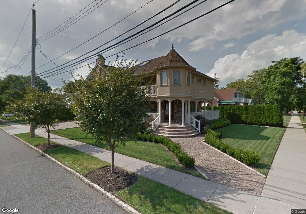
200 Westcott Blvd Staten Island, NY 10314
Westerleigh NeighborhoodEstimated Value: $973,000 - $1,336,000
4
Beds
2
Baths
1,443
Sq Ft
$766/Sq Ft
Est. Value
About This Home
This home is located at 200 Westcott Blvd, Staten Island, NY 10314 and is currently estimated at $1,105,604, approximately $766 per square foot. 200 Westcott Blvd is a home located in Richmond County with nearby schools including P.S. 30 Westerleigh, I.S. 51 Edwin Markham, and Susan E Wagner High School.
Ownership History
Date
Name
Owned For
Owner Type
Purchase Details
Closed on
Aug 11, 2003
Sold by
Walter James H
Bought by
Troost Jeffrey
Current Estimated Value
Home Financials for this Owner
Home Financials are based on the most recent Mortgage that was taken out on this home.
Original Mortgage
$300,000
Interest Rate
5.81%
Mortgage Type
Purchase Money Mortgage
Create a Home Valuation Report for This Property
The Home Valuation Report is an in-depth analysis detailing your home's value as well as a comparison with similar homes in the area
Home Values in the Area
Average Home Value in this Area
Purchase History
| Date | Buyer | Sale Price | Title Company |
|---|---|---|---|
| Troost Jeffrey | $375,000 | -- |
Source: Public Records
Mortgage History
| Date | Status | Borrower | Loan Amount |
|---|---|---|---|
| Previous Owner | Troost Jeffrey | $300,000 |
Source: Public Records
Tax History Compared to Growth
Tax History
| Year | Tax Paid | Tax Assessment Tax Assessment Total Assessment is a certain percentage of the fair market value that is determined by local assessors to be the total taxable value of land and additions on the property. | Land | Improvement |
|---|---|---|---|---|
| 2025 | $9,960 | $73,920 | $16,591 | $57,329 |
| 2024 | $5,080 | $69,360 | $17,378 | $51,982 |
| 2023 | $9,565 | $48,496 | $16,458 | $32,038 |
| 2022 | $8,924 | $56,640 | $23,640 | $33,000 |
| 2021 | $8,940 | $55,620 | $23,640 | $31,980 |
| 2020 | $8,855 | $55,740 | $23,640 | $32,100 |
| 2019 | $8,596 | $60,480 | $23,640 | $36,840 |
| 2018 | $7,941 | $40,413 | $17,402 | $23,011 |
| 2017 | $7,539 | $38,451 | $17,677 | $20,774 |
| 2016 | $7,007 | $36,602 | $17,127 | $19,475 |
| 2015 | $6,490 | $36,026 | $20,020 | $16,006 |
| 2014 | $6,490 | $35,409 | $20,705 | $14,704 |
Source: Public Records
Map
Nearby Homes
- 160 Westcott Blvd
- 125 Westcott Blvd
- 36 Sawyer Ave
- 80 Kemball Ave
- 25 Coale Ave
- 142 Margaretta Ct
- 14 Leonard Ave
- 48 Markham Place
- 751 Jewett Ave Unit 17
- 751 Jewett Ave
- 148 Sturges St
- 136 Sturges St
- 307 Fiske Ave
- 307 Clinton B Fiske Ave
- 33 Gower St
- 63 Avon Ln
- 254 Rice Ave
- 86 Clermont Place
- 282 Willard Ave
- 85 Perry Ave
- 196 Westcott Blvd
- 145 Kemball Ave
- 0 Kemball Ave
- 190 Westcott Blvd
- 138 Kemball Ave
- 149 Kemball Ave
- 124 Crowell Ave
- 151 Kemball Ave
- 146 Kemball Ave
- 210 Westcott Blvd
- 136 Crowell Ave
- 199 Westcott Blvd
- 150 Kemball Ave
- 157 Kemball Ave
- 193 Westcott Blvd
- 203 Westcott Blvd Unit 205
- 203-205 Westcott Blvd
- 214 Westcott Blvd
- 142 Crowell Ave
- 205 Westcott Blvd