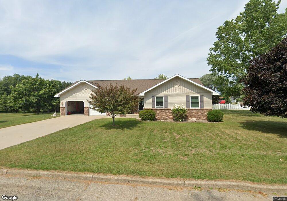
2000 12th Ave S Escanaba, MI 49829
Estimated Value: $261,000 - $315,000
3
Beds
2
Baths
1,560
Sq Ft
$183/Sq Ft
Est. Value
About This Home
This home is located at 2000 12th Ave S, Escanaba, MI 49829 and is currently estimated at $285,272, approximately $182 per square foot. 2000 12th Ave S is a home located in Delta County with nearby schools including Escanaba Jr./Sr. High School, Holy Name Catholic School, and Escanaba Sda School.
Ownership History
Date
Name
Owned For
Owner Type
Purchase Details
Closed on
Apr 28, 2006
Sold by
Richard T Richard T and Brazeau Carol J
Bought by
Kwarciany Dale E and Kwarciany Jane M
Current Estimated Value
Home Financials for this Owner
Home Financials are based on the most recent Mortgage that was taken out on this home.
Original Mortgage
$186,441
Interest Rate
6.39%
Mortgage Type
Purchase Money Mortgage
Purchase Details
Closed on
Aug 7, 2000
Bought by
Brazeau
Purchase Details
Closed on
Jan 15, 1999
Bought by
Mccowan
Create a Home Valuation Report for This Property
The Home Valuation Report is an in-depth analysis detailing your home's value as well as a comparison with similar homes in the area
Home Values in the Area
Average Home Value in this Area
Purchase History
| Date | Buyer | Sale Price | Title Company |
|---|---|---|---|
| Kwarciany Dale E | -- | -- | |
| Kwarciany | $185,000 | -- | |
| Brazeau | $157,000 | -- | |
| Mccowan | $153,000 | -- |
Source: Public Records
Mortgage History
| Date | Status | Borrower | Loan Amount |
|---|---|---|---|
| Closed | Kwarciany | $186,441 |
Source: Public Records
Tax History
| Year | Tax Paid | Tax Assessment Tax Assessment Total Assessment is a certain percentage of the fair market value that is determined by local assessors to be the total taxable value of land and additions on the property. | Land | Improvement |
|---|---|---|---|---|
| 2025 | $3,430 | $145,300 | $0 | $0 |
| 2024 | $3,332 | $129,800 | $0 | $0 |
| 2023 | $3,176 | $117,300 | $0 | $0 |
| 2022 | $4,053 | $101,700 | $0 | $0 |
| 2021 | $3,907 | $96,000 | $0 | $0 |
| 2020 | $3,869 | $97,600 | $0 | $0 |
| 2019 | $3,747 | $89,600 | $0 | $0 |
| 2018 | $3,852 | $92,100 | $0 | $0 |
| 2017 | $2,839 | $91,849 | $0 | $0 |
| 2016 | $3,729 | $91,443 | $0 | $0 |
| 2014 | $2,718 | $88,792 | $0 | $0 |
| 2013 | $2,718 | $87,900 | $0 | $0 |
Source: Public Records
Map
Nearby Homes
- 1930 S 22nd St
- 1020 S 18th St
- 1824 9th Ave S
- 1524 9th Ave S
- 1524 8th Ave S
- 1617 17th Ave S
- 1605 17th Ave S
- 804 S 13th St
- 910 13th St S
- 105 N 19th St
- 509 S 10th St
- 2414 Ludington St
- 1620 Willow Creek Rd Unit Lot 13
- 517 S 9th St
- 206 N 21st
- 219 N 20th St
- 1114 1st Ave S
- 417 S 8th St
- 605 Ogden Ave
- 113 S 10th St
- 2000 12th Ave S
- 2022 12th Ave S
- 2005 12th Ave S
- 2009 12th Ave S
- 2013 12th Ave S
- 2013 12th Ave S
- 2015 12th Ave S
- 2021 12th Ave S
- 2021 12th Ave S
- 1918 12th Ave S
- 1902 12th Ave S
- 2006 13th Ave S
- 2010 13th Ave S
- 2010 13th Ave S Unit S
- 2014 13th Ave S
- 2110 12th Ave S
- 1200 S 20th St
- 1203 S 20th St
- 2101 12th Ave S
- 2022 13th Ave S
Your Personal Tour Guide
Ask me questions while you tour the home.