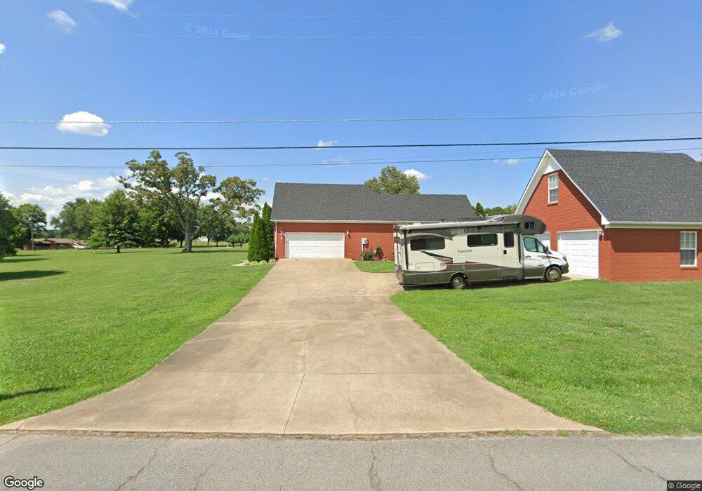
2000 Branch Dr Lawrenceburg, TN 38464
Estimated Value: $434,962 - $556,000
--
Bed
3
Baths
2,077
Sq Ft
$231/Sq Ft
Est. Value
About This Home
This home is located at 2000 Branch Dr, Lawrenceburg, TN 38464 and is currently estimated at $479,241, approximately $230 per square foot. 2000 Branch Dr is a home located in Lawrence County with nearby schools including Ingram Sowell Elementary School, Lawrenceburg Public Elementary School, and David Crockett Elementary School.
Ownership History
Date
Name
Owned For
Owner Type
Purchase Details
Closed on
Aug 28, 2024
Sold by
Johnson Jeffrey P and Johnson Debra G
Bought by
Johnson Family Living Trust and Johnson
Current Estimated Value
Purchase Details
Closed on
Feb 23, 2017
Sold by
Tinin Kyle
Bought by
Gobble Cassie Mashe and Copelan Dooley Lance
Purchase Details
Closed on
Jan 21, 2008
Sold by
Allen Fields Mark
Bought by
Kyle Tinin
Purchase Details
Closed on
Apr 8, 2002
Bought by
Fields Mark Allen and Fields Candice
Create a Home Valuation Report for This Property
The Home Valuation Report is an in-depth analysis detailing your home's value as well as a comparison with similar homes in the area
Home Values in the Area
Average Home Value in this Area
Purchase History
| Date | Buyer | Sale Price | Title Company |
|---|---|---|---|
| Johnson Family Living Trust | -- | None Listed On Document | |
| Gobble Cassie Mashe | $250,000 | -- | |
| Kyle Tinin | $230,000 | -- | |
| Fields Mark Allen | $20,000 | -- |
Source: Public Records
Tax History Compared to Growth
Tax History
| Year | Tax Paid | Tax Assessment Tax Assessment Total Assessment is a certain percentage of the fair market value that is determined by local assessors to be the total taxable value of land and additions on the property. | Land | Improvement |
|---|---|---|---|---|
| 2025 | $1,872 | $93,125 | $0 | $0 |
| 2024 | $1,872 | $93,125 | $6,650 | $86,475 |
| 2023 | $1,872 | $93,125 | $6,650 | $86,475 |
| 2022 | $1,872 | $93,125 | $6,650 | $86,475 |
| 2021 | $1,681 | $56,800 | $4,425 | $52,375 |
| 2020 | $1,681 | $56,800 | $4,425 | $52,375 |
| 2019 | $1,681 | $56,800 | $4,425 | $52,375 |
| 2018 | $1,681 | $56,800 | $4,425 | $52,375 |
| 2017 | $1,681 | $56,800 | $4,425 | $52,375 |
| 2016 | $1,681 | $56,800 | $4,425 | $52,375 |
| 2015 | $1,556 | $56,800 | $4,425 | $52,375 |
| 2014 | $1,349 | $49,250 | $4,425 | $44,825 |
Source: Public Records
Map
Nearby Homes
- 114 Hummingbird Ln
- 132 Sundance Dr
- 52 Beuerlein Cir
- 31 Community Rd
- 14 Delana Ave
- 0 Woodland Cir Unit RTC3033314
- 48 Woodland Cir
- 975 Weakley Creek Rd
- 4000 Weakley Creek Rd
- 4951 Weakley Creek Rd
- 970 9th St
- 1050 Baylee Cir
- 1303 5th Ave
- 717 Toben Terrace
- 801 Douglas Dr
- 413 Kirk St
- 1083 Mattox Town Rd
- 1088 Mattox Town Rd
- 335 Robins St
- 729 Weakley Creek Rd
- 1998 Branch Dr
- 581 Weakley Creek Rd
- 2190 Pine Ridge Dr
- 1997 Branch Dr
- 571 Weakley Creek Rd
- 1950 Branch Dr
- 2180 Pine Ridge Dr
- 587 Weakley Creek Rd
- 1993 Branch Dr
- 586 Weakley Creek Rd
- 2175 Pine Ridge Dr
- 2170 Pine Ridge Dr
- 1910 Branch Dr
- 1925 Branch Dr
- 589 Weakley Creek Rd
- 42 Glade Ct
- 2155 Pine Ridge Dr
- 563 Weakley Creek Rd
- 466 Sundance Dr
- 2185 Betty Ave