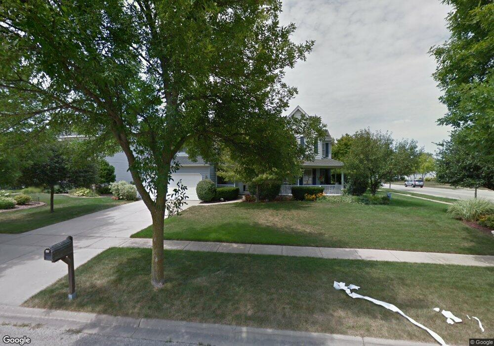
2000 Carlisle St Algonquin, IL 60102
Estimated Value: $475,000 - $526,000
4
Beds
3
Baths
2,696
Sq Ft
$188/Sq Ft
Est. Value
About This Home
This home is located at 2000 Carlisle St, Algonquin, IL 60102 and is currently estimated at $507,687, approximately $188 per square foot. 2000 Carlisle St is a home located in McHenry County with nearby schools including Westfield Community School, Kenneth E Neubert Elementary School, and United Junior High School.
Ownership History
Date
Name
Owned For
Owner Type
Purchase Details
Closed on
Jan 30, 1998
Sold by
Lavin John A and Lavin Jeanette
Bought by
Cummings Donald S and Cummings Marlene J
Current Estimated Value
Home Financials for this Owner
Home Financials are based on the most recent Mortgage that was taken out on this home.
Original Mortgage
$184,000
Outstanding Balance
$32,921
Interest Rate
7.12%
Estimated Equity
$474,766
Create a Home Valuation Report for This Property
The Home Valuation Report is an in-depth analysis detailing your home's value as well as a comparison with similar homes in the area
Home Values in the Area
Average Home Value in this Area
Purchase History
| Date | Buyer | Sale Price | Title Company |
|---|---|---|---|
| Cummings Donald S | $230,000 | -- |
Source: Public Records
Mortgage History
| Date | Status | Borrower | Loan Amount |
|---|---|---|---|
| Open | Cummings Donald S | $184,000 |
Source: Public Records
Tax History Compared to Growth
Tax History
| Year | Tax Paid | Tax Assessment Tax Assessment Total Assessment is a certain percentage of the fair market value that is determined by local assessors to be the total taxable value of land and additions on the property. | Land | Improvement |
|---|---|---|---|---|
| 2024 | $11,886 | $159,941 | $39,481 | $120,460 |
| 2023 | $11,305 | $143,047 | $35,311 | $107,736 |
| 2022 | $10,473 | $128,120 | $41,257 | $86,863 |
| 2021 | $10,059 | $119,359 | $38,436 | $80,923 |
| 2020 | $9,799 | $115,133 | $37,075 | $78,058 |
| 2019 | $9,568 | $110,196 | $35,485 | $74,711 |
| 2018 | $9,131 | $101,798 | $32,781 | $69,017 |
| 2017 | $8,952 | $95,900 | $30,882 | $65,018 |
| 2016 | $8,828 | $89,946 | $28,965 | $60,981 |
| 2013 | -- | $85,454 | $27,021 | $58,433 |
Source: Public Records
Map
Nearby Homes
- 2161 Burnham Ct
- 2043 Peach Tree Ln Unit 4122
- 000 County Line Rd
- 1971 Peach Tree Ln
- 2101 Peach Tree Ln Unit 4094
- 1900 Waverly Ln
- 30 Arbordale Ct Unit 4284
- 2060 Dorchester Ave
- 741 Regal Ln
- 1820 Crofton Dr
- 2235 Dawson Ln
- 2248 Dawson Ln Unit 272
- 661 Majestic Dr
- Adams Plan at Algonquin Meadows - Single Family
- Sequoia Plan at Algonquin Meadows - Single Family
- Bryce Plan at Algonquin Meadows - Single Family
- Rainier Plan at Algonquin Meadows - Single Family
- Santa Rosa Plan at Algonquin Meadows - Single Family
- Biscayne Plan at Algonquin Meadows - Single Family
- Marianne Plan at Algonquin Meadows - Traditional Townhomes
- 2020 Carlisle St
- 2040 Carlisle St
- 1465 Darlington Ct
- 2001 Carlisle St
- 2021 Carlisle St
- 1475 Stonegate Rd
- 2041 Carlisle St
- 1430 Darlington Ct
- 2060 Carlisle St
- 1485 Stonegate Rd
- 2061 Carlisle St
- 1455 Darlington Ct
- 1425 Stonegate Rd
- 1420 Darlington Ct
- 2081 Carlisle St
- 2080 Carlisle St
- 2101 Burnham Ct
- 2101 Carlisle St
- 1495 Stonegate Rd
- 2121 Burnham Ct