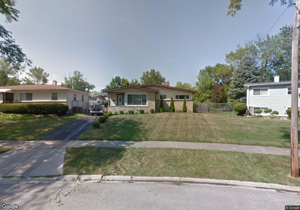
2000 Devonshire Rd Waukegan, IL 60087
Estimated Value: $222,000 - $282,000
3
Beds
1
Bath
1,081
Sq Ft
$234/Sq Ft
Est. Value
About This Home
This home is located at 2000 Devonshire Rd, Waukegan, IL 60087 and is currently estimated at $252,871, approximately $233 per square foot. 2000 Devonshire Rd is a home located in Lake County with nearby schools including H R McCall Elementary School, Jack Benny Middle School, and Waukegan High School.
Ownership History
Date
Name
Owned For
Owner Type
Purchase Details
Closed on
Nov 12, 2003
Sold by
Redd Rudolph Q
Bought by
Maldonado Esmeralda
Current Estimated Value
Home Financials for this Owner
Home Financials are based on the most recent Mortgage that was taken out on this home.
Original Mortgage
$139,000
Interest Rate
7.75%
Mortgage Type
Purchase Money Mortgage
Purchase Details
Closed on
Sep 19, 1996
Sold by
Doyel Cynthia K
Bought by
Redd Ruldoph Q
Home Financials for this Owner
Home Financials are based on the most recent Mortgage that was taken out on this home.
Original Mortgage
$97,495
Interest Rate
8.14%
Mortgage Type
FHA
Create a Home Valuation Report for This Property
The Home Valuation Report is an in-depth analysis detailing your home's value as well as a comparison with similar homes in the area
Purchase History
| Date | Buyer | Sale Price | Title Company |
|---|---|---|---|
| Maldonado Esmeralda | $139,000 | Ticor Title Insurance Compan | |
| Redd Ruldoph Q | -- | -- |
Source: Public Records
Mortgage History
| Date | Status | Borrower | Loan Amount |
|---|---|---|---|
| Previous Owner | Maldonado Esmeralda | $139,000 | |
| Previous Owner | Redd Ruldoph Q | $97,495 |
Source: Public Records
Tax History
| Year | Tax Paid | Tax Assessment Tax Assessment Total Assessment is a certain percentage of the fair market value that is determined by local assessors to be the total taxable value of land and additions on the property. | Land | Improvement |
|---|---|---|---|---|
| 2024 | $4,679 | $63,787 | $12,275 | $51,512 |
| 2023 | $4,184 | $57,624 | $11,089 | $46,535 |
| 2022 | $4,184 | $48,798 | $10,355 | $38,443 |
| 2021 | $4,514 | $49,298 | $9,862 | $39,436 |
| 2020 | $4,526 | $45,927 | $9,188 | $36,739 |
| 2019 | $4,505 | $42,084 | $8,419 | $33,665 |
| 2018 | $4,027 | $37,506 | $10,833 | $26,673 |
| 2017 | $3,870 | $33,182 | $9,584 | $23,598 |
| 2016 | $3,532 | $28,834 | $8,328 | $20,506 |
| 2015 | $3,346 | $25,807 | $7,454 | $18,353 |
| 2014 | $3,941 | $28,831 | $6,134 | $22,697 |
| 2012 | $3,895 | $31,237 | $6,646 | $24,591 |
Source: Public Records
Map
Nearby Homes
- 2936 Witchwood Ln
- 1507 W York House Rd
- 3101 Country Club Ln
- 1730 W Beach Rd
- 2820 N Elmwood Ave
- 2805 N Elmwood Ave
- 1403 W Beach Rd
- 38169 N North Shore Ave
- 38132 N Manor Ave
- 38546 N Pine Ave
- 11471 W Leland Ave
- 38119 N Wilson Ave
- 38633 N Cedar Ave
- 2629 N Mcaree Rd
- 3805 Bertrand Ln
- 2605 N Pine St
- 1136 10 Pin Ln
- 12346 W Sallmon Ave
- 2705 Jacquelyn Ln
- 38410 N Tewes Ct
- 3325 Bristol Rd
- 2004 Devonshire Rd
- 2001 Edgewood Rd Unit 1
- 1925 Edgewood Rd
- 2008 Devonshire Rd
- 2005 Edgewood Rd Unit 1
- 3321 Bristol Rd
- 1921 Edgewood Rd
- 2009 Edgewood Rd
- 2012 Devonshire Rd Unit 1
- 2005 Devonshire Rd
- 1917 Edgewood Rd
- 3317 Bristol Rd
- 2013 Edgewood Rd Unit 1
- 2009 Devonshire Rd
- 2016 Devonshire Rd Unit 1
- 2013 Devonshire Rd
- 3328 Stonegate Rd
- 3313 Bristol Rd Unit 1
- 2017 Edgewood Rd
Your Personal Tour Guide
Ask me questions while you tour the home.