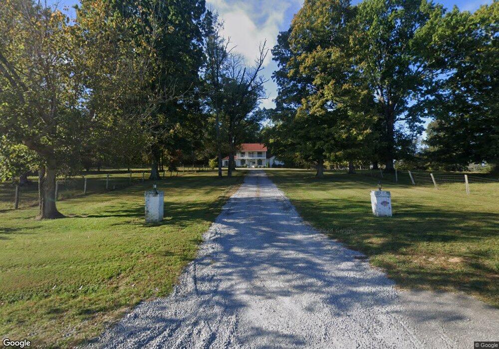
2000 Highway 130 E Shelbyville, TN 37160
Estimated Value: $511,000 - $702,987
--
Bed
1
Bath
1,947
Sq Ft
$307/Sq Ft
Est. Value
About This Home
This home is located at 2000 Highway 130 E, Shelbyville, TN 37160 and is currently estimated at $597,662, approximately $306 per square foot. 2000 Highway 130 E is a home located in Bedford County with nearby schools including Liberty Elementary School.
Ownership History
Date
Name
Owned For
Owner Type
Purchase Details
Closed on
Jan 6, 2009
Sold by
Ashley Mark F
Bought by
Ashley Luke W
Current Estimated Value
Purchase Details
Closed on
Jan 3, 2007
Sold by
Ashley Mark F
Bought by
Ashley Luke W
Purchase Details
Closed on
May 11, 2000
Sold by
Rogers Donald R
Bought by
Domini Ashley Foundation
Purchase Details
Closed on
Sep 19, 1970
Bought by
Ashley Albert R
Create a Home Valuation Report for This Property
The Home Valuation Report is an in-depth analysis detailing your home's value as well as a comparison with similar homes in the area
Home Values in the Area
Average Home Value in this Area
Purchase History
| Date | Buyer | Sale Price | Title Company |
|---|---|---|---|
| Ashley Luke W | $24,000 | -- | |
| Ashley Luke W | $24,000 | -- | |
| Domini Ashley Foundation | -- | -- | |
| Ashley Albert R | -- | -- |
Source: Public Records
Tax History Compared to Growth
Tax History
| Year | Tax Paid | Tax Assessment Tax Assessment Total Assessment is a certain percentage of the fair market value that is determined by local assessors to be the total taxable value of land and additions on the property. | Land | Improvement |
|---|---|---|---|---|
| 2025 | $1,774 | $76,275 | $0 | $0 |
| 2024 | $1,774 | $76,275 | $35,450 | $40,825 |
| 2023 | $1,774 | $76,275 | $35,450 | $40,825 |
| 2022 | $1,774 | $76,275 | $35,450 | $40,825 |
| 2021 | $1,499 | $76,275 | $35,450 | $40,825 |
| 2020 | $1,367 | $76,275 | $35,450 | $40,825 |
| 2019 | $1,367 | $51,400 | $29,200 | $22,200 |
| 2018 | $1,316 | $51,400 | $29,200 | $22,200 |
| 2017 | $1,316 | $51,400 | $29,200 | $22,200 |
| 2016 | $1,295 | $51,400 | $0 | $0 |
| 2015 | $1,295 | $51,400 | $0 | $0 |
| 2014 | $1,056 | $46,513 | $0 | $0 |
Source: Public Records
Map
Nearby Homes
- 0 Himesville Rd
- 231 Riverbend Country Club Rd
- 209 Gladys Dr
- 339 Riverbend Country Club Rd
- 455 Himesville Rd
- 0 Highway 130 E
- 119 Crestland Cir
- 1519 Highway 130 E
- 495 Himesville Rd
- 148 Maupin Cir
- 201 Sulphur Springs Rd
- 1413 Highway 130 E
- 1725 Wartrace Pike
- 128 Riverlake Rd
- 104 Townsend Ave
- 711 S Wall St
- 719 S Wall St
- 715 S Wall St
- 713 S Wall St
- 705 S Wall St
- 2000 Highway 130 E
- 2000 Highway 130 E
- 1819 Highway 130 E
- 1815 Highway 130 E
- 120 New Hope Rd
- 102 Stanley Davis Cir
- 115 Himesville Rd
- 115 Himesville Rd
- 105 Brookfield Rd
- 121 Himesville Rd
- 104 Stanley Davis Cir
- 101 Stanley Davis Cir
- 107 Brookfield Rd
- 115 Fairway View Dr
- 110 Himesville Rd
- 103 Stanley Davis Cir
- 109 Brookfield Rd
- 102 Brookfield Rd
- 117 Fairway View Dr
- 105 Stanley Davis Cir