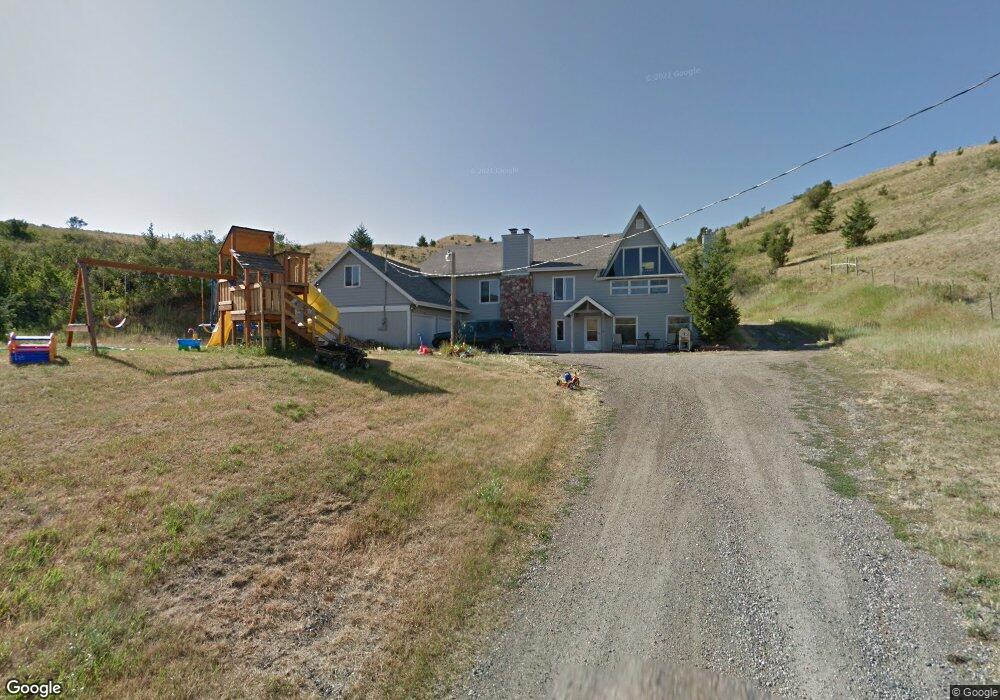
2000 Hillside Ln Bozeman, MT 59715
East Bozeman NeighborhoodEstimated Value: $1,524,000 - $1,779,000
5
Beds
4
Baths
2,579
Sq Ft
$647/Sq Ft
Est. Value
About This Home
This home is located at 2000 Hillside Ln, Bozeman, MT 59715 and is currently estimated at $1,667,381, approximately $646 per square foot. 2000 Hillside Ln is a home located in Gallatin County with nearby schools including Hawthorne Elementary School, Chief Joseph Middle School, and Bozeman High School.
Ownership History
Date
Name
Owned For
Owner Type
Purchase Details
Closed on
Jun 30, 2016
Sold by
Ogle Christopher W and Ogle Marjorie J
Bought by
Ogle Marjorie J
Current Estimated Value
Purchase Details
Closed on
Feb 27, 2006
Sold by
Ogle Christopher W
Bought by
Ogle Christopher W and Ogle Marjorie J
Home Financials for this Owner
Home Financials are based on the most recent Mortgage that was taken out on this home.
Original Mortgage
$356,500
Interest Rate
6.04%
Mortgage Type
Stand Alone Refi Refinance Of Original Loan
Create a Home Valuation Report for This Property
The Home Valuation Report is an in-depth analysis detailing your home's value as well as a comparison with similar homes in the area
Home Values in the Area
Average Home Value in this Area
Purchase History
| Date | Buyer | Sale Price | Title Company |
|---|---|---|---|
| Ogle Marjorie J | -- | Accommodation | |
| Ogle Christopher W | -- | American Land Title Company |
Source: Public Records
Mortgage History
| Date | Status | Borrower | Loan Amount |
|---|---|---|---|
| Closed | Ogle Christopher W | $356,500 |
Source: Public Records
Tax History
| Year | Tax Paid | Tax Assessment Tax Assessment Total Assessment is a certain percentage of the fair market value that is determined by local assessors to be the total taxable value of land and additions on the property. | Land | Improvement |
|---|---|---|---|---|
| 2025 | $7,599 | $1,675,815 | $0 | $0 |
| 2024 | $5,775 | $1,090,911 | $0 | $0 |
| 2023 | $5,556 | $1,090,911 | $0 | $0 |
| 2022 | $4,358 | $652,864 | $0 | $0 |
| 2021 | $5,113 | $709,984 | $0 | $0 |
| 2020 | $5,002 | $686,970 | $0 | $0 |
| 2019 | $4,934 | $686,970 | $0 | $0 |
| 2018 | $4,254 | $533,439 | $0 | $0 |
| 2017 | $3,943 | $533,439 | $0 | $0 |
| 2016 | $3,734 | $476,649 | $0 | $0 |
| 2015 | $3,800 | $476,649 | $0 | $0 |
| 2014 | $3,823 | $287,652 | $0 | $0 |
Source: Public Records
Map
Nearby Homes
- 2434 Richau Ln
- 1846 Chippewa Ln
- 1804 Chippewa Ln
- 2550 Kootenai Ct
- 1719 Midfield St
- 18 Moon Shadow Dr
- TBD Story Mill Rd
- TBD Lucy Ln
- TBD Canyon Gate Blvd
- TBD Blvd
- 2503 Valhalla Ct
- 2402 Blue Silos Way
- 3592 Bridger Canyon Rd
- 1002 Boylan Rd Unit G
- 1050 Boylan Rd Unit 4
- 1031 Boylan Rd
- 1055 Caddie Ct
- 805 N Ida Ave Unit 209
- 805 N Ida Ave Unit 205
- 805 N Ida Ave Unit 203
- 2226 Powder Park Ct
- 2212 Powder Park Ct
- 2206 Bridger Dr
- 2234 Powder Park Ct
- 1970 Hillside Ln
- 2200 Powder Park Ct
- 2106 Bridger Dr
- 2106 Bridger Dr
- 2016 Bridger Dr
- 2112 Bridger Dr
- 2251 Powder Park Ct
- 2200 Powder Park
- 2200 Bridger Dr
- 2210 Bridger Dr
- 2202 Bridger Dr
- 2202 Bridger Dr
- 2277 Powder Park Ct
- 1817 Hillside Ln
- 2015 Bridger Dr
- 2015 Bridger Dr
Your Personal Tour Guide
Ask me questions while you tour the home.