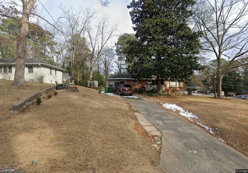
2000 Laurel Ln Decatur, GA 30032
Estimated Value: $164,000 - $188,000
2
Beds
1
Bath
978
Sq Ft
$180/Sq Ft
Est. Value
About This Home
This home is located at 2000 Laurel Ln, Decatur, GA 30032 and is currently estimated at $176,143, approximately $180 per square foot. 2000 Laurel Ln is a home located in DeKalb County with nearby schools including Snapfinger Elementary School, Columbia Middle School, and Columbia High School.
Ownership History
Date
Name
Owned For
Owner Type
Purchase Details
Closed on
Feb 2, 2001
Sold by
Rotundo Carla
Bought by
Hancock Thomas and Hancock Lizzie
Current Estimated Value
Home Financials for this Owner
Home Financials are based on the most recent Mortgage that was taken out on this home.
Original Mortgage
$101,350
Outstanding Balance
$36,363
Interest Rate
7.16%
Mortgage Type
New Conventional
Estimated Equity
$139,780
Purchase Details
Closed on
Sep 25, 2000
Sold by
Petersen Claude T
Bought by
Rotundo Carla
Home Financials for this Owner
Home Financials are based on the most recent Mortgage that was taken out on this home.
Original Mortgage
$79,865
Interest Rate
7.92%
Mortgage Type
New Conventional
Create a Home Valuation Report for This Property
The Home Valuation Report is an in-depth analysis detailing your home's value as well as a comparison with similar homes in the area
Home Values in the Area
Average Home Value in this Area
Purchase History
| Date | Buyer | Sale Price | Title Company |
|---|---|---|---|
| Hancock Thomas | $103,000 | -- | |
| Rotundo Carla | $65,500 | -- |
Source: Public Records
Mortgage History
| Date | Status | Borrower | Loan Amount |
|---|---|---|---|
| Open | Hancock Thomas | $101,350 | |
| Previous Owner | Rotundo Carla | $79,865 |
Source: Public Records
Tax History Compared to Growth
Tax History
| Year | Tax Paid | Tax Assessment Tax Assessment Total Assessment is a certain percentage of the fair market value that is determined by local assessors to be the total taxable value of land and additions on the property. | Land | Improvement |
|---|---|---|---|---|
| 2025 | $668 | $65,880 | $23,320 | $42,560 |
| 2024 | $691 | $68,200 | $23,320 | $44,880 |
| 2023 | $691 | $59,480 | $23,320 | $36,160 |
| 2022 | $327 | $50,400 | $13,320 | $37,080 |
| 2021 | $327 | $47,720 | $13,320 | $34,400 |
| 2020 | $328 | $41,040 | $11,400 | $29,640 |
| 2019 | $318 | $39,120 | $11,400 | $27,720 |
| 2018 | $173 | $24,960 | $11,400 | $13,560 |
| 2017 | $119 | $16,560 | $3,040 | $13,520 |
| 2016 | $127 | $17,480 | $3,040 | $14,440 |
| 2014 | $88 | $11,880 | $3,040 | $8,840 |
Source: Public Records
Map
Nearby Homes
- 3168 Mcafee Rd
- 1986 Bandera Dr
- 3199 Mcafee Rd
- 2024 Rosewood Rd
- 1968 Rosewood Rd
- 2003 Rosewood Rd
- 3110 Mcafee Rd
- 1882 Rosewood Rd
- 3235 Mcafee Rd
- 1932 Rosewood Rd
- 1990 Shamrock Dr
- 1879 Rosewood Rd
- 2004 Shamrock Dr
- 1911 Rosewood Rd
- 2048 Glendale Dr
- 1923 Rosewood Rd
- 1973 Glendale Dr
- 2064 Shamrock Dr
- 1819 Rosewood Rd
- 1884 Derrill Dr
- 1996 Laurel Ln
- 1990 Laurel Ln
- 2001 Laurel Ln
- 1997 Laurel Ln
- 1984 Laurel Ln
- 3182 Mcafee Rd
- 3163 Mcafee Rd
- 3169 Mcafee Rd
- 1991 Laurel Ln
- 3157 Mcafee Rd
- 3142 Mcafee Rd
- 3175 Mcafee Rd
- 1989 Bandera Dr
- 1978 Laurel Ln
- 3151 Mcafee Rd
- 1985 Laurel Ln
- 3181 Mcafee Rd
- 3136 Mcafee Rd
- 1983 Bandera Dr
- 3145 Mcafee Rd