Estimated Value: $799,000 - $1,216,000
4
Beds
4
Baths
3,053
Sq Ft
$333/Sq Ft
Est. Value
About This Home
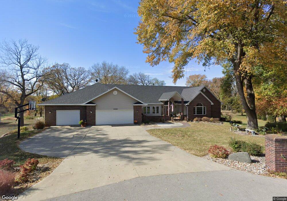
This home is located at 2000 Michael Ln, Ames, IA 50010 and is currently estimated at $1,015,310, approximately $332 per square foot. 2000 Michael Ln is a home located in Story County with nearby schools including Gilbert Elementary School, Gilbert Intermediate School, and Gilbert Middle School.
Ownership History
Date
Name
Owned For
Owner Type
Purchase Details
Closed on
Jan 3, 2022
Sold by
Greenfield Lyle E and Greenfield Miriam E
Bought by
Lyle Greenfield Revocable Trust
Current Estimated Value
Purchase Details
Closed on
May 31, 2011
Sold by
Holliday Mwlvin Paul and Holliday Seanne E
Bought by
Greenfield Lyle and Greenfield Miriam E
Home Financials for this Owner
Home Financials are based on the most recent Mortgage that was taken out on this home.
Original Mortgage
$574,400
Interest Rate
4.75%
Mortgage Type
New Conventional
Purchase Details
Closed on
Apr 17, 2007
Sold by
Mccarney Patrik D and Mccarney Margaret A
Bought by
Holliday Melvin Paul and Holliday Seanne E
Home Financials for this Owner
Home Financials are based on the most recent Mortgage that was taken out on this home.
Original Mortgage
$199,500
Interest Rate
7.37%
Mortgage Type
Adjustable Rate Mortgage/ARM
Create a Home Valuation Report for This Property
The Home Valuation Report is an in-depth analysis detailing your home's value as well as a comparison with similar homes in the area
Home Values in the Area
Average Home Value in this Area
Purchase History
| Date | Buyer | Sale Price | Title Company |
|---|---|---|---|
| Lyle Greenfield Revocable Trust | -- | Gartin Timothy L | |
| Greenfield Lyle | -- | None Available | |
| Holliday Melvin Paul | $685,000 | -- |
Source: Public Records
Mortgage History
| Date | Status | Borrower | Loan Amount |
|---|---|---|---|
| Previous Owner | Greenfield Lyle | $574,400 | |
| Previous Owner | Holliday Melvin Paul | $199,500 |
Source: Public Records
Tax History Compared to Growth
Tax History
| Year | Tax Paid | Tax Assessment Tax Assessment Total Assessment is a certain percentage of the fair market value that is determined by local assessors to be the total taxable value of land and additions on the property. | Land | Improvement |
|---|---|---|---|---|
| 2025 | $11,714 | $943,800 | $292,100 | $651,700 |
| 2024 | $11,140 | $900,100 | $262,800 | $637,300 |
| 2023 | $11,328 | $900,100 | $262,800 | $637,300 |
| 2022 | $11,262 | $774,700 | $214,200 | $560,500 |
| 2021 | $11,538 | $774,700 | $214,200 | $560,500 |
| 2020 | $11,696 | $740,600 | $214,200 | $526,400 |
| 2019 | $11,696 | $740,600 | $214,200 | $526,400 |
| 2018 | $11,530 | $702,500 | $214,200 | $488,300 |
| 2017 | $11,530 | $702,500 | $214,200 | $488,300 |
| 2016 | $11,506 | $703,900 | $214,200 | $489,700 |
| 2015 | $11,506 | $703,900 | $214,200 | $489,700 |
| 2014 | $11,316 | $703,900 | $214,200 | $489,700 |
Source: Public Records
Map
Nearby Homes
- 2279 Pheasant Ridge Ln
- 5007 Skycrest Dr
- 4882 Copperstone Dr
- 532 W Riverside Rd
- 1827 Ledges Dr
- 1914 Ada Hayden Rd
- 2006 Aikman Dr
- 2009 Lacey Dr
- 1920 Ada Hayden Rd
- 2015 Lacey Dr
- 3500 Grand Ave
- 2017 Lacey Dr
- 2007 Ketelsen Dr
- 2108 Aikman Dr
- 2102 Aikman Dr
- 2242 Ketelsen Dr
- 2206 Ketelsen Dr
- 2113 Ada Hayden Rd
- 2111 Ketelsen Dr
- 2123 Ketelsen Dr
- 2020 Michael Ln
- 2027 Michael Ln
- 2085 Michael Ln
- 2078 Michael Ln
- 2100 Katie Ln
- 2103 Quail Ridge Rd
- 2054 Katie Ln
- 2112 Quail Ridge Rd
- 2131 Quail Ridge Rd
- 2104 Quail Ridge Rd
- 2129 Quail Ridge Rd
- 2096 Quail Ridge Rd
- 2063 Katie Ln
- 2105 Katie Ln
- 2128 Quail Ridge Rd
- 2134 Quail Ridge Rd
- 2134 Quail Ridge Rd
- 2088 Quail Ridge Rd
- 2176 Pintail Ridge Ln
- 2124 Pintail Ridge Ln