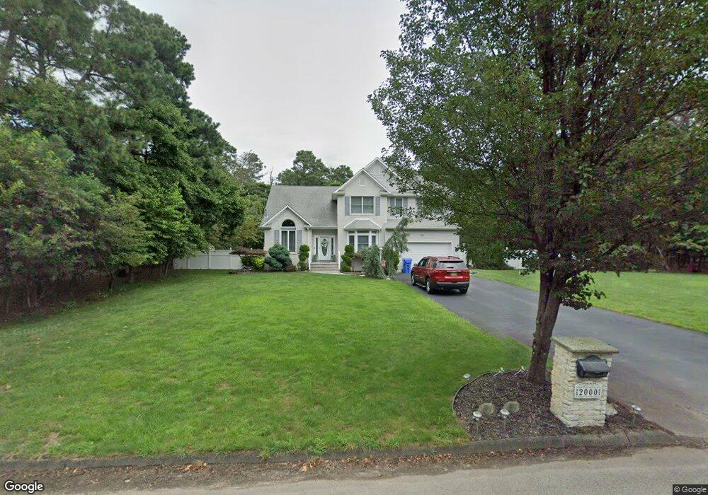
2000 Newark Ave Whiting, NJ 08759
Manchester Township NeighborhoodEstimated Value: $603,000 - $672,000
3
Beds
3
Baths
2,286
Sq Ft
$278/Sq Ft
Est. Value
About This Home
This home is located at 2000 Newark Ave, Whiting, NJ 08759 and is currently estimated at $635,750, approximately $278 per square foot. 2000 Newark Ave is a home located in Ocean County with nearby schools including Manchester Township High School.
Ownership History
Date
Name
Owned For
Owner Type
Purchase Details
Closed on
Oct 27, 2000
Sold by
Vlahos Christina
Bought by
Defonzo Michael
Current Estimated Value
Home Financials for this Owner
Home Financials are based on the most recent Mortgage that was taken out on this home.
Original Mortgage
$30,000
Outstanding Balance
$11,015
Interest Rate
7.83%
Estimated Equity
$624,735
Create a Home Valuation Report for This Property
The Home Valuation Report is an in-depth analysis detailing your home's value as well as a comparison with similar homes in the area
Home Values in the Area
Average Home Value in this Area
Purchase History
| Date | Buyer | Sale Price | Title Company |
|---|---|---|---|
| Defonzo Michael | $39,000 | -- | |
| Defonzo Michael | $39,000 | -- |
Source: Public Records
Mortgage History
| Date | Status | Borrower | Loan Amount |
|---|---|---|---|
| Open | Defonzo Michael | $30,000 | |
| Closed | Defonzo Michael | $30,000 |
Source: Public Records
Tax History Compared to Growth
Tax History
| Year | Tax Paid | Tax Assessment Tax Assessment Total Assessment is a certain percentage of the fair market value that is determined by local assessors to be the total taxable value of land and additions on the property. | Land | Improvement |
|---|---|---|---|---|
| 2025 | $9,616 | $658,000 | $200,200 | $457,800 |
| 2024 | $9,127 | $391,700 | $88,000 | $303,700 |
| 2023 | $8,676 | $391,700 | $88,000 | $303,700 |
| 2022 | $8,676 | $391,700 | $88,000 | $303,700 |
| 2021 | $8,488 | $391,700 | $88,000 | $303,700 |
| 2020 | $8,265 | $391,700 | $88,000 | $303,700 |
| 2019 | $9,116 | $355,400 | $88,000 | $267,400 |
| 2018 | $9,080 | $355,400 | $88,000 | $267,400 |
| 2017 | $9,116 | $355,400 | $88,000 | $267,400 |
| 2016 | $9,006 | $355,400 | $88,000 | $267,400 |
| 2015 | $8,839 | $355,400 | $88,000 | $267,400 |
| 2014 | $8,658 | $355,400 | $88,000 | $267,400 |
Source: Public Records
Map
Nearby Homes
- 1130 Monroe Ave
- 70 Norwalk Ave Unit 73
- 22 Hummingbird Ln Unit 73
- 11 Hartford Rd Unit 70
- 1 Chelsea Dr
- 23 Brentwood St Unit 73
- 85 Falmouth Ave Unit 72
- 1901 Chilvers Ave
- 1751 Chilvers Ave
- 9 Apple Ln
- 81 Falmouth Ave Unit 72
- 81 Falmouth Ave
- 69 Chelsea Dr Unit 72
- 74 Chelsea Dr
- 43 S Chestnut Ave Unit 72
- 58 St John Place Unit C
- 53 St John Place Unit B
- 2 Verbena Ct Unit B
- 6 N Chestnut Ave
- 27 Keene St Unit 70
- 2020 Newark Ave
- 1980 Newark Ave
- 2001 Paterson Ave
- 2001 Newark Ave
- 2021 Paterson Ave
- 1981 Paterson Ave
- 1981 Newark Ave
- 2040 Newark Ave
- 1960 Newark Ave
- 2041 Paterson Ave
- 1961 Paterson Ave
- 2041 Newark Ave
- 2000 Paterson Ave
- 2000 Brooklyn Ave
- 1961 Newark Ave
- 2020 Paterson Ave
- 1980 Paterson Ave
- 2020 Brooklyn Ave
- 1940 Newark Ave
- 850 Monroe Ave