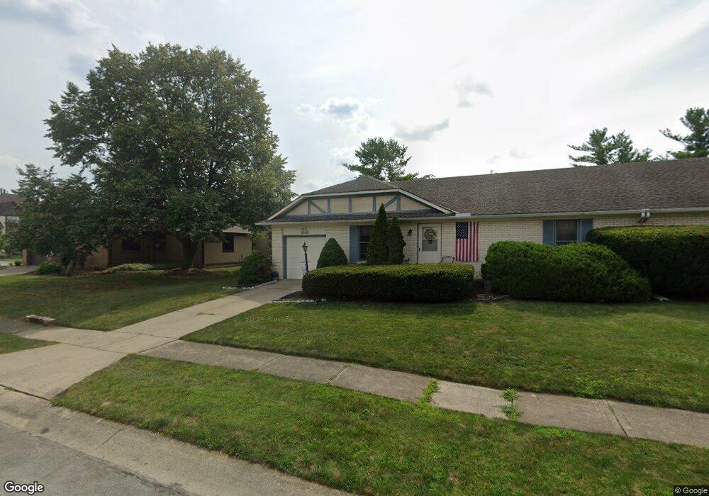
2000 Queensgate Ln Columbus, OH 43235
The Gables NeighborhoodEstimated Value: $254,000 - $379,000
2
Beds
2
Baths
1,227
Sq Ft
$255/Sq Ft
Est. Value
About This Home
This home is located at 2000 Queensgate Ln, Columbus, OH 43235 and is currently estimated at $312,413, approximately $254 per square foot. 2000 Queensgate Ln is a home located in Franklin County with nearby schools including Daniel Wright Elementary School, Ann Simpson Davis Middle School, and Dublin Scioto High School.
Ownership History
Date
Name
Owned For
Owner Type
Purchase Details
Closed on
Feb 2, 2007
Sold by
Dunn Austin P
Bought by
Omalley Susan Kent
Current Estimated Value
Purchase Details
Closed on
Oct 3, 2002
Sold by
Dunn Austin P and Dunn Leonora G
Bought by
Dunn Austin P and Dunn Leonora G
Purchase Details
Closed on
Jul 30, 1985
Bought by
Dunn Austin P
Purchase Details
Closed on
Nov 1, 1984
Purchase Details
Closed on
Dec 1, 1983
Create a Home Valuation Report for This Property
The Home Valuation Report is an in-depth analysis detailing your home's value as well as a comparison with similar homes in the area
Home Values in the Area
Average Home Value in this Area
Purchase History
| Date | Buyer | Sale Price | Title Company |
|---|---|---|---|
| Omalley Susan Kent | $126,900 | Attorney | |
| Dunn Austin P | -- | -- | |
| Dunn Austin P | $73,000 | -- | |
| -- | $30,000 | -- | |
| -- | $31,500 | -- |
Source: Public Records
Tax History
| Year | Tax Paid | Tax Assessment Tax Assessment Total Assessment is a certain percentage of the fair market value that is determined by local assessors to be the total taxable value of land and additions on the property. | Land | Improvement |
|---|---|---|---|---|
| 2025 | $4,339 | $70,280 | $21,000 | $49,280 |
| 2024 | $4,339 | $70,280 | $21,000 | $49,280 |
| 2023 | $4,279 | $70,280 | $21,000 | $49,280 |
| 2022 | $4,170 | $63,460 | $19,710 | $43,750 |
| 2021 | $4,238 | $63,460 | $19,710 | $43,750 |
| 2020 | $4,213 | $63,460 | $19,710 | $43,750 |
| 2019 | $3,806 | $50,750 | $15,750 | $35,000 |
| 2018 | $3,632 | $50,750 | $15,750 | $35,000 |
| 2017 | $3,472 | $50,750 | $15,750 | $35,000 |
| 2016 | $3,417 | $46,170 | $13,090 | $33,080 |
| 2015 | $3,439 | $46,170 | $13,090 | $33,080 |
| 2014 | $3,442 | $46,170 | $13,090 | $33,080 |
| 2013 | $1,664 | $43,960 | $12,460 | $31,500 |
Source: Public Records
Map
Nearby Homes
- 5446 Baneberry Ave Unit 16A
- 5258 Captains Ct Unit E
- 5331 Bethel Park Dr
- 2176 Hedgerow Rd Unit 2176D
- 5374 Tartan Ln Unit 33
- 5354 Shannon Ln Unit 71
- 5672 Fraley Ct
- 5624 Wigmore Dr Unit 50B
- 5094 Reed Rd
- 5647 Barney Ln
- 5273 Berrywood Dr Unit 5273
- 2260 Lila Way Unit 62D
- 5109 Ranstead Ct Unit 9
- 5107 Delancey St
- 5354 Coral Berry Dr Unit 79C
- 5275 Portland St Unit 204
- 5285 Portland St Unit 104
- 5294 Brandy Oaks Ln
- 2010 Willoway Ct N Unit 2010
- 2391 Bethel Rd Unit 2391
- 2005 Bayswater Dr
- 2012 Queensgate Ln
- 2014 Queensgate Ln Unit 2014
- 2018 Queensgate Ln Unit 2018
- 1995 Queensgate Ln
- 2020 Queensgate Ln Unit 2020
- 1987 Bayswater Dr
- 2024 Queensgate Ln Unit 2024
- 1994 Drury Ln Unit 1994
- 1996 Drury Ln
- 5436 Baneberry Ave
- 1992 Drury Ln Unit 1992
- 5434 Baneberry Ave Unit 15B
- 1992 Bayswater Dr
- 1990 Drury Ln Unit 1990
- 1975 Bayswater Dr
- 5432 Baneberry Ave
- 1988 Drury Ln
- 1986 Drury Ln Unit 1986
- 5475 Gardenbrooke St
Your Personal Tour Guide
Ask me questions while you tour the home.