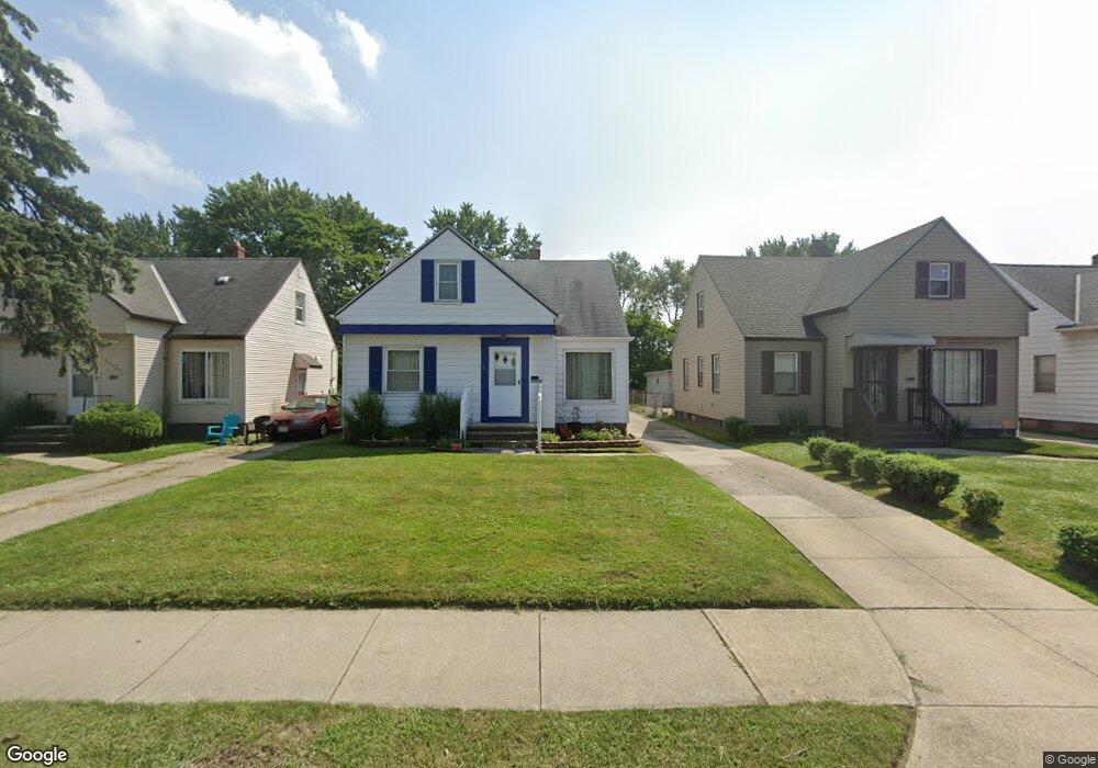
20000 Mccracken Rd Maple Heights, OH 44137
Estimated Value: $115,850 - $141,000
3
Beds
1
Bath
1,284
Sq Ft
$97/Sq Ft
Est. Value
About This Home
This home is located at 20000 Mccracken Rd, Maple Heights, OH 44137 and is currently estimated at $124,963, approximately $97 per square foot. 20000 Mccracken Rd is a home located in Cuyahoga County with nearby schools including Abraham Lincoln Elementary School, Rockside/ J.F. Kennedy School, and Italy High School.
Ownership History
Date
Name
Owned For
Owner Type
Purchase Details
Closed on
Jul 23, 1997
Sold by
Mangeri Daryl L
Bought by
Clack Willima E and Clack Estella L
Current Estimated Value
Home Financials for this Owner
Home Financials are based on the most recent Mortgage that was taken out on this home.
Original Mortgage
$69,462
Outstanding Balance
$10,845
Interest Rate
8.5%
Mortgage Type
VA
Estimated Equity
$114,118
Purchase Details
Closed on
Jan 1, 1975
Bought by
Mangeri Anthony F and Mangeri Helen J
Create a Home Valuation Report for This Property
The Home Valuation Report is an in-depth analysis detailing your home's value as well as a comparison with similar homes in the area
Home Values in the Area
Average Home Value in this Area
Purchase History
| Date | Buyer | Sale Price | Title Company |
|---|---|---|---|
| Clack Willima E | $68,100 | -- | |
| Mangeri Anthony F | -- | -- |
Source: Public Records
Mortgage History
| Date | Status | Borrower | Loan Amount |
|---|---|---|---|
| Open | Clack Willima E | $69,462 |
Source: Public Records
Tax History Compared to Growth
Tax History
| Year | Tax Paid | Tax Assessment Tax Assessment Total Assessment is a certain percentage of the fair market value that is determined by local assessors to be the total taxable value of land and additions on the property. | Land | Improvement |
|---|---|---|---|---|
| 2024 | $2,477 | $37,590 | $7,105 | $30,485 |
| 2023 | $1,495 | $21,670 | $4,310 | $17,360 |
| 2022 | $2,315 | $21,665 | $4,305 | $17,360 |
| 2021 | $2,467 | $21,670 | $4,310 | $17,360 |
| 2020 | $2,109 | $16,420 | $3,260 | $13,160 |
| 2019 | $2,098 | $46,900 | $9,300 | $37,600 |
| 2018 | $1,986 | $16,420 | $3,260 | $13,160 |
| 2017 | $2,038 | $15,610 | $3,010 | $12,600 |
| 2016 | $1,972 | $15,610 | $3,010 | $12,600 |
| 2015 | $1,973 | $15,610 | $3,010 | $12,600 |
| 2014 | $1,973 | $17,160 | $3,330 | $13,830 |
Source: Public Records
Map
Nearby Homes
- 20120 Mccracken Rd
- 20715 Watson Rd
- 19309 Nitra Ave
- 20814 Watson Rd
- 20907 Watson Rd
- 19807 Gardenview Dr
- 5165 Camden Rd
- 19520 Maple Heights Blvd
- 21102 Raymond St
- 19806 Mountville Dr
- 20107 Libby Rd
- 20510 Mountville Dr
- 21207 Franklin Rd
- 20701 Kenyon Dr
- 20814 Kenyon Dr
- 19812 Stockton Ave
- 5265 Bellview St
- 19289 Stafford Ave
- 19221 Stafford Ave
- 21416 Gardenview Dr
- 19980 Mccracken Rd
- 20020 Mccracken Rd
- 20040 Mccracken Rd
- 19960 Mccracken Rd
- 20060 Mccracken Rd
- 19940 Mccracken Rd
- 20080 Mccracken Rd
- 19920 Mccracken Rd
- 19909 Fairway Ave
- 19905 Fairway Ave
- 20100 Mccracken Rd
- 19901 Fairway Ave
- 19900 Mccracken Rd
- 19817 Fairway Ave
- 19913 Fairway Ave
- 19820 Mccracken Rd
- 19917 Fairway Ave
- 19813 Fairway Ave
- 20011 Maple Heights Blvd
- 20140 Mccracken Rd