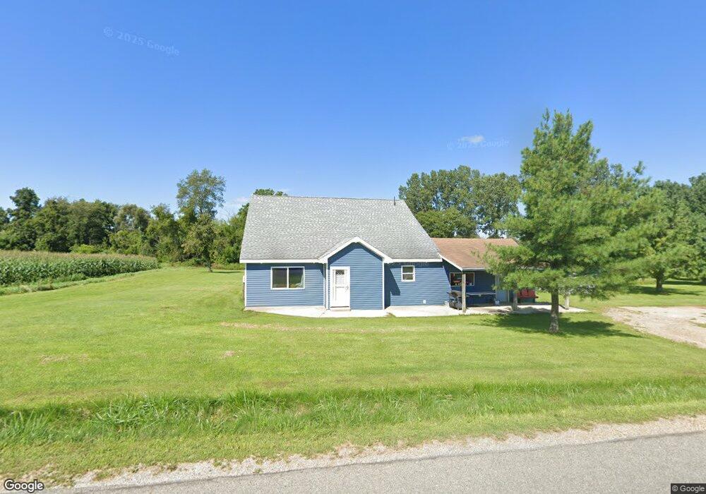
20003 27 Mile Rd Albion, MI 49224
Estimated Value: $178,000 - $279,000
3
Beds
1
Bath
1,590
Sq Ft
$142/Sq Ft
Est. Value
About This Home
This home is located at 20003 27 Mile Rd, Albion, MI 49224 and is currently estimated at $225,864, approximately $142 per square foot. 20003 27 Mile Rd is a home located in Calhoun County with nearby schools including Springport Elementary School, Springport Middle School, and Springport High School.
Ownership History
Date
Name
Owned For
Owner Type
Purchase Details
Closed on
Feb 24, 2023
Sold by
Steven C Cottrell Revocable Trust
Bought by
England Randy Dale
Current Estimated Value
Purchase Details
Closed on
Aug 18, 2006
Sold by
Wilson Michael J and Wilson Angela D
Bought by
Hsbc Bank Usa Na and Ace Securities Corp Home Equity Loan Tru
Purchase Details
Closed on
Apr 23, 2001
Bought by
Wilson Michael and Wilson Angela
Purchase Details
Closed on
Sep 12, 1994
Bought by
Hamilton Gene and Hamilton Tammy
Create a Home Valuation Report for This Property
The Home Valuation Report is an in-depth analysis detailing your home's value as well as a comparison with similar homes in the area
Home Values in the Area
Average Home Value in this Area
Purchase History
| Date | Buyer | Sale Price | Title Company |
|---|---|---|---|
| England Randy Dale | -- | -- | |
| England Randy Dale | -- | None Listed On Document | |
| Hsbc Bank Usa Na | $86,664 | None Available | |
| Wilson Michael | $59,000 | -- | |
| Hamilton Gene | $45,000 | -- |
Source: Public Records
Tax History Compared to Growth
Tax History
| Year | Tax Paid | Tax Assessment Tax Assessment Total Assessment is a certain percentage of the fair market value that is determined by local assessors to be the total taxable value of land and additions on the property. | Land | Improvement |
|---|---|---|---|---|
| 2025 | $1,225 | $85,000 | $0 | $0 |
| 2024 | $436 | $83,100 | $0 | $0 |
| 2023 | $1,058 | $74,500 | $0 | $0 |
| 2022 | $1,058 | $64,700 | $0 | $0 |
| 2021 | $1,012 | $52,000 | $0 | $0 |
| 2020 | $1,012 | $51,700 | $0 | $0 |
| 2019 | $0 | $44,900 | $0 | $0 |
| 2018 | $0 | $28,100 | $5,800 | $22,300 |
| 2017 | $0 | $25,800 | $0 | $0 |
| 2016 | $0 | $25,000 | $0 | $0 |
| 2015 | -- | $19,600 | $18,045 | $1,555 |
| 2014 | -- | $17,300 | $0 | $0 |
Source: Public Records
Map
Nearby Homes
- 26838 Q-Drive N
- 4643 Anderson Rd
- 19822 27 1 2 Mile Rd
- 2321 Country Club Way
- 20933 26 Mile Rd
- 21602 26 Mile Rd
- 1551 Charlotte Landing Rd
- 29510 S Dr N
- 17208 28 Mile Rd
- 0 R-Drive N
- 16711 Stark Rd
- 16594 Stark Rd
- 16568 28 Mile Rd
- 26506 E Baseline Hwy
- 000 24 Mile Rd
- 16445 29 Mile Rd
- 27350 H Dr N
- 27650 H Dr N
- 406 Green St
- 0 Green St